
Deadhorse, Alaska facts for kids
Quick facts for kids
Deadhorse, Alaska
|
|
|---|---|

Aerial view of Deadhorse, March 2007
|
|

Deadhorse, Alaska
Location in Alaska
|
|
| Country | United States |
| State | Alaska |
| Borough | North Slope |
| Elevation | 49 ft (15 m) |
| Time zone | UTC-9 (Alaska (AKST)) |
| • Summer (DST) | UTC-8 (AKDT) |
| GNIS ID | 1866941 |
Deadhorse is a small community in Alaska, located in the North Slope Borough. It's very far north, close to the Arctic Ocean. Deadhorse is not a city with its own government. Instead, it's part of a larger area called Prudhoe Bay.
The town mainly provides services for workers and companies. These companies operate at the nearby Prudhoe Bay Oil Field. You can reach Deadhorse by driving the Dalton Highway from Fairbanks. Fairbanks is about 495 miles (797 km) south. You can also fly into Deadhorse Airport.
Only a few people live in Deadhorse permanently. Their numbers are usually between 25 and 50 residents. However, many temporary workers stay there. These workers are employed by companies with local interests. Their numbers can go up to 3,000 people.
Companies in Deadhorse support the oil fields. They also help with the Trans-Alaska Pipeline System (TAPS). This pipeline moves oil from Prudhoe Bay to Valdez. Valdez is on the south-central Alaska coast. All buildings in Deadhorse are built on man-made gravel pads. They are usually pre-made sections shipped to Deadhorse.
Contents
History of Deadhorse
How Deadhorse Was Developed
The area around Prudhoe Bay was developed to house workers. It also supported drilling for oil. It helped transport oil through the Alaskan pipeline. Before 1977, oil was found seeping from the ground. This caught the attention of oil companies. The U.S. Navy drilled for oil from 1944 to 1953. They did not have much success.
In 1967, the Prudhoe Bay oil field was discovered. This happened after several drilling attempts. Oil companies also merged and bid for state leases.
Origin of the Name Deadhorse
People are not sure how Deadhorse got its name. The most common idea is that it came from a local business. This business was called "Dead Horse Haulers." It was a trucking company popular in the 1960s and 1970s. How the trucking company got its name is still a mystery.
Recent Events in Deadhorse
In February 2023, something unusual happened. A "high altitude object" was shot down near Deadhorse. It was about the size of a small car. This decision was made by President Joe Biden.
Population of Deadhorse
Changes in Population Over Time
Deadhorse first appeared on the U.S. Census in 1970. It was listed as an unincorporated village. In 1980, it became a census-designated place (CDP). This means it's a place defined by the census bureau. It was last listed on its own in the 1990 census. After 2000, Deadhorse was combined with the Prudhoe Bay CDP.
| Historical population | |||
|---|---|---|---|
| Census | Pop. | %± | |
| 1970 | 163 | — | |
| 1980 | 64 | −60.7% | |
| 1990 | 26 | −59.4% | |
| U.S. Decennial Census | |||
Visiting Deadhorse and Local Wildlife
.jpg)
Tourism in Deadhorse
Many tourists visit Deadhorse and Prudhoe Bay. They often take tour buses from Fairbanks. This trip takes two days. They usually stop overnight in Coldfoot. During summer, visitors can take guided tours to the Arctic Ocean. You must book these tours 24 hours ahead of time. This allows for background checks for everyone. There is no public access to the Arctic Ocean from Deadhorse anymore.
Experiencing the Midnight Sun and Polar Night
Because Deadhorse is so far north, it is above the Arctic Circle. This means you can experience the midnight sun in summer. The sun stays visible for 24 hours a day. In winter, the opposite happens. This is called polar night. The sun does not rise for many weeks.
Wildlife Around Deadhorse
The area around Deadhorse is home to many animals. You can often see large herds of caribou. Over 200 types of birds live there, too. These include geese, swans, gulls, and eagles. Other animals you might see are Arctic foxes and Arctic ground squirrels. There are also grizzly bears, polar bears, musk oxen, and Arctic hares.
Fun Facts About Deadhorse
Deadhorse does not sell alcoholic drinks. So, people sometimes joke, "All that far and still no bar." The town is also a starting or ending point for motorcycle challenges. These challenges are offered by the Iron Butt Association. One challenge is called the Ultimate Coast to Coast. Riders have 30 days to travel between Deadhorse and Key West. Key West is the southernmost city in the United States.
Climate in Deadhorse
Understanding the Tundra Climate
Deadhorse has a cold and dry tundra climate. Even in July, the warmest month, the average temperature is only 48°F (9°C). However, Deadhorse can reach 80°F (27°C) about once every four years. It averages four days a year when temperatures reach 70°F (21°C) or more. Since 1968, only 1972 and 1980 did not reach that mark.
Precipitation and Snowfall
Not much rain or snow falls in Deadhorse. It averages only 5.70 inches (14.5 cm) of precipitation each year. This includes only 23.73 inches (60.3 cm) of snow. This is less snow than warmer places in Alaska. The average yearly temperature is 14°F (-10°C). Temperatures usually stay below freezing from October to April. In winter, temperatures can drop below -40°F (-40°C).
Extreme Weather Records
- Longest day: 63 days, 23 hours, 40 minutes (May 20 to July 22)
- Shortest day: 45 minutes (November 24)
- Longest night: 54 days, 22 hours, 51 minutes (November 24 to January 18)
- Shortest night: 26 minutes (May 19 to May 20)
- Highest temperature ever: 85°F (29°C) on July 13, 2016
- Lowest temperature ever: −62°F (−52°C) on January 27, 1989
- Highest wind speed ever: 95 knots (109 mph; 176 km/h) on February 25, 1989
- Lowest wind chill ever: −102°F (−74°C) on January 28, 1989
| Climate data for Deadhorse Airport, Alaska, 1991–2020 normals, extremes 1968–present | |||||||||||||
|---|---|---|---|---|---|---|---|---|---|---|---|---|---|
| Month | Jan | Feb | Mar | Apr | May | Jun | Jul | Aug | Sep | Oct | Nov | Dec | Year |
| Record high °F (°C) | 40 (4) |
40 (4) |
37 (3) |
43 (6) |
55 (13) |
83 (28) |
85 (29) |
84 (29) |
70 (21) |
54 (12) |
39 (4) |
39 (4) |
85 (29) |
| Mean maximum °F (°C) | 21.0 (−6.1) |
17.3 (−8.2) |
17.8 (−7.9) |
29.3 (−1.5) |
42.5 (5.8) |
69.2 (20.7) |
73.7 (23.2) |
69.3 (20.7) |
58.3 (14.6) |
38.0 (3.3) |
26.8 (−2.9) |
20.4 (−6.4) |
77.4 (25.2) |
| Mean daily maximum °F (°C) | −8.0 (−22.2) |
−7.7 (−22.1) |
−6.6 (−21.4) |
10.2 (−12.1) |
28.5 (−1.9) |
46.2 (7.9) |
55.0 (12.8) |
49.7 (9.8) |
39.3 (4.1) |
23.8 (−4.6) |
8.3 (−13.2) |
−2.8 (−19.3) |
19.7 (−6.8) |
| Daily mean °F (°C) | −14.9 (−26.1) |
−14.8 (−26.0) |
−13.8 (−25.4) |
2.8 (−16.2) |
23.6 (−4.7) |
39.9 (4.4) |
47.3 (8.5) |
43.5 (6.4) |
34.6 (1.4) |
18.3 (−7.6) |
1.7 (−16.8) |
−9.2 (−22.9) |
13.3 (−10.4) |
| Mean daily minimum °F (°C) | −21.7 (−29.8) |
−21.8 (−29.9) |
−21.0 (−29.4) |
−4.5 (−20.3) |
18.7 (−7.4) |
33.6 (0.9) |
39.7 (4.3) |
37.4 (3.0) |
30.0 (−1.1) |
12.8 (−10.7) |
−4.9 (−20.5) |
−15.7 (−26.5) |
6.9 (−13.9) |
| Mean minimum °F (°C) | −43.3 (−41.8) |
−44.9 (−42.7) |
−40.6 (−40.3) |
−26.6 (−32.6) |
−2.6 (−19.2) |
25.4 (−3.7) |
32.1 (0.1) |
29.2 (−1.6) |
17.7 (−7.9) |
−10.6 (−23.7) |
−25.6 (−32.0) |
−37.1 (−38.4) |
−47.2 (−44.0) |
| Record low °F (°C) | −62 (−52) |
−58 (−50) |
−54 (−48) |
−47 (−44) |
−24 (−31) |
18 (−8) |
28 (−2) |
23 (−5) |
−4 (−20) |
−30 (−34) |
−45 (−43) |
−53 (−47) |
−62 (−52) |
| Average precipitation inches (mm) | 0.25 (6.4) |
0.13 (3.3) |
0.14 (3.6) |
0.21 (5.3) |
0.30 (7.6) |
0.57 (14) |
1.00 (25) |
1.37 (35) |
0.64 (16) |
0.40 (10) |
0.33 (8.4) |
0.36 (9.1) |
5.70 (145) |
| Average precipitation days (≥ 0.01 in) | 1.6 | 1.8 | 2.0 | 1.7 | 3.1 | 4.8 | 8.5 | 10.6 | 8.7 | 6.3 | 3.1 | 2.5 | 54.7 |
| Source 1: NOAA | |||||||||||||
| Source 2: National Weather Service | |||||||||||||
Deadhorse in Popular Culture
Deadhorse in Comic Books
A made-up version of Deadhorse, Alaska, appears in a comic book series. It is simply called Deadhorse. Eric Grissom, Phil Sloan, Marissa Louise, and David Halvorson created it.
Deadhorse on Television
Deadhorse has been shown on several TV shows.
- It was the main topic of the second episode of America's Toughest Jobs.
- It is featured in seasons three through six of Ice Road Truckers. This show is about trucking on the Dalton Highway. Truckers often move equipment for oil companies near Prudhoe Bay.
- It appears briefly in the first, second, and third seasons of the BBC's Life Below Zero.
- It is featured in the first episode of the BBC's World's Most Dangerous Roads.
- It is also in the X-Files, season 2, episode 17, called "End Game".
Deadhorse in Music
The album Deadhorse (Deluxe Edition) by the group Dirt Poor Robins is set in Deadhorse.
Image gallery
-
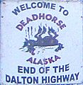
Sign at General Store, Deadhorse, Alaska (January 2008)
-
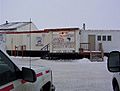
Deadhorse General Store (2003)
-
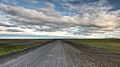
The Dalton Highway at Deadhorse (July 2010)


See also
 In Spanish: Deadhorse (Alaska) para niños
