
Prudhoe Bay Oil Field facts for kids
Quick facts for kids Prudhoe Bay oil field |
|
|---|---|

|
|
| Country | United States |
| Region | Alaska North Slope |
| Offshore/onshore | onshore |
| Coordinates | 70°18′24″N 148°43′57″W / 70.30667°N 148.73250°W |
| Operator | BP |
| Partners | BP, ExxonMobil, ConocoPhillips |
| Field history | |
| Discovery | March 12, 1968 by ARCO and Exxon's Prudhoe Bay State #1 well |
| Start of production | June 20, 1977 |
| Peak of production | 1.5 million barrels per day (240,000 m3/d) |
| Peak year | 1988 |
| Production | |
| Current production of oil | 319,013 barrels per day (~1.590×10⁷ t/a) |
| Year of current production of oil | 2023 |
| Estimated oil in place | 25,000 million barrels (~3.4×10⁹ t) |
| Estimated gas in place | 46,500×109 cu ft (1,320×109 m3) |
| Producing formations | Sadlerochit Group |
The Prudhoe Bay Oil Field is a very large area in Alaska where oil is found deep underground. It is located on Alaska's North Slope. This oil field is the biggest in North America. It covers about 213,543 acres (86,418 ha) of land. When it was first discovered, it held around 25 billion barrels (4.0×10⁹ m3) of oil.
For many years, the company BP operated this oil field. Other companies like ExxonMobil and ConocoPhillips were also partners. In August 2019, BP sold its operations in Alaska to another company called Hilcorp. Now, Hilcorp manages the Prudhoe Bay oil field.
Contents
Where is Prudhoe Bay?
The Prudhoe Bay oil field is located far north in Alaska. It is about 400 miles (640 km) north of Fairbanks. It is also 650 miles (1,050 km) north of Anchorage. The field is about 250 miles (400 km) north of the Arctic Circle. It is also 1,200 miles (1,900 km) south of the North Pole.
The oil field is on the North Slope. To its west is the National Petroleum Reserve–Alaska. To its east is the Arctic National Wildlife Refuge. You can reach the oil field by road from Fairbanks. This road is called the Dalton Highway.

How the Oil Field Started
|
Prudhoe Bay Oil Field Discovery Well Site
|
|

Location in Alaska
|
|
| Location | About 1.5 miles (2.4 km) northwest of Putuligayuk River mouth, along western shore of Prudhoe Bay |
|---|---|
| Nearest city | Prudhoe Bay |
| Area | less than one acre |
| Built | 1967 |
| Built by | Atlantic Richfield Corporation; Humble Oil Company |
| NRHP reference No. | 00000264 |
| Added to NRHP | March 23, 2000 |
The idea of finding oil in this area began in the early 1960s. The US government gave Alaska 100 million acres of land. This was to help Alaska's economy. Experts thought the land around Prudhoe Bay might have a lot of oil.
Oil exploration started in the Prudhoe Bay area in the 1960s. After several years, a drilling rig found natural gas in December 1967. The oil field was officially confirmed on March 12, 1968. This happened with a well called Prudhoe Bay State #1. The companies Humble Oil (now part of Exxon) and Atlantic Richfield Company (ARCO) made this discovery.
BP also became a big part of the Prudhoe field. At first, the field was run by two separate groups. One was BP's Western Operating Area. The other was ARCO's Eastern Operating Area. In 2000, BP bought ARCO's Alaska assets. After that, BP became the only company operating the field.
Oil production did not start right away. It began on June 20, 1977. This was when the Alaska Pipeline was finished. This pipeline carries the oil from Prudhoe Bay to ports further south.
The exact spot where the oil field was discovered is now a historic site. It was added to the National Register of Historic Places in 2000. There is a special marker there.
How Oil is Extracted
Oil is moved through many pipelines at the Prudhoe Bay field. There are about 1000 wells that bring oil up from underground. Smaller "flow lines" carry oil from these wells to processing centers. Then, larger "transit lines" move the oil to a main pumping station. From there, the oil enters the Trans-Alaska Pipeline.
To help get the oil out, seawater is injected into the ground. This water comes from Prudhoe Bay. It helps to replace the large amount of oil removed from beneath the earth.
Oil Production Over Time
Oil production from the North Slope reached its highest point in 1989. At that time, it produced about 2 million barrels per day (320×103 m3/d) of oil per day. The Greater Prudhoe Bay area produced about 1.5 million barrels per day (240×103 m3/d) of that.
By 2005, the total production had dropped to 943,000 barrels per day (149,900 m3/d). In December 2006, Greater Prudhoe Bay produced 411,000 barrels per day (65,300 m3/d). Prudhoe Bay itself produced 285,000 barrels per day (45,300 m3/d). From 1977 to 2005, a total of 11 billion barrels (1.7×10⁹ m3) of oil was produced.
In 2006, BP thought that about 2 billion barrels (320×106 m3) of oil could still be recovered. This was using the technology available at the time.
Since Hilcorp took over in mid-2019, they have been working to improve the aging oil field. In February 2023, Prudhoe Bay produced 319,013 barrels per day (50,719.0 m3/d) of oil. This was slightly more than in January 2023.
Nearby Oil Fields
The Milne Point oil field is located about 35 miles (56 km) west of Prudhoe Bay. This area includes other oil pools. These are the Kuparuk River Oil Pool, Sag River Oil Pool, and Schrader Bluff Oil Pool.
The rocks that contain oil in Prudhoe Bay could also hold "tight oil" and "shale gas." These are types of oil and gas found in very dense rock. Special methods like fracking are sometimes used to get them out.
Geology of the Field

The Prudhoe Bay oil field is shaped like a dome, which geologists call an anticline. It has faults (cracks in the earth's crust) on its northern side.
People first found oil seeps (places where oil naturally leaks out of the ground) in the Cape Simpson area in 1915. Local Eskimo people pointed out large mounds of oil. This led to more exploration. The United States Geological Survey studied the area from 1923 to 1926. They thought the best places to find oil were in Cretaceous rocks. From 1943 to 1953, the Navy drilled many wells, but they didn't find much oil.
In 1957, the Richfield Oil Corporation found oil in the Swanson River Oil Field in Alaska. This made them send geologists to the Arctic in 1959. In 1963, they used seismic surveys to map the ground. In 1964, they mapped the Prudhoe structure. In 1965, Richfield partnered with Humble Oil. They bought leases for the area that later became the "gas cap" of the field. BP bought leases for the "oil ring."
In 1968, the Prudhoe Bay State No. 1 well found the Permian-Triassic Sadlerochit formation. This rock layer was about 8200 feet deep. It had good porosity (spaces for oil) and permeability (how easily oil can flow through it). Oil, gas, and other liquids are produced from the Ivishak sandstone within this formation. This sandstone was formed by ancient rivers and deltas. In the early days, the oil-rich sandstone was 600 feet (180 m) thick in some places. Today, it averages about 60 feet (18 m) thick.
The Prudhoe Bay State No. 1 well also aimed for the Mississippian Lisburne limestone. This was found at 8,800 feet. It produced about 1,152 barrels of oil per day.
Key Facts and Figures
Here are some interesting facts about the Greater Prudhoe Bay Field:
- Discovery Well: Prudhoe Bay State #1
- Discovery Date: December 26, 1967 (confirmed March 1968)
- Production Started: June 20, 1977
- Total Field Area: 213,543 acres (864.18 km2)
- Oil Production Wells: 1114
- Total Oil Capacity: 25 billion barrels (4.0×10⁹ m3) (estimated)
- Produced so far: 12 billion barrels (1.9×10⁹ m3) (as of March 28, 2013)
- Total oil that can be recovered: 16 billion barrels (2.5×10⁹ m3)
- Oil still left to recover: 4 billion barrels (640,000,000 m3)
- Peak Production: 1.97 million barrels per day (in 1988)
- Natural Gas:
- Total estimated: 46×1012 cu ft (1,300 km3)
- Recoverable: 26×1012 cu ft (740 km3)
- Satellite Fields (part of Greater Prudhoe Bay):
- East Operating Area (started 1977)
- West Operating Area (started 1977)
- Midnight Sun (started 1998)
- Aurora (started 2000)
- Orion (started 2002)
- Polaris (started 1999)
- Borealis (started 2001)
- Ownership (before 2019 sale):
- BP Exploration (Operator): 26%
- ConocoPhillips: 36%
- ExxonMobil: 36%
- Others: 2%
- On August 27, 2019, BP announced it would sell all its Alaska operations to Hilcorp. This included its share in the Prudhoe Bay field and the Trans-Alaska Pipeline.
Oil Spills and Shutdowns
On March 2, 2006, a worker found an oil spill in western Prudhoe Bay. About 6,400 barrels (1,020 m3) of oil spilled. This was the largest oil spill on Alaska's North Slope at that time. The spill happened because a pipeline broke.
Later, in October 2007, BP had to pay a fine. This was because of problems with crude oil leaking from pipelines. BP Alaska agreed to pay $20 million.
In August 2006, the US government asked for the pipelines to be checked for rust (corrosion). BP found very bad corrosion, with up to 81 percent of the pipe walls worn away. A small oil leak was also found. This damage meant that 16 of the 22 miles (35 km) of pipeline at Prudhoe Bay needed to be replaced.
BP said they were surprised by how bad the corrosion was. They had not used special cleaning tools in the pipelines for 14 years. They thought these tools might damage the pipes. Because of the severe corrosion and the leak, BP announced they would shut down the oil field.
This shutdown caused oil prices around the world to go up. Prudhoe Bay was the biggest oil producer in the United States. Its shutdown meant 8% less oil for the country. Alaska also lost a lot of money each day because it gets most of its income from taxing the oil industry.
The main Alaska Pipeline was not damaged. However, less oil flowing from Prudhoe Bay meant less oil for the pipeline to carry. The field has since reopened. In June 2007, another small leak happened, causing the field to shut down for a week.
Images for kids
-

Caribou near Prudhoe Bay, 1973
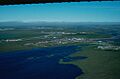
-

1971 aerial photo of the oil fields by the United States Fish and Wildlife Service.
-
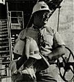
Roger MacBride touring the oil field facilities during his 1976 presidential campaign.
-
Oilfield facilities at Prudhoe Bay.


See also
 In Spanish: Bahía Prudhoe para niños
