
Prudhoe Bay, Alaska facts for kids
Quick facts for kids
Prudhoe Bay, Alaska
|
|
|---|---|

Caribou walk across a gravel pad at Kuparuk, 45 miles away from Prudhoe Bay, with oilfield facilities in the background.
|
|

Location in North Slope Borough and the state of Alaska
|
|

Prudhoe Bay, Alaska
Location in Alaska
|
|
| Country | United States |
| State | Alaska |
| Borough | North Slope |
| Area | |
| • Total | 569.89 sq mi (1,476.00 km2) |
| • Land | 390.42 sq mi (1,011.17 km2) |
| • Water | 179.47 sq mi (464.83 km2) |
| Elevation | 26 ft (8 m) |
| Population
(2020)
|
|
| • Total | 1,310 |
| • Density | 3.36/sq mi (1.30/km2) |
| Time zone | UTC-9 (Alaska (AKST)) |
| • Summer (DST) | UTC-8 (AKDT) |
| ZIP code |
99734
|
| Area code(s) | 907 (Local exchange prefix: 659) |
| FIPS code | 02-64380 |
| GNIS feature ID | 2419192 |
Prudhoe Bay is a special area in Alaska, USA. It is known for its large oil field. This area is called a census-designated place (CDP).
In 2020, about 1,310 people lived here. But many more people, often thousands, work at the oil field. They are called transient workers because they don't live there permanently.
The main airport, places to stay, and a store are in a nearby town called Deadhorse. The oil rigs and processing buildings are on special gravel pads. These pads are built on top of the tundra, which is frozen ground.
Heavy equipment can only be used in winter. This is when the ground is frozen solid enough. So, most new buildings are put up during the cold winter months.
You can reach Prudhoe Bay by driving on the Dalton Highway. The actual bay is about 10 miles further north. You need to pass a security checkpoint to see the open water.
Some tourists visit Prudhoe Bay. They travel by bus or car from Fairbanks. It's a two-day trip on the Dalton Highway.
Tourists come to see the tundra, the Arctic Ocean, and the midnight sun. The midnight sun means the sun stays out all night long in summer. They stay in buildings made from smaller, connected parts. If you want to see the Arctic Ocean or the bay, you need to book a tour ahead of time.
Prudhoe Bay got its name in 1826. A British explorer, Sir John Franklin, named it. He named it after his friend, Captain Algernon Percy, Baron Prudhoe. Franklin explored the coast from the Mackenzie River in Canada. He traveled almost to Point Barrow.
Template:TOC limit=3
Contents
Exploring Prudhoe Bay's Location
Prudhoe Bay is located on the Sagavanirktok River. This river flows into the Arctic Ocean.
The area covers about 558 square miles. About 416 square miles of this is land. The rest, about 142 square miles, is water. This means about a quarter of the area is water.
Prudhoe Bay's Climate
Prudhoe Bay has a tundra climate. This is common for places on the North Slope of Alaska. The area is above the Arctic Circle.
Winter Weather
Winters are very long and cold. The sun does not rise for several weeks each winter. This means it stays dark almost all day.
Summer Weather
Summers have very long daylight hours. The sun stays out for 24 hours a day during some weeks. Even with constant daylight, summers are cool. Temperatures are usually between 45 and 55 degrees Fahrenheit. Sometimes it can even drop to freezing.
| Climate data for Prudhoe Bay, Alaska | |||||||||||||
|---|---|---|---|---|---|---|---|---|---|---|---|---|---|
| Month | Jan | Feb | Mar | Apr | May | Jun | Jul | Aug | Sep | Oct | Nov | Dec | Year |
| Record high °F (°C) | 36 (2) |
39 (4) |
34 (1) |
43 (6) |
55 (13) |
83 (28) |
82 (28) |
80 (27) |
67 (19) |
45 (7) |
39 (4) |
34 (1) |
83 (28) |
| Mean maximum °F (°C) | 19 (−7) |
17 (−8) |
16 (−9) |
28 (−2) |
43 (6) |
65 (18) |
74 (23) |
69 (21) |
56 (13) |
37 (3) |
24 (−4) |
20 (−7) |
77 (25) |
| Mean daily maximum °F (°C) | −11.9 (−24.4) |
−10.1 (−23.4) |
−5.2 (−20.7) |
10.1 (−12.2) |
28.8 (−1.8) |
45.2 (7.3) |
55.4 (13.0) |
51.0 (10.6) |
38.3 (3.5) |
21.0 (−6.1) |
0.9 (−17.3) |
−6.6 (−21.4) |
18.1 (−7.7) |
| Daily mean °F (°C) | −18.0 (−27.8) |
−17.2 (−27.3) |
−12.8 (−24.9) |
2.7 (−16.3) |
23.9 (−4.5) |
39.0 (3.9) |
47.8 (8.8) |
44.3 (6.8) |
33.6 (0.9) |
15.4 (−9.2) |
−5.1 (−20.6) |
−12.9 (−24.9) |
11.7 (−11.3) |
| Mean daily minimum °F (°C) | −24.0 (−31.1) |
−24.3 (−31.3) |
−20.3 (−29.1) |
−4.8 (−20.4) |
19.0 (−7.2) |
32.7 (0.4) |
39.7 (4.3) |
37.5 (3.1) |
28.9 (−1.7) |
9.7 (−12.4) |
−11.0 (−23.9) |
−19.2 (−28.4) |
5.3 (−14.8) |
| Mean minimum °F (°C) | −44 (−42) |
−47 (−44) |
−43 (−42) |
−30 (−34) |
−1 (−18) |
25 (−4) |
31 (−1) |
29 (−2) |
17 (−8) |
−13 (−25) |
−30 (−34) |
−38 (−39) |
−50 (−46) |
| Record low °F (°C) | −62 (−52) |
−57 (−49) |
−54 (−48) |
−47 (−44) |
−19 (−28) |
18 (−8) |
28 (−2) |
23 (−5) |
1 (−17) |
−30 (−34) |
−45 (−43) |
−47 (−44) |
−62 (−52) |
| Average precipitation inches (mm) | 0.20 (5.1) |
0.17 (4.3) |
0.14 (3.6) |
0.08 (2.0) |
0.09 (2.3) |
0.39 (9.9) |
0.68 (17) |
1.14 (29) |
0.61 (15) |
0.38 (9.7) |
0.18 (4.6) |
0.20 (5.1) |
4.26 (107.6) |
| Average snowfall inches (cm) | 2.8 (7.1) |
2.4 (6.1) |
2.7 (6.9) |
1.7 (4.3) |
1.4 (3.6) |
1.0 (2.5) |
0.0 (0.0) |
0.5 (1.3) |
3.5 (8.9) |
9.3 (24) |
4.3 (11) |
3.5 (8.9) |
33.1 (84) |
| Source: Desert Research Institute | |||||||||||||
Population of Prudhoe Bay

| Historical population | |||
|---|---|---|---|
| Census | Pop. | %± | |
| 1970 | 49 | — | |
| 1980 | 50 | 2.0% | |
| 1990 | 47 | −6.0% | |
| 2000 | 5 | −89.4% | |
| 2010 | 2,174 | 43,380.0% | |
| 2020 | 1,310 | −39.7% | |
| U.S. Decennial Census | |||
Prudhoe Bay first appeared in the U.S. Census in 1970. Back then, it was a small, unincorporated village. In 1980, it became a census-designated place (CDP).
In 2010, there were 2,174 people living in the CDP. Most of the people were White (83.0%). There were also Native American (7.5%), Black (1.9%), and Asian (1.5%) residents. A small number were from other races or mixed races. About 4.0% of the people were Hispanic or Latino.
Images for kids
-
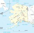
Map of Alaska, showing place names and the Trans-Alaska pipeline route in red.
-
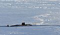
The submarine HMS Tireless in the icy waters near Prudhoe Bay.

_in_ice.jpg)
See also
 In Spanish: Prudhoe Bay (Alaska) para niños
