Diamondhead, Mississippi facts for kids
Quick facts for kids
Diamondhead, Mississippi
|
|||
|---|---|---|---|
 |
|||
|
|||
| Motto(s):
"Where living is easy."
|
|||

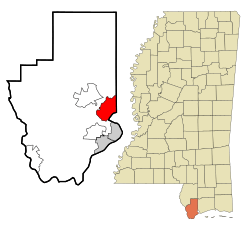
Location of Diamondhead, Mississippi
|
|||
| Country | United States | ||
| State | Mississippi | ||
| County | Hancock | ||
| Incorporated | February 6, 2012 | ||
| Area | |||
| • Total | 12.57 sq mi (32.55 km2) | ||
| • Land | 10.11 sq mi (26.18 km2) | ||
| • Water | 2.46 sq mi (6.36 km2) | ||
| Elevation | 66 ft (20 m) | ||
| Population
(2020)
|
|||
| • Total | 9,529 | ||
| • Density | 942.63/sq mi (363.95/km2) | ||
| Time zone | UTC-6 (Central (CST)) | ||
| • Summer (DST) | UTC-5 (CDT) | ||
| ZIP code |
39525
|
||
| Area code(s) | 228 | ||
| FIPS code | 28-19100 | ||
| GNIS feature ID | 0689399 | ||
Diamondhead is a city in Hancock County, Mississippi, United States. It's located about 50 miles northeast of New Orleans, Louisiana. Diamondhead is part of the larger Gulfport-Biloxi Metropolitan Statistical Area. It officially became a city on February 6, 2012. In 2020, the city had a population of 9,529 people.
Contents
History of Diamondhead
Becoming a Resort Community
In 1961, NASA announced plans for the Mississippi Test Facility. This facility, now called the John C. Stennis Space Center, brought many government workers and contractors to the area.
A large part of the land that became Diamondhead was bought by Walter Gex Sr. in 1937. Later, in the late 1960s, a company called Diamondhead Corporation started a big resort project here. The Mississippi Coast was already a popular vacation spot, especially for people from the Midwest. Diamondhead was a great location for second homes because it was easy to reach by Interstate 55.
The land for Diamondhead is also the highest point on the Mississippi Gulf Coast, about 100 feet above sea level. This is why it was named "Diamondhead," after the famous volcanic cone in Hawaii.
Plans for the biggest resort community in the southern United States were announced in 1969. The development featured Hawaiian-style buildings, landscaping, and even street names. The company bought 6,000 acres near Interstate 10, which was still being built. The community would have two miles of shoreline on the Bay of Saint Louis and nine miles on the Jourdan River.
The corporation was set to buy the land on August 18, 1969. This was just one day after Hurricane Camille hit Hancock County. After the storm, the investors saw that the Diamondhead area had much less damage than other coastal areas. Because of this, they decided to go ahead with the project.
Soon, Diamondhead had streets, building lots, homes, a country club, an airport, and a community center. The I-10 exit for Diamondhead was finished in October 1970, making it even easier to get there. By 1973, thousands of lots were sold, and many homes were built. Diamondhead helped the local economy by creating jobs for builders and other workers. Many people working at the Naval Oceanographic Office and other nearby facilities chose to live in Diamondhead. By the end of the 1970s, most of the available lots were sold. Many early residents came from New Orleans, looking for a less crowded place to live.
Diamondhead was first managed by a property owners association (POA). In 1985, the POA was handed over to a board elected by the homeowners. As more families moved in, Diamondhead changed from mainly a retirement community to a more diverse, suburban area. The population became younger. However, some residents started to disagree with the POA's decisions, especially about fees and golf course maintenance. In 1994, some people wanted Diamondhead to become an official city instead of being run by the POA. This first attempt to become a city didn't work out, but the idea remained.
Hurricane Katrina's Impact
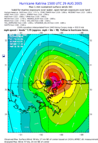
On August 29, 2005, Hurricane Katrina hit the Mississippi Coast. Before and during the storm, water flooded into the Bay of St. Louis. Low-lying areas along the Jourdan River and its bayous, including parts of Diamondhead and Kiln, flooded first. A huge storm surge of nearly 30 feet caused a lot of damage. Many homes were badly damaged or completely destroyed, especially those closer to the Bay of Saint Louis. The shopping area, with stores and restaurants, was mostly ruined.
The northern part of Diamondhead was less damaged. Many people whose homes were destroyed, both in Diamondhead and nearby cities, moved into the undamaged houses on the north side. Overnight, the population grew from 6,500 to 9,000 people.
Becoming an Official City
After Hurricane Katrina, the POA faced new challenges. They realized that an official city could get federal and state money that a private POA could not. Also, there were concerns about rules for homeowners expiring. In 2006, a study suggested that becoming a city would be the best way to protect the community's assets.
In 2009, the POA supported a petition to hold an election for incorporation. The election approved the idea of becoming a city. However, some people who disagreed said the petition didn't have enough signatures. The case went to court. In 2010, the Hancock Chancery Court ruled in favor of incorporation. The opponents then appealed to the Supreme Court of Mississippi.
On October 29, 2011, the Supreme Court of Mississippi agreed with the lower court's decision. In January 2012, the Supreme Court denied a final appeal. This meant Diamondhead had to become a city. On February 6, 2012, Diamondhead officially received its charter as the 111th city in Mississippi from Secretary of State Delbert Hosemann.
Geography and Climate
Unlike most of the Mississippi Gulf Coast, Diamondhead has rolling hills. Its elevation ranges from sea level to over 100 feet. The Bay of Saint Louis borders the city to the south. Rotten Bayou runs to the west and northwest. Harrison County is to the east.
According to the United States Census Bureau, in 2010, Diamondhead had a total area of about 30.3 square kilometers (11.7 sq mi). Most of this was land, with about 1.5 square kilometers (0.6 sq mi) being water.
Major Roads
 Interstate 10 runs through the southern part of the city. You can access it from Exit 16. I-10 goes east about 35 miles to Biloxi and southwest about 56 miles to New Orleans.
Nearby Places
- Bay St. Louis (11 miles south by road)
- DeLisle (7 miles east)
- Kiln (7 miles northwest)
- Picayune (21 miles northwest)
- Shoreline Park (6 miles south)
- Waveland (10 miles south)
Climate in Diamondhead
The average temperature in Diamondhead is 67°F. This is warmer than the average for Mississippi (64°F) and much warmer than the national average (54°F).
| Weather chart for Diamondhead | |||||||||||||||||||||||||||||||||||||||||||||||
|---|---|---|---|---|---|---|---|---|---|---|---|---|---|---|---|---|---|---|---|---|---|---|---|---|---|---|---|---|---|---|---|---|---|---|---|---|---|---|---|---|---|---|---|---|---|---|---|
| J | F | M | A | M | J | J | A | S | O | N | D | ||||||||||||||||||||||||||||||||||||
|
5.5
59
41
|
5
62
44
|
5.7
68
50
|
5.5
75
57
|
5
82
64
|
4.8
87
71
|
6.7
89
71
|
6.4
89
71
|
5.7
86
69
|
3.1
78
59
|
3.9
68
48
|
5.1
60
42
|
||||||||||||||||||||||||||||||||||||
| temperatures in °F precipitation totals in inches source: WeatherBase.com (13 March 2021) |
|||||||||||||||||||||||||||||||||||||||||||||||
|
Metric conversion
|
|||||||||||||||||||||||||||||||||||||||||||||||
Population and People
| Historical population | |||
|---|---|---|---|
| Census | Pop. | %± | |
| 1980 | 1,011 | — | |
| 1990 | 2,661 | 163.2% | |
| 2000 | 5,912 | 122.2% | |
| 2010 | 8,425 | 42.5% | |
| 2020 | 9,529 | 13.1% | |
| U.S. Census data | |||
| Race | Number of People | Percentage |
|---|---|---|
| White (non-Hispanic) | 8,123 | 85.25% |
| Black or African American (non-Hispanic) | 335 | 3.52% |
| Native American | 39 | 0.41% |
| Asian | 130 | 1.36% |
| Pacific Islander | 2 | 0.02% |
| Other/Mixed | 463 | 4.86% |
| Hispanic or Latino | 437 | 4.59% |
In 2020, there were 9,529 people living in Diamondhead. There were 3,767 households and 2,630 families.
Education in Diamondhead
The schools in Diamondhead are part of the Hancock County School District. All of Hancock County is also served by Pearl River Community College.
Local Schools to Know About
- Hancock High School
- Our Lady Academy
- Saint Stanislaus College
See also
 In Spanish: Diamondhead para niños
 | Laphonza Butler |
 | Daisy Bates |
 | Elizabeth Piper Ensley |


