
Bay St. Louis, Mississippi facts for kids
Quick facts for kids
Bay St. Louis, Mississippi
|
|||
|---|---|---|---|

The Bay of St. Louis, the new bay bridge, and the city of Bay St. Louis on the western shore (upper part of photo)
|
|||
|
|||

Location of Bay St. Louis, MS
|
|||

Bay St. Louis, Mississippi
Location in the United States
|
|||
| Country | United States | ||
| State | Mississippi | ||
| County | Hancock | ||
| Area | |||
| • Total | 26.62 sq mi (68.95 km2) | ||
| • Land | 14.69 sq mi (38.05 km2) | ||
| • Water | 11.93 sq mi (30.90 km2) | ||
| Elevation | 23 ft (7 m) | ||
| Population
(2020)
|
|||
| • Total | 9,284 | ||
| • Density | 631.91/sq mi (243.99/km2) | ||
| Time zone | UTC−6 (Central (CST)) | ||
| • Summer (DST) | UTC−5 (CDT) | ||
| ZIP Code |
39520, 39521, 39522
|
||
| Area code(s) | 228 | ||
| FIPS code | 28-03980 | ||
| GNIS feature ID | 0666588 | ||

Bay St. Louis is a city located in Hancock County, Mississippi, in the United States. It is the main city of the county. The city sits on the Gulf Coast, on the western side of the Bay of St. Louis. It is part of the larger Gulfport–Biloxi metropolitan area.
In 2020, about 9,284 people lived in Bay St. Louis. This was a small increase from 9,260 people in 2010.
Contents
History of Bay St. Louis
.jpg)
The first European settlers in this area were French colonists. Their culture still has a big impact on the small city today. These French settlers brought people from Africa to work. Over time, a special group of people called Louisiana Creoles developed. This group included both white colonists of French background and people of color.
The county was named after John Hancock, one of the Founding Fathers of the United States. After the 1830s, more American settlers moved into this area. Even so, many Catholic families still live here. Some of these families have roots going back to both African and French ancestors from the early colonial times. Catholic schools in the area are still popular with students.
Geography and Location
Bay St. Louis is found in the southeastern part of Hancock County. It is on the west side of the Bay of St. Louis. This bay flows into the Mississippi Sound. The city is next to Pass Christian to the east.
To the north, the city is bordered by the Jourdan River. This river is the main waterway flowing into the bay. Diamondhead is also to the north. The eastern edge of the city is in the middle of the bay, marking the line with Harrison County.
The city covers about 69 square kilometers (26.6 square miles) in total. About 38 square kilometers (14.7 square miles) of this is land. The remaining 30.9 square kilometers (11.9 square miles), or about 45%, is water.
Hurricanes and Their Impact
Bay St. Louis has been hit by strong hurricanes. These storms have caused a lot of damage but the city has always rebuilt.
On August 17, 1969, Hurricane Camille hit the area. It first made landfall in Louisiana before moving towards Bay St. Louis.
On August 29, 2005, Hurricane Katrina made its final landfall just west of Bay St. Louis. This powerful storm brought a huge storm surge of about 8.5 meters (28 feet). Because it hit during high tide, the water level was even higher, over 9 meters (30 feet).
Some higher ground in the city, along the old Highway 90, was saved from the worst flooding. This area sits about 7.6 meters (25 feet) above sea level.
Hurricane Katrina damaged many libraries in Mississippi. The Bay St. Louis Public Library had severe roof and water damage. Luckily, it was able to reopen to the public just a few weeks later, on October 12, 2005.
The bridge on US Highway 90 in Bay St. Louis was badly damaged. Many parts of the bridge fell into the water. A new bridge was built to replace it. This new Bay St. Louis Bridge even won an award for transportation. It has a special path for people to walk or bike, featuring art by local artists. The city's underground pipes and utilities were also completely replaced with federal help.
Climate of Bay St. Louis
The weather in Bay St. Louis is known for its hot and humid summers. Winters are generally mild to cool. The area has a humid subtropical climate. This means it gets a lot of rain throughout the year.
Nearby Cities and Towns
Bay St. Louis is close to several other communities:
- Diamondhead (north)
- Gulfport (east)
- Pass Christian (east)
- Waveland (west)
Population Changes

The number of people living in Bay St. Louis has changed over the years.
| Historical population | |||
|---|---|---|---|
| Census | Pop. | %± | |
| 1880 | 1,978 | — | |
| 1890 | 1,974 | −0.2% | |
| 1900 | 2,872 | 45.5% | |
| 1910 | 3,388 | 18.0% | |
| 1920 | 3,033 | −10.5% | |
| 1930 | 3,724 | 22.8% | |
| 1940 | 4,138 | 11.1% | |
| 1950 | 4,621 | 11.7% | |
| 1960 | 5,073 | 9.8% | |
| 1970 | 6,752 | 33.1% | |
| 1980 | 7,850 | 16.3% | |
| 1990 | 8,063 | 2.7% | |
| 2000 | 8,209 | 1.8% | |
| 2010 | 9,260 | 12.8% | |
| 2020 | 9,284 | 0.3% | |
| U.S. Decennial Census | |||
In 2020, there were 9,284 people living in the city. There were 5,447 households and 4,273 families.
Education in Bay St. Louis
Most of Bay St. Louis is served by the Bay St. Louis-Waveland School District. A small part of the city is in the Hancock County School District.
Bay High School is located here. There are also private Catholic schools. Saint Stanislaus College is a school for boys in grades 7–12. Students can live there or attend during the day. Our Lady Academy is a day school for girls in grades 7–12. These two schools share some classrooms and follow a Roman Catholic curriculum.
All of Hancock County, including Bay St. Louis, is served by Pearl River Community College.
Bay St. Louis in Media
The 1966 movie This Property is Condemned was filmed in Bay St. Louis. The city was called "Dodson" in the movie. It starred Natalie Wood and Robert Redford. Some scenes were also shot in Biloxi, Mississippi, and New Orleans, Louisiana.
Transportation and Highways
Bay St. Louis has important roads that connect it to other places.
 Interstate 10 goes through the northern part of the city. You can get to it from Exit 13 (Highway 603). I-10 goes east to Biloxi (about 60 km or 37 miles away). It goes southwest to New Orleans (about 87 km or 54 miles away).
 U.S. Highway 90 runs just north of downtown Bay St. Louis. It crosses the St. Louis Bay Bridge to Pass Christian. From US 90, it's about 24 km (15 miles) east to Gulfport. It's about 97 km (60 miles) southwest to New Orleans.
 Mississippi Highway 603 runs along the western edge of Bay St. Louis. It connects US 90 and Interstate 10.
Notable People from Bay St. Louis
Many interesting people have connections to Bay St. Louis:
- Stephen E. Ambrose, a famous historian and author.
- Richmond Barthé, a sculptor known for his work during the Harlem Renaissance.
- Walter J. Gex III, a United States federal judge.
- Jacob Lindgren, a former Major League Baseball (MLB) player.
- Alice Moseley, a well-known folk artist.
- Leo Norris, a former infielder for the Philadelphia Phillies baseball team.
- Albert J. Raboteau, a scholar who studied African and African-American religions.
- Lawrence E. Roberts, a pilot with the famous Tuskegee Airmen.
- John Scafide, a former football player and mayor of Bay St. Louis for many years.
- Caroline Snedeker, a children's author.
- Gene Taylor, a former member of the U.S. House of Representatives.
- Tank Williams, a former National Football League (NFL) player.
Images for kids
-
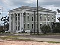
Hancock County Courthouse in Bay St. Louis
See also
 In Spanish: Bay St. Louis para niños
