Dourbie facts for kids
Quick facts for kids Dourbie |
|
| River | |
|
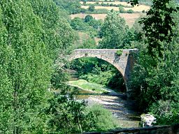
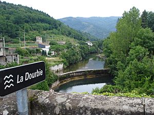
Pont de la Prade over the Dourbie at Nant
|
|
| Country | France |
|---|---|
| Region | Occitanie |
| Departments | Gard, Aveyron |
| Commune | Dourbies, Saint-Jean-du-Bruel, Nant, Millau |
| Tributaries | |
| - right | Trèvezel |
| City | Millau |
| Source | Mont Aigoual |
| - location | Arphy, Massif Central, France |
| - elevation | 1,290 m (4,232 ft) |
| - coordinates | 44°03′40″N 3°34′31″E / 44.06111°N 3.57528°E |
| Mouth | Tarn |
| - location | Millau, Occitanie, France |
| - elevation | 350 m (1,148 ft) |
| - coordinates | 44°06′05″N 3°05′14″W / 44.10139°N 3.08722°W |
| Length | 71.9 km (45 mi) |
| Basin | 568 km² (219 sq mi) |
| Discharge | for Millau |
| - average | 13.7 m³/s (484 cu ft/s) |
The Dourbie is a river located in southern France. It flows through two important areas: the Gard and Aveyron departments. The Dourbie river is a "tributary" of the Tarn river. This means it's a smaller river that flows into a larger one.
Contents
About the Dourbie River
The Dourbie river is about 71.9 km (44.7 mi) long. Imagine a line of 71.9 kilometers! The area of land that collects water for the Dourbie river is called its drainage basin. This basin covers about 568 km2 (219 sq mi) of land.
Where Does the River Start and End?
The Dourbie river begins high up in the Cévennes National Park. Its source is on the southern side of Mont Aigoual. This starting point is in a small town called Arphy, in the Gard department. The river begins at a high altitude of about 1,290 m (4,232 ft).
From its source, the Dourbie river generally flows towards the west. As it continues its journey, it passes through the beautiful Regional Natural Park of Grands Causses.
The Dourbie river flows through several departments and towns in France:
- In the Gard department, it passes through Arphy, Dourbies, Bréau-et-Salagosse, Trèves, and Revens.
- In the Aveyron department, it flows through Saint-André-de-Vézines, Nant, Saint-Jean-du-Bruel, Millau, and La Roque-Sainte-Marguerite.
Finally, the Dourbie river joins the Tarn river. It flows into the Tarn in the city of Millau. At this point, the Dourbie is about 350 m (1,148 ft) above sea level.
Other Rivers Joining the Dourbie
Smaller rivers and streams that flow into a larger river are called tributaries. The Dourbie river has a few important ones:
- Ruisseau de Garène: This stream joins the Dourbie from the left side. It is about 17.4 kilometers long.
- Trèvezel: This river flows into the Dourbie from the right side. It is longer, at about 29.6 kilometers.
Related pages
 | Shirley Ann Jackson |
 | Garett Morgan |
 | J. Ernest Wilkins Jr. |
 | Elijah McCoy |


