Eatons Hill, Queensland facts for kids
Quick facts for kids Eatons HillQueensland |
|||||||||||||||
|---|---|---|---|---|---|---|---|---|---|---|---|---|---|---|---|

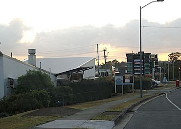
Bunya Park Drive, Eatons Hill
|
|||||||||||||||
| Population | 7,822 (2021 census) | ||||||||||||||
| • Density | 879/km2 (2,280/sq mi) | ||||||||||||||
| Postcode(s) | 4037 | ||||||||||||||
| Area | 8.9 km2 (3.4 sq mi) | ||||||||||||||
| Time zone | AEST (UTC+10:00) | ||||||||||||||
| Location |
|
||||||||||||||
| LGA(s) | City of Moreton Bay | ||||||||||||||
| State electorate(s) | Everton | ||||||||||||||
| Federal Division(s) | Dickson | ||||||||||||||
|
|||||||||||||||
Eatons Hill is a suburb located in the City of Moreton Bay, Queensland, Australia. It's a place where many families live. In 2021, about 7,822 people called Eatons Hill home. The postcode for this area is 4037.
Contents
Geography of Eatons Hill
Eatons Hill has some interesting natural features.
Rivers and Crossings
The South Pine River forms most of the southern border of the suburb. This river has played an important role in the area's history.
Cashs Crossing
In the eastern part of Eatons Hill, you'll find a spot called Cashs Crossing. This place is named after James and Mary Cash, who were early settlers nearby. Today, South Pine Road crosses the river here using a bridge.
Bunya Crossing
Another crossing point on the South Pine River is Bunya Crossing. This is a "ford," which means it's a shallow part of the river you can cross without a bridge. It gets its name from the "Bunya pine" tree, which is called "Bonyi" or "Bunyi" in the Kabi language.
The Hill Itself
The actual Eatons Hill is located in the eastern part of the suburb. It rises to a height of 84 meters (about 275 feet).
History of Eatons Hill
The land where Eatons Hill is located has a rich history.
Traditional Owners
The area is part of the traditional country of the Yugarabul Indigenous Australian people.
Naming the Suburb
Eatons Hill is named after an early pioneer, William Eaton. He was a farmer in nearby Albany Creek starting in 1874. He also served on the local council from 1909 to 1912.
Early Development
Cashs Crossing was once a main route from Brisbane to Gympie. A bridge was built there in 1892. It even survived big floods in 1893!
People started building houses in Eatons Hill in the early 1970s. Most homes are spread out, with larger properties in the western areas. More houses were built towards the west in the late 1990s.
Eatons Hill State School
Eatons Hill State School opened its doors on January 22, 1998. This was an important step for the growing community.
Who Lives in Eatons Hill?
Let's look at some facts about the people who live in Eatons Hill.
Population Details
According to the 2021 census, Eatons Hill had a population of 7,822 people. In 2011, the median age was 34 years old. This was a bit younger than the national average.
Where People Are From
Most people living in Eatons Hill were born in Australia (78.3% in 2011). Other common birthplaces included England (5.6%), New Zealand (3.5%), and South Africa (2.2%).
Languages Spoken
In 2011, most residents (91.6%) spoke only English at home. Some other languages spoken included Afrikaans, Italian, and Polish.
Education in Eatons Hill
Eatons Hill has a primary school for younger students.
Eatons Hill State School
Eatons Hill State School is a government primary school for students from Prep to Year 6. It's located on Marylin Terrace. In 2018, the school had over 1,000 students. It also has a special education program.
Secondary Schools
There isn't a high school directly in Eatons Hill. Students usually attend Albany Creek State High School, which is in the nearby suburb of Albany Creek.
Getting Around
Eatons Hill is connected by public transport. Transport for Brisbane offers bus routes 338, 357, and 359 to service the area.
 | James B. Knighten |
 | Azellia White |
 | Willa Brown |


