Edmonton, Queensland facts for kids
Quick facts for kids EdmontonCairns, Queensland |
|||||||||||||||
|---|---|---|---|---|---|---|---|---|---|---|---|---|---|---|---|

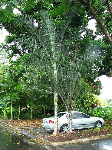
Triangle palms at SugarWorld, Edmonton, 2008
|
|||||||||||||||
| Population | 11,409 (2021 census) | ||||||||||||||
| • Density | 556.5/km2 (1,441/sq mi) | ||||||||||||||
| Postcode(s) | 4869 | ||||||||||||||
| Elevation | 16.8 m (55 ft) | ||||||||||||||
| Area | 20.5 km2 (7.9 sq mi) | ||||||||||||||
| Time zone | AEST (UTC+10:00) | ||||||||||||||
| Location |
|
||||||||||||||
| LGA(s) | Cairns Region | ||||||||||||||
| State electorate(s) | Mulgrave | ||||||||||||||
| Federal Division(s) | Kennedy | ||||||||||||||
|
|||||||||||||||
Edmonton is a town and suburb located in the Cairns Region of Queensland, Australia. It's like a neighbourhood within the bigger city of Cairns. In 2021, about 11,409 people lived here.
Where is Edmonton?
Edmonton is about 13.1 kilometres (8.1 miles) south-southwest of the main part of Cairns. It's part of the Cairns Region local government area.
Roads and Railways
The main road, the Bruce Highway, goes right through the middle of Edmonton. It connects the south (like Mount Peter) to the north (like White Rock).
The North Coast railway line also runs through Edmonton. It goes in the same direction as the highway. There are two train stations here: Edmonton and Queerah.
You might also see small trains called cane tramways. These special trains carry harvested sugarcane to the Mulgrave Sugar Mill in Gordonvale.
How High is it?
Edmonton is about 16.8 metres (55.1 feet) above sea level.
Edmonton's Story
Edmonton is on the traditional land of the Yidinji Aboriginal people.
Early Days
Edmonton was first known as Hambledon, then Hambledon Junction. It started in 1883 when Thomas Swallow created several sugarcane farms.
The first school, Blackfellow's Creek Provisional School, opened in 1887 with 23 students. It later became Blackfellow's Creek State School. In 1910, it moved to its current spot and was renamed Hambledon State School.
There was a train station called Hambledon Junction from 1897. In 1911, the railway department took over and renamed it Edmonton. This name probably came from Edmonton, London, England. Soon after, the town also took this name.
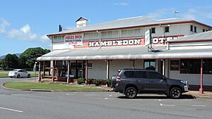
The Hambledon Hotel was first built in 1907. It burned down in 1918 but was rebuilt in 1919. Today, it's known as the Historic Hambledon Hotel.
A Special March
On April 20, 1916, a special event called the Cane Beetles March began nearby. This was a "snowball march" during World War I. It aimed to encourage men to join the Australian army. The march started with just 4 men and grew as it passed through towns like Babinda and Gordonvale. By the time it reached Cairns, 60 kilometres later, it had 29 new recruits!
Community Buildings
In 1924, the Anglican community built a church in Edmonton. It opened on Christmas Day that year. In 2000, the church building was sold and is now a private home.
The Edmonton Catholic School opened in 1929 with 30 students. It was run by the Sisters of Mercy. In 1965, it became St Therese's School. As Edmonton grew, the school moved to Bentley Park in 1995 because there were so many students.
The Edmonton public library building opened in 1975.
In 1983, the first Sikh temple in Queensland, the Guru Nanak Gurudwara, opened near Edmonton. It is now within the area of Mount Peter.
The Edmonton Uniting Church opened in 1998.
Recent Times
Traditionally, growing sugarcane was the main industry in Edmonton. But now, Edmonton has become a growing suburb of Cairns. Many new houses have been built, and the number of people living here has increased a lot.
In 2006, Tropical Cyclone Larry hit the area. Edmonton had only minor damage, but the centre of the cyclone passed through Innisfail, about 75 kilometres (47 miles) south.
In 2023, Blackfellow's Creek was renamed Bana Gindarja Creek. This name change caused some discussion in the community.
Schools in Edmonton
Edmonton has several schools for younger students.
Hambledon State School
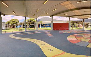
Hambledon State School is a government primary school for students from Prep to Year 6. It's located at 77-83 Stokes Street. In 2018, about 694 students attended this school. It also has a special education program.
Isabella State School
Isabella State School is another government primary school for students from Prep to Year 6. You can find it on Walker Road. In 2018, around 600 students were enrolled here. This school also offers a special education program.
Autism Queensland Education & Therapy Centre
This centre is a special education school for young children (Prep-Year 2) at 15-17 Marr Street. It provides special programs for children with autism two days a week. For the rest of the week, these children attend regular schools.
There are no high schools directly in Edmonton. The closest high school is Bentley Park State College, which is in the nearby suburb of Bentley Park.
Local News
As part of Cairns, Edmonton gets news from the city's TV and radio stations. The Cairns Post is the main newspaper. There's also a local newspaper called The Southern Herald, which is delivered to homes in Edmonton every month.
Places to Visit
Edmonton Library
The Cairns Regional Council runs the Edmonton Library. It's a great place to find books and learn new things, located at 175 Bruce Highway.
Edmonton Community Hall
The Edmonton Community Hall is on Pyne Street, inside Down Park. It's a place where up to 80 people can gather for events. The Cairns Regional Council manages it.
Edmonton Uniting Church
The Edmonton Uniting Church is at 2-6 Ravizza Close. It's part of the wider Uniting Church in Australia.
Sugarworld
Sugarworld is a fun water park and recreation area in Hambledon Drive. It's built on the site of an old sugar mill, and you can still see some old parts and trees from the mill there.
Cairns International Raceway
If you like fast cars, the Cairns International Raceway is at 1308 Fisherman Road. It hosts many different motorsport competitions.
 | Toni Morrison |
 | Barack Obama |
 | Martin Luther King Jr. |
 | Ralph Bunche |


