Ellicottville, New York facts for kids
Quick facts for kids
Ellicottville, New York
|
|
|---|---|

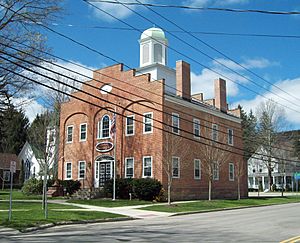
Town hall
|
|
| Country | United States |
| State | New York |
| County | Cattaraugus |
| Government | |
| • Type | Town Council |
| Area | |
| • Total | 45.19 sq mi (117.03 km2) |
| • Land | 45.09 sq mi (116.79 km2) |
| • Water | 0.09 sq mi (0.24 km2) |
| Population
(2020)
|
|
| • Total | 1,317 |
| • Estimate
(2021)
|
1,311 |
| • Density | 35.46/sq mi (13.69/km2) |
| Time zone | UTC-5 (Eastern (EST)) |
| • Summer (DST) | UTC-4 (EDT) |
| ZIP code |
14731
|
| FIPS code | 36-009-24031 |
Ellicottville is a small town in Cattaraugus County, New York, USA. In 2020, about 1,317 people lived here. The town is named after Joseph Ellicott. He was a main land agent for the Holland Land Company.
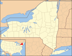
The town of Ellicottville also has a village with the same name, Ellicottville. The town is in the north-central part of Cattaraugus County. It is located north of the city of Salamanca.
Contents
History of Ellicottville
People first settled in the Ellicottville area around 1815.
Town Formation
The Town of Ellicottville was officially created in 1820. It was formed from a part of the town of Franklinville. Back then, Franklinville was known as Ischua.
Later, Ellicottville lost some land. This happened when the town of Ashford was created in 1824. In 1858, a small piece of the town was used to help form the town of East Otto.
County Seat History
The Village of Ellicottville used to be the main government center, or county seat, for Cattaraugus County. However, in May 1868, the county seat moved to Little Valley.
Historic Places
Two important historic places in Ellicottville are listed on the National Register of Historic Places. These are the John J. Aiken House and the Bryant Hill Cemetery.
Ellicottville's Growth and Changes
Ellicottville has changed a lot since two ski resorts were built here. These resorts are Holimont and Holiday Valley.
Ski Resorts and Property Values
Many ski fans, especially from Canada, have bought homes in Ellicottville. They often live here part-time. This has caused property values in the town to become much higher. They are much higher than in other parts of Cattaraugus County.
Local Businesses
The village of Ellicottville has rules that make it hard for big national chain restaurants to open there. Because of this, these types of restaurants have opened just outside the village limits.
Special Events
Ellicottville also has a special place that hosts two big events. Every Independence Day weekend, it holds the Ellicottville Championship Rodeo. In October, the same spot becomes home to the Nightmare Hayrides.
Geography of Ellicottville
Ellicottville covers a total area of about 117 square kilometers (45.19 square miles). Most of this is land, about 116.8 square kilometers (45.09 square miles). Only a small part, about 0.2 square kilometers (0.09 square miles), is water.
Waterways and Roads
The Great Valley Creek flows through the town. This creek is a branch of the Allegheny River.
Several important roads pass through Ellicottville:
- U.S. Route 219 connects the town to Buffalo suburbs in the north. It also goes south to Salamanca.
- New York State Route 242 runs east and west through the town. It crosses US 219 in the village of Ellicottville.
- New York State Route 240 ends at NY 242 in the small community of Ashford. This is in the northeast part of the town.
Neighboring Towns
Ellicottville shares its borders with several other towns:
- To the north is the town of Ashford.
- To the west are the towns of East Otto and Mansfield.
- To the south is the town of Great Valley.
- To the east are the towns of Franklinville and Machias.
Climate in Ellicottville
| Climate data for Ellicottville, NY | |||||||||||||
|---|---|---|---|---|---|---|---|---|---|---|---|---|---|
| Month | Jan | Feb | Mar | Apr | May | Jun | Jul | Aug | Sep | Oct | Nov | Dec | Year |
| Record high °F (°C) | 70 (21) |
67 (19) |
80 (27) |
88 (31) |
89 (32) |
95 (35) |
96 (36) |
94 (34) |
95 (35) |
86 (30) |
77 (25) |
71 (22) |
96 (36) |
| Mean daily maximum °F (°C) | 30 (−1) |
33 (1) |
41 (5) |
55 (13) |
66 (19) |
75 (24) |
78 (26) |
77 (25) |
70 (21) |
58 (14) |
47 (8) |
34 (1) |
55 (13) |
| Daily mean °F (°C) | 22 (−6) |
23 (−5) |
31 (−1) |
44 (7) |
54 (12) |
63 (17) |
67 (19) |
66 (19) |
59 (15) |
48 (9) |
39 (4) |
27 (−3) |
45 (7) |
| Mean daily minimum °F (°C) | 13 (−11) |
13 (−11) |
20 (−7) |
32 (0) |
41 (5) |
51 (11) |
55 (13) |
54 (12) |
47 (8) |
37 (3) |
30 (−1) |
20 (−7) |
34 (1) |
| Record low °F (°C) | −26 (−32) |
−28 (−33) |
−18 (−28) |
5 (−15) |
20 (−7) |
29 (−2) |
34 (1) |
31 (−1) |
22 (−6) |
14 (−10) |
−5 (−21) |
−22 (−30) |
−28 (−33) |
| Average precipitation inches (mm) | 3.75 (95) |
2.85 (72) |
3.45 (88) |
3.68 (93) |
3.73 (95) |
4.48 (114) |
4.72 (120) |
4.19 (106) |
4.53 (115) |
4.19 (106) |
4.31 (109) |
4.09 (104) |
48.0 (1,220) |
| Source: The Weather Channel (Historical Monthly Averages) | |||||||||||||
Population of Ellicottville
| Historical population | |||
|---|---|---|---|
| Census | Pop. | %± | |
| 1830 | 626 | — | |
| 1840 | 1,084 | 73.2% | |
| 1850 | 1,725 | 59.1% | |
| 1860 | 1,881 | 9.0% | |
| 1870 | 1,833 | −2.6% | |
| 1880 | 1,949 | 6.3% | |
| 1890 | 1,932 | −0.9% | |
| 1900 | 2,038 | 5.5% | |
| 1910 | 2,067 | 1.4% | |
| 1920 | 1,766 | −14.6% | |
| 1930 | 1,793 | 1.5% | |
| 1940 | 1,790 | −0.2% | |
| 1950 | 1,830 | 2.2% | |
| 1960 | 1,968 | 7.5% | |
| 1970 | 1,779 | −9.6% | |
| 1980 | 1,677 | −5.7% | |
| 1990 | 1,607 | −4.2% | |
| 2000 | 1,738 | 8.2% | |
| 2010 | 1,598 | −8.1% | |
| 2020 | 1,317 | −17.6% | |
| 2021 (est.) | 1,311 | −18.0% | |
| U.S. Decennial Census | |||
In 2000, there were 1,738 people living in Ellicottville. These people lived in 770 households, and 462 of these were families. The population density was about 38.5 people per square mile. There were 2,097 housing units in the town.
Most people in the town were White (98.16%). A small number were Black, Native American, or Asian. Some people were from other races or had mixed racial backgrounds. About 0.86% of the population was Hispanic or Latino.
About 22.9% of households had children under 18 living with them. About half (50.5%) were married couples. The average household had 2.24 people, and the average family had 2.86 people.
The median age in the town was 43 years old. This means half the people were older than 43, and half were younger. About 22.2% of the population was under 18. About 17.3% were 65 years or older.
The median income for a household in the town was $43,571. For families, it was $50,813. The average income per person was $23,291. About 7.7% of all people in the town lived below the poverty line.
Communities and Places in Ellicottville
- Ashford Junction – This is a small community, or hamlet. It is near the eastern town line. You can find it where NY Route 240 and NY Route 242 meet.
- Ellicottville – This is the main village. It is in the southwest part of the town. It is located on US Route 219 and NY Route 242.
- Fancy Tract – This place is on the eastern town line. It is in the northern part of the town.
- Holiday Valley – This is a popular ski resort. It is located south of Ellicottville village.
- HoliMont – This is a ski resort that is mostly private. It is located west of Ellicottville village.
- Plato – This hamlet is in the northwest part of the town. It is located on County Road 75.
Points of Interest
- Nannen Arboretum – This is a special garden where many different trees and plants are grown. It is located north of Ellicottville village.
See also
 In Spanish: Ellicottville (pueblo) para niños
 | Dorothy Vaughan |
 | Charles Henry Turner |
 | Hildrus Poindexter |
 | Henry Cecil McBay |


