Erving's Location, New Hampshire facts for kids
Quick facts for kids
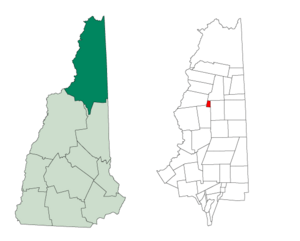
Erving's Location, New Hampshire
|
|
|---|---|

Location in Coös County, New Hampshire
|
|
| Country | United States |
| State | New Hampshire |
| County | Coös |
| Area | |
| • Total | 3.75 sq mi (9.72 km2) |
| • Land | 3.75 sq mi (9.72 km2) |
| • Water | 0 sq mi (0 km2) 0% |
| Elevation | 2,200 ft (700 m) |
| Population
(2020)
|
|
| • Total | 0 |
| Time zone | UTC-5 (EST) |
| • Summer (DST) | UTC-4 (EDT) |
| Area code(s) | 603 |
| FIPS code | 33-007-25180 |
| GNIS feature ID | 873594 |
Erving's Location is a special kind of area in Coös County, New Hampshire, United States. It's called a township. As of the 2020 census, no one lives there. In New Hampshire, "locations," "grants," "townships," and "purchases" are parts of a county that are not officially part of any town. They have very little or no local government. Many of these areas are empty.
There is one dirt road that leads into Erving's Location. It starts near a pond in Millsfield and goes west into the northeast part of Erving's Location. This road is the only way to get there without hiking.
Contents
History of Erving's Location
In 1775, this area was given as a land grant to Captain William Erving. He was from Boston and had fought in the French and Indian Wars.
Geography of the Area
According to the United States Census Bureau, Erving's Location covers about 9.7 square kilometers (3.7 square miles). All of this area is land.
Rivers and Streams
Phillips Brook starts in the township. It flows south into the Upper Ammonoosuc River in Stark. This river is part of the larger Connecticut River system. The northeast part of the township is drained by the West Branch of Clear Stream. This stream flows east to the Androscoggin River in Errol.
Highest Point
The highest point in Erving's Location is about 866 meters (2,840 feet) above sea level. This spot is along the eastern border of the township. It's part of the side of Mount Kelsey, but the very top of Mount Kelsey is in Millsfield.
Nearby Places
Erving's Location shares borders with several other areas:
- Dixville is to the north.
- Millsfield is to the east.
- Odell is to the south.
- Columbia is to the west.
Population Changes
| Historical population | |||
|---|---|---|---|
| Census | Pop. | %± | |
| 1920 | 31 | — | |
| 1960 | 0 | — | |
| 1970 | 0 | — | |
| 1980 | 0 | — | |
| 1990 | 0 | — | |
| 2000 | 1 | — | |
| 2010 | 0 | −100.0% | |
| 2020 | 0 | — | |
| U.S. Decennial Census | |||
In the 2020 census, no one was recorded as living in Erving's Location. The population has been zero for many years.
See also
 In Spanish: Erving's Location para niños
 | DeHart Hubbard |
 | Wilma Rudolph |
 | Jesse Owens |
 | Jackie Joyner-Kersee |
 | Major Taylor |

