Estell Manor, New Jersey facts for kids
Quick facts for kids
Estell Manor, New Jersey
|
|
|---|---|
|
City
|
|
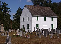
Head of the River Church
|
|
| Motto(s):
"Small City Charm in the Pines"
|
|
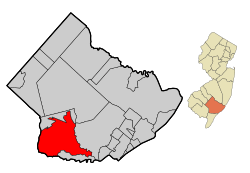
Location of Estell Manor in Atlantic County highlighted in red (left). Inset map: Location of Atlantic County in New Jersey highlighted in orange (right).
|
|
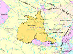
Census Bureau map of Estell Manor, New Jersey
|
|
| Country | |
| State | |
| County | Atlantic |
| Incorporated | March 14, 1925 |
| Government | |
| • Type | Faulkner Act (small municipality) |
| • Body | City Council |
| Area | |
| • Total | 55.18 sq mi (142.93 km2) |
| • Land | 53.39 sq mi (138.27 km2) |
| • Water | 1.80 sq mi (4.65 km2) 3.26% |
| Area rank | 27th of 565 in state 5th of 23 in county |
| Elevation | 39 ft (12 m) |
| Population
(2020)
|
|
| • Total | 1,668 |
| • Estimate
(2023)
|
1,679 |
| • Rank | 504th of 565 in state 20th of 23 in county |
| • Density | 31.2/sq mi (12.0/km2) |
| • Density rank | 559th of 565 in state 23rd of 23 in county |
| Time zone | UTC−05:00 (Eastern (EST)) |
| • Summer (DST) | UTC−04:00 (Eastern (EDT)) |
| ZIP Code |
08319
|
| Area code(s) | 609 |
| FIPS code | 3400121870 |
| GNIS feature ID | 0885212 |
Estell Manor is a small city located in Atlantic County, New Jersey. It's part of the South Jersey region. The city is also included in the larger Philadelphia area.
The city was officially created on March 14, 1925. It was formed from parts of Weymouth Township.
Contents
About Estell Manor
Estell Manor is a city in Atlantic County, New Jersey. It is part of the Atlantic City-Hammonton metropolitan area. This area is also part of the larger Delaware Valley region.
Population Changes Over Time
According to the 2020 United States census, Estell Manor had a population of 1,668 people. This was a small decrease from the 1,735 people counted in the 2010 census. However, the 2010 number was an increase from the 1,585 people in the 2000 census. As of 2023, the population is estimated to be around 1,679.
Geography and Location
Estell Manor covers about 55.18 square miles (142.93 square kilometers). Most of this area is land, with a small portion being water.
Nearby Communities and Borders
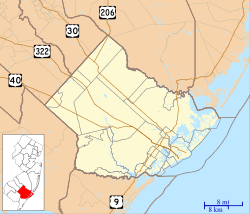
Several smaller communities and places are found within Estell Manor. These include Estellville, Gibsons Landing, and Head of River.
Estell Manor shares its borders with several other towns. In Atlantic County, it borders Corbin City, Egg Harbor Township, Hamilton Township, and Weymouth Township. It also borders Upper Township in Cape May County and Maurice River Township in Cumberland County.
The Pinelands National Reserve
Estell Manor is special because it's located within the New Jersey Pinelands National Reserve. This is a large, protected natural area. It's known for its unique plants and animals. The Pinelands was established in 1978 as the first National Reserve in the United States. It covers over a million acres.
Climate in Estell Manor
Estell Manor experiences a typical climate for its region. Summers are generally warm, while winters are cold. The area receives a good amount of rain throughout the year. Snowfall is common during the winter months.
Who Lives in Estell Manor?
| Historical population | |||
|---|---|---|---|
| Census | Pop. | %± | |
| 1930 | 423 | — | |
| 1940 | 406 | −4.0% | |
| 1950 | 381 | −6.2% | |
| 1960 | 496 | 30.2% | |
| 1970 | 539 | 8.7% | |
| 1980 | 848 | 57.3% | |
| 1990 | 1,404 | 65.6% | |
| 2000 | 1,585 | 12.9% | |
| 2010 | 1,735 | 9.5% | |
| 2020 | 1,668 | −3.9% | |
| 2023 (est.) | 1,679 | −3.2% | |
| Population sources: 1930–2000 1930 1940–2000 2000 2010 2020 |
|||
The population of Estell Manor has changed over the years. In 2010, there were 1,735 people living in the city. Most residents were White (96.48%). A small percentage were Black or African American (0.92%) or Asian (1.61%). About 1% of the population identified as Hispanic or Latino.
The average household had about 2.79 people. Many households (66.1%) were married couples living together. About 23.9% of the population was under 18 years old. The median age in 2010 was 43.4 years.
How Estell Manor is Governed
Estell Manor has a local government system called the Faulkner Act. This system is designed for smaller towns. The city is led by a mayor and a four-member City Council.
Local Leadership
The mayor is chosen by the people and serves a four-year term. The City Council members are also elected by the community. They serve three-year terms.
As of 2023, the Mayor of Estell Manor is Elizabeth Owen. She is a Republican and her term ends on December 31, 2025. The City Council members are Nelson Dilg, Linda G. Givens, Thomas A. Maddox, and Christine Masker.
Political Views
In Estell Manor, more voters are registered as Republicans or Unaffiliated (meaning they don't belong to a specific party) than Democrats. For example, in the 2020 presidential election, the Republican candidate received 69.4% of the votes. The Democratic candidate received 29.3%. This shows that the city tends to vote Republican in national elections.
Education in Estell Manor
Students in Estell Manor attend public schools.
Elementary and Middle School
Children in kindergarten through eighth grade go to the Estell Manor Elementary School. This school is part of the Estell Manor School District. In the 2021–22 school year, there were 181 students and 16 teachers. This means there were about 11 students for every teacher.
High School Education
For ninth through twelfth grade, students attend Buena Regional High School. This high school serves students from Estell Manor, Buena Borough, and Buena Vista Township. In the 2021–22 school year, the high school had 498 students.
Other School Options
Students in Estell Manor can also choose to attend special schools. These include the Atlantic County Institute of Technology in Mays Landing. Another option is the Charter-Tech High School for the Performing Arts in Somers Point.
Getting Around Estell Manor
Estell Manor has a network of roads and highways.
Roads and Highways
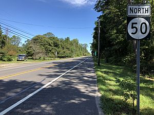
As of 2015, the city had over 56 miles of roads. Some roads are maintained by the city, while others are managed by Atlantic County or the state of New Jersey. Major routes like Route 49 and Route 50 pass through Estell Manor. Several county routes also run through the city.
Public Transportation
NJ Transit offers bus service in the area. The 315 bus route connects Cape May to Philadelphia, passing through Estell Manor.
See also
 In Spanish: Estell Manor para niños
 | Charles R. Drew |
 | Benjamin Banneker |
 | Jane C. Wright |
 | Roger Arliner Young |


