Fades Creek facts for kids
Quick facts for kids Fades Creek |
|
|---|---|

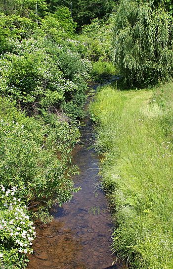
Fades Creek looking upstream from Pennsylvania Route 118
|
|
| Physical characteristics | |
| Main source | valley at the base of a hill in Lake Township, Luzerne County, Pennsylvania between 1,340 and 1,360 feet (410 and 410 m) |
| River mouth | Pikes Creek in Lake Township, Luzerne County, Pennsylvania between 1,120 and 1,140 feet (340 and 350 m) 41°18′09″N 76°05′37″W / 41.30253°N 76.09366°W |
| Length | 3.2 mi (5.1 km) |
| Basin features | |
| Progression | Pikes Creek → Harveys Creek → Susquehanna River → Chesapeake Bay |
| Basin size | 2.07 sq mi (5.4 km2) |
| Tributaries |
|
Fades Creek is a small stream, also called a tributary, located in Luzerne County, Pennsylvania, in the United States. It flows into Pikes Creek. The creek is about 3.2 miles (5.1 km) long and runs through Lake Township.
The area of land that drains into Fades Creek, called its watershed, covers about 2.07 square miles (5.4 km2). Fades Creek has one smaller stream that flows into it. It is known for its clean, cold water, which makes it a great home for wild trout.
Contents
Journey of Fades Creek
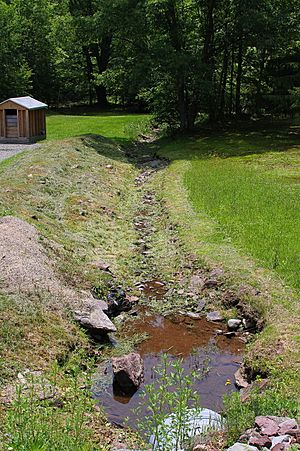
Fades Creek starts in a valley at the bottom of a hill in Lake Township. It flows south for a short distance before turning southwest. Then, it slowly turns southeast and passes through a pond.
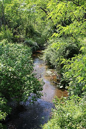
The creek continues flowing southeast through a narrow valley for over a mile. Along the way, a smaller, unnamed stream joins it from the right side. The creek then enters the community of Pikes Creek.
After that, it turns south-southeast for almost a mile, flowing under Pennsylvania Route 118. Finally, it turns east-southeast, crosses Pennsylvania Route 29, and soon after joins Pikes Creek.
Water Quality and Flow
The water in Fades Creek has a low amount of alkalinity, which is a measure of how well the water can handle pollution.
When there's a lot of rain, the amount of water flowing in Fades Creek can increase a lot. There's a 10 percent chance each year that the water flow at the creek's mouth will reach 424 cubic feet per second.
Sometimes, sediment (like dirt and small rocks) can wash into Fades Creek during heavy rain. However, in 2009, Lake Township received money to help fix this problem. They worked on roads nearby, raising them and building special ditches called swales. These swales help direct stormwater away from the creek, keeping it cleaner.
Land and Rocks Around the Creek
The land near where Fades Creek joins Pikes Creek is about 1,120 and 1,140 feet (340 and 350 m) above sea level. Near where the creek starts, the elevation is higher, between 1,340 and 1,360 feet (410 and 410 m) above sea level.
A pipeline crosses Fades Creek about 1.6 miles from its mouth. The land around Fades Creek is mostly made of alluvium (deposits from rivers) and different types of till (rock and dirt left by glaciers). You can also find solid bedrock made of sandstone and shale in the area. There are also a few small wetland areas nearby.
Fades Creek's Watershed
The watershed of Fades Creek, which is the entire area of land that drains water into the creek, covers about 2.07 square miles (5.4 km2). Fades Creek flows through areas shown on the United States Geological Survey maps called Harveys Lake and Sweet Valley.
All of Fades Creek flows through private land.
Fades Creek, along with other nearby streams like Beaver Run, Pikes Creek, and Harveys Creek, can sometimes cause flooding in Lake Township. However, since the township doesn't have many buildings, these floods usually don't cause a lot of damage.
History of the Creek
Fades Creek was officially added to the Geographic Names Information System on August 2, 1979. This system keeps track of names and locations of places in the United States.
In the early 1900s, local officials asked for permission to build a bridge over a small stream that flows into Fades Creek. This bridge was on a road connecting the communities of Pikes Creek and Kettle.
Later, in 1932, a concrete slab bridge was built to carry Pennsylvania Route 118 over Fades Creek. This bridge was repaired in 1960. It is 22.0 feet (6.7 m) long and is located in Lake Township, close to Pennsylvania Route 29.
Animals in Fades Creek
Fades Creek is a very important place for fish. The Pennsylvania Fish and Boat Commission considers part of Fades Creek to be "Class A Wild Trout Waters." This means it's an excellent habitat for brook trout.
Wild trout naturally reproduce and live throughout the entire length of Fades Creek. The creek is also called a "High-Quality Coldwater Fishery," which means its cold, clean water is perfect for fish that need cool temperatures to survive.
 | Georgia Louise Harris Brown |
 | Julian Abele |
 | Norma Merrick Sklarek |
 | William Sidney Pittman |


