Farah, Afghanistan facts for kids
Quick facts for kids
Farah
فراه
Faridon
|
|
|---|---|
| Country | |
| Province | Farah Province |
| Elevation | 2,461 ft (750 m) |
| Population
(2022)
|
|
| • City | 1,000,000 |
| • Urban | 500,000 |
| Time zone | UTC+4:30 |
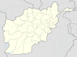
Farah is a big city in western Afghanistan. It is the capital of Farah Province. The city is located along the Farah River, not far from the border with Iran.
Farah is one of the largest cities in western Afghanistan. About 1.5 million people live in its urban area.
Contents
City Layout and Land Use
Farah is in western Afghanistan, between the cities of Kandahar and Herat. It is close to the Iranian border, but there isn't a direct road connecting it to Iran.
The city has a clear network of roads, especially in areas where many people live. However, a large part of the land (60%) is empty or not used. This includes barren land and vacant plots.
History of Farah
Ancient Times
The Farah Citadel (a strong fortress) was likely built by Alexander the Great. He was a famous ancient Greek king. The city was an important stop between his other fortresses in the region.
When Alexander arrived in 330 BC, he added "Alexandria" to the city's name.
Later, under the Parthian Empire, Farah was a key city in the area called Aria. Some ancient writers like Isidorus Characenus and Pliny the Elder mentioned it. They might have called it "Phra" or "Alexandria Prophthasia."
By the 5th century AD, Farah was a major stronghold for the Sassanid Empire. It was important because it controlled the routes to India and Sistan from Herat.
Medieval and Early Modern Eras
In 651 AD, the region became part of the Muslim world during the Muslim conquest of Persia. Over time, many different groups ruled Farah.
These included the Tahirids, Saffarids, Samanids, Ghaznavids, and Ghurids. Later, the Khwarazmshahs, Ilkhanids, Kartids, and Timurids also took control.
The Safavids ruled until the early 1700s. Then, the Hotaki dynasty of Afghans defeated them. In the mid-18th century, Farah became part of the Durrani Empire.
In 1862, Dost Mohammad Khan took back Farah from Sultan Jan, who was the ruler of Herat.
Soviet-Afghan War
When the Soviet Union invaded Afghanistan in 1979, Farah was one of the first cities they occupied. Soviet soldiers from the 357th and 66th Motorized Rifle Divisions moved in.
Local Afghan fighters, called mujahideen, started fighting back in Farah in 1979. They were forced out of the city in 1982. However, they set up a strong base on a nearby mountain called Lor Koh, which they renamed Sharafat Koh (meaning "Honor Mountain").
From Civil War to Today
After the Soviet-backed government fell in 1992, Ismail Khan gained control of Farah. He also controlled other nearby provinces. But in 1995, the Taliban took over Herat and Farah.
Since 2005, the roads in Farah Province have gotten much better. The education system has also improved a lot. Many illegal weapons have been collected and destroyed by the Provincial Reconstruction Team.
The United States built a base at Farah Airport. This base also houses the Afghan National Security Forces (ANFS).
People of Farah
In 2015, the city of Farah had about 54,000 people. The main groups living in the city are Pashtuns (50-60%) and Tajiks (30-40%). There are also some Balochis.
Across the whole province, Pashtuns are the largest group. Tajiks are the second largest, living mostly in Farah city. Balochis are the third group. In winter, many Kuchi nomads, who are Pashtuns, also live in the province.
The main languages spoken in Farah Province are Farsi (Dari) and Pashto.
Economy
Farah is an important center for trade and farming in its region.
Transportation
The Farah Airport is right next to the city. As of May 2014, it had regular flights to Herat.
There are also secondary roads leading out of the city in different directions. In 2010, Farah City had 30 kilometers (19 miles) of paved roads. It also had 136 kilometers (85 miles) of gravel roads and 150 kilometers (93 miles) of unpaved roads.
The main road is Route 515. This road connects Farah to the Ring Road, which is a major highway in Afghanistan. Both roads were improved in 2009.
Healthcare
The city has a hospital called Farah City Hospital that serves its people.
Climate
Farah has a hot desert climate. This means it is very hot and dry. In winter, there is more rain than in summer. From June to October, there is almost no rain at all. Snowfall has not been seen in Farah between 1960 and 1983.
The average yearly temperature in Farah is about 20.7°C (69.3°F). About 95 mm (3.7 inches) of rain falls each year. February is the wettest month, with about 22.8 mm (0.9 inches) of rain.
In August 2009, Farah recorded a temperature of 49.9°C (121.8°F). This is the highest temperature ever recorded in Afghanistan. July is the hottest month, with an average high of 42.6°C (108.7°F). January is the coldest, with an average low of 0.9°C (33.6°F).
| Climate data for Farah (normals and extremes 1960-1983) | |||||||||||||
|---|---|---|---|---|---|---|---|---|---|---|---|---|---|
| Month | Jan | Feb | Mar | Apr | May | Jun | Jul | Aug | Sep | Oct | Nov | Dec | Year |
| Record high °C (°F) | 28.3 (82.9) |
34.0 (93.2) |
34.5 (94.1) |
42.0 (107.6) |
44.2 (111.6) |
47.8 (118.0) |
49.5 (121.1) |
47.2 (117.0) |
43.9 (111.0) |
37.9 (100.2) |
32.2 (90.0) |
26.6 (79.9) |
49.5 (121.1) |
| Mean daily maximum °C (°F) | 14.6 (58.3) |
17.1 (62.8) |
23.1 (73.6) |
29.5 (85.1) |
35.5 (95.9) |
41.0 (105.8) |
42.6 (108.7) |
40.8 (105.4) |
36.2 (97.2) |
29.9 (85.8) |
22.7 (72.9) |
17.2 (63.0) |
29.2 (84.5) |
| Daily mean °C (°F) | 7.2 (45.0) |
9.9 (49.8) |
15.6 (60.1) |
21.7 (71.1) |
27.0 (80.6) |
32.2 (90.0) |
34.3 (93.7) |
31.9 (89.4) |
26.7 (80.1) |
20.2 (68.4) |
12.9 (55.2) |
8.8 (47.8) |
20.7 (69.3) |
| Mean daily minimum °C (°F) | 0.9 (33.6) |
3.4 (38.1) |
8.2 (46.8) |
13.8 (56.8) |
18.0 (64.4) |
22.9 (73.2) |
25.2 (77.4) |
22.3 (72.1) |
17.1 (62.8) |
10.5 (50.9) |
4.3 (39.7) |
1.1 (34.0) |
12.3 (54.2) |
| Record low °C (°F) | −10.5 (13.1) |
−8.0 (17.6) |
−3.0 (26.6) |
2.6 (36.7) |
7.0 (44.6) |
4.0 (39.2) |
16.0 (60.8) |
12.0 (53.6) |
5.3 (41.5) |
−0.7 (30.7) |
−11.9 (10.6) |
−11.0 (12.2) |
−11.9 (10.6) |
| Average precipitation mm (inches) | 24.3 (0.96) |
22.8 (0.90) |
22.5 (0.89) |
8.5 (0.33) |
2.0 (0.08) |
0 (0) |
0 (0) |
0 (0) |
0.1 (0.00) |
1.3 (0.05) |
3.3 (0.13) |
10.3 (0.41) |
95.1 (3.75) |
| Average rainy days | 4 | 4 | 4 | 3 | 1 | 0 | 0 | 0 | 0 | 0 | 1 | 2 | 19 |
| Average relative humidity (%) | 60 | 58 | 53 | 50 | 38 | 30 | 29 | 31 | 32 | 38 | 43 | 50 | 43 |
| Mean monthly sunshine hours | 204.3 | 198.1 | 236.3 | 253.3 | 333.4 | 360.6 | 358.9 | 345.8 | 318.2 | 288.4 | 251.1 | 201.9 | 3,350.3 |
| Source: NOAA NCEI | |||||||||||||
Books About Farah
Not many books have been written only about Farah. You can find small mentions of it in books about Afghanistan. It also appears in books about the "Great Game" politics between the UK and Russia in the 1800s.
In 2011, a book called Words in the Dust was published by Trent Reedy. He was one of the first American soldiers to enter Farah in 2004. His book is fiction, but it takes place in Farah City and the surrounding province.
In 2021, Trent Reedy also wrote another book called Enduring Freedom with Jawad Arash. This book is also set in Farah Province.
See also
 In Spanish: Farāh para niños
 | Jewel Prestage |
 | Ella Baker |
 | Fannie Lou Hamer |


