
Fernandina Beach, Florida facts for kids
Quick facts for kids
Fernandina Beach
|
||
|---|---|---|
| City of Fernandina Beach | ||

Images from top, left to right: Beach, statue of a pirate (the mascot of Fernandina Beach High School), Nassau County Courthouse (Florida), shrimp statue (representing the annual Shrimp Festival), United States Post Office, Custom House, and Courthouse (Fernandina, Florida, 1912), Fort Clinch, Old School House, Fort Clinch Pier
|
||
|
||
| Nickname(s):
Isle of 8 Flags
|
||

Location in Nassau County and the state of Florida
|
||

Fernandina Beach
Location in the United States
|
||
| Country | United States of America | |
| State | Florida | |
| County | Nassau | |
| Government | ||
| • Type | Commissioner-Manager | |
| Area | ||
| • Total | 12.62 sq mi (32.68 km2) | |
| • Land | 11.83 sq mi (30.64 km2) | |
| • Water | 0.79 sq mi (2.04 km2) | |
| Elevation | 25 ft (7.6 m) | |
| Population
(2020)
|
||
| • Total | 13,052 | |
| • Density | 1,103.11/sq mi (425.92/km2) | |
| Time zone | UTC−5 (EST) | |
| • Summer (DST) | UTC−4 (EDT) | |
| ZIP codes |
32034-32035
|
|
| Area code(s) | 904, 324 | |
| FIPS code | 12-22175 | |
| GNIS feature ID | 0294308 | |
| Website | www.fbfl.us. | |

Fernandina Beach is a city in northeastern Florida, United States. It is the main city of Nassau County. It is the city furthest north on Florida's Atlantic coast. Fernandina Beach is located on Amelia Island. It is part of the larger Jacksonville area.
The Timucuan Indian people first lived in this area. Amelia Island is famous as the "Isle of 8 Flags." This means eight different flags have flown over it. These flags belonged to France, Spain, Great Britain, Spain (again), the Republic of East Florida, the Republic of the Floridas, Mexico, the Confederate States of America, and the United States.
The French, English, and Spanish all spent time on Amelia Island over many centuries. But Spain was the one to create Fernandina. The town was named after King Ferdinand VII of Spain. This happened in 1811. Fernandina was the last Spanish city ever planned in the Western Hemisphere.
In 2020, the city had 13,052 people living there. This was an increase from 11,487 people in 2010. Fernandina Beach is the largest city in Nassau County.
Contents
History of Fernandina Beach
Before Europeans arrived, Native Americans lived on Amelia Island. The Timucuan people settled there around 1000 A.D. They called the island Napoyca. They stayed until the early 1700s.
In 1736, James Oglethorpe ordered Fort Amelia to be built. This fort was for Scottish soldiers. It was at the mouth of the St. Marys River. In 1774, a naturalist named William Bartram visited the island. He saw large earth mounds built by the Native Americans.
France, England, and Spain were all present on the island at different times. But the first lasting European settlement came when Spain took over Florida. This happened after the American Revolution. The area became important for its deep harbor. Its location was also key, being near the northern border of Spanish Florida.
On January 1, 1811, the governor of Spanish Florida, Enrique White, named the town Fernandina. It was named for King Ferdinand VII. On May 10 of that year, Fernandina became the last town planned under Spanish law in the Western Hemisphere. The town was meant to stop the United States from expanding.
Over the next few years, different groups captured and recaptured the town. On February 22, 1821, the Adams–Onís Treaty was announced. This treaty officially gave Florida, including Amelia Island, to the United States.
Geography and Location
Fernandina Beach is located at 30°24′04″N 81°16′27″W / 30.4010°N 81.2742°W. It is about 25 miles (40 km) northeast of downtown Jacksonville.
The city covers a total area of about 15.7 square miles (40.7 square kilometers). All of this area is land. It is the northernmost city on Florida's eastern coast.
Climate and Weather
Fernandina Beach has a mild climate. Summers are warm and humid. Winters are generally cool. The city gets a good amount of rain throughout the year.
| Climate data for Fernandina Beach, Florida (elevation 49 ft.) | |||||||||||||
|---|---|---|---|---|---|---|---|---|---|---|---|---|---|
| Month | Jan | Feb | Mar | Apr | May | Jun | Jul | Aug | Sep | Oct | Nov | Dec | Year |
| Mean daily maximum °F (°C) | 63.0 (17.2) |
65.8 (18.8) |
71.2 (21.8) |
76.8 (24.9) |
83.3 (28.5) |
88.0 (31.1) |
90.6 (32.6) |
89.3 (31.8) |
85.6 (29.8) |
79.2 (26.2) |
72.2 (22.3) |
64.9 (18.3) |
77.5 (25.3) |
| Daily mean °F (°C) | 53.8 (12.1) |
56.5 (13.6) |
61.9 (16.6) |
67.7 (19.8) |
75.0 (23.9) |
80.4 (26.9) |
82.6 (28.1) |
82.1 (27.8) |
79.2 (26.2) |
72.1 (22.3) |
63.9 (17.7) |
56.3 (13.5) |
69.3 (20.7) |
| Mean daily minimum °F (°C) | 44.5 (6.9) |
47.2 (8.4) |
52.6 (11.4) |
58.6 (14.8) |
66.7 (19.3) |
72.8 (22.7) |
74.6 (23.7) |
74.9 (23.8) |
72.8 (22.7) |
65.0 (18.3) |
55.6 (13.1) |
47.6 (8.7) |
61.1 (16.2) |
| Average precipitation inches (mm) | 3.42 (87) |
3.20 (81) |
3.92 (100) |
2.82 (72) |
2.31 (59) |
5.27 (134) |
5.52 (140) |
5.82 (148) |
6.91 (176) |
4.59 (117) |
2.08 (53) |
2.95 (75) |
48.81 (1,240) |
| Average precipitation days (≥ 0.01 in) | 9.1 | 8.4 | 8.4 | 5.9 | 6.0 | 11.5 | 11.9 | 12.5 | 11.8 | 8.1 | 7.3 | 8.2 | 109.1 |
| Source: NOAA (1981-2010 Normals) | |||||||||||||
Economy and Jobs
In 2020, the total value of goods and services produced in Fernandina Beach was $87.9 million. This shows the city's economic activity.
Population and People
| Historical population | |||
|---|---|---|---|
| Census | Pop. | %± | |
| 1860 | 1,390 | — | |
| 1870 | 1,722 | 23.9% | |
| 1880 | 2,562 | 48.8% | |
| 1890 | 2,803 | 9.4% | |
| 1900 | 3,245 | 15.8% | |
| 1910 | 3,482 | 7.3% | |
| 1920 | 3,147 | −9.6% | |
| 1930 | 3,023 | −3.9% | |
| 1940 | 3,492 | 15.5% | |
| 1950 | 4,420 | 26.6% | |
| 1960 | 7,276 | 64.6% | |
| 1970 | 6,955 | −4.4% | |
| 1980 | 7,224 | 3.9% | |
| 1990 | 8,765 | 21.3% | |
| 2000 | 10,549 | 20.4% | |
| 2010 | 11,487 | 8.9% | |
| 2020 | 13,052 | 13.6% | |
| U.S. Decennial Census | |||
According to the 2020 census, Fernandina Beach had 13,052 residents. There were 5,869 households and 3,544 families.
Here are some facts about the population in 2020:
- 4.0% of people were under 5 years old.
- 10.8% were under 18 years old.
- 33.5% were 65 years or older.
- About half (49.8%) of the population were female.
- There were 1,576 veterans living in the city.
- 8.8% of the people were born outside the United States.
- The average household had 2.12 people.
Most homes (81.0%) were owned by the people living in them. The average value of these homes was $356,600. The average rent was $1,041. The average household income was $80,260.
In 2020, almost all households (97.9%) had a computer. Also, 96.5% had a fast internet connection. Most adults (95.5%) had finished high school or more. And 45.5% had a college degree or higher.
Education in Fernandina Beach

The public schools in Fernandina Beach are part of the Nassau County School District.
Public Schools:
- Southside Elementary School (Pre-Kindergarten to 2nd grade)
- Emma Love Hardee Elementary School (3rd to 5th grade)
- Fernandina Beach Middle School (6th to 8th grade)
- Fernandina Beach High School (9th to 12th grade)

Private Schools:
- Amelia Island Montessori School (Preschool to 8th grade)
- Fernandina Beach Christian Academy (Kindergarten to 8th grade)
- St. Michael's Academy (Pre-Kindergarten to 8th grade)
All three public schools in Fernandina Beach have received an "A" rating from the State of Florida. The sports teams at Fernandina Beach High School are called the "Pirates."
Local Library
The Fernandina Beach Branch is part of the Nassau County Public Library system. It is located at 25 N. 4th Street. This is the main library branch. It offers many services to the community. The library also helps people apply for passports. The building was updated in 2014 and 2015. It is still in the historic downtown area.
Notable People from Fernandina Beach
Many interesting people have connections to Fernandina Beach.
- William B. Allen (born 1944): A political scientist who led the U.S. Commission on Civil Rights.
- Liberty Billings: A politician from the Reconstruction era.
- Raymond A. Brown: A lawyer known for his famous clients.
- George Rainsford Fairbanks: A historian, lawyer, and Florida State Senator. He was a Confederate Major in the U.S. Civil War. The Fairbanks House is a historic home.
- Joseph Finegan: A businessman and Brigadier General for the Confederate States Army.
- Anna Madgigine Jai Kingsley: The wife of a slave trader and planter. She lived in Fernandina in the early 1800s.
- Samuel Petty: A politician.
- Rick Stockstill: A college football head coach. He grew up in Fernandina Beach.
- David Levy Yulee: Florida's first U.S. Senator. He built Florida's first railroad across the state. He was also the first person of Jewish background to be a U.S. Senator. There is a statue of him in town.
Fun Attractions and Events
Fernandina Beach has some fun things to see and do.
- The 1988 fantasy movie The New Adventures of Pippi Longstocking was filmed here. Pippi's house in the movie is known as Captain Bell's House. It is on Estrada Street in the Old Town area.
- The Isle of Eight Flags Shrimp Festival happens every year. It takes place on the first weekend in May. The festival has seafood, arts, crafts, and live music. There is also a Miss Shrimp Festival pageant, fireworks, and a parade.
Historic Places to Visit
Fernandina Beach has many important historic sites.
- Original Town of Fernandina Historic Site
- Fairbanks House
- Historic Nassau County Courthouse
- United States Post Office, Custom House, and Courthouse (Fernandina, Florida, 1912)
- Fort Clinch State Park
- You can find more historic places listed on the National Register of Historic Places listings in Nassau County, Florida.
Images for kids
-
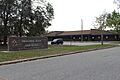
Fernandina Beach High School
-
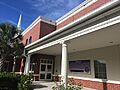
Fernandina Beach Christian Academy
See also
 In Spanish: Fernandina Beach para niños
