Fieldsboro, New Jersey facts for kids
Quick facts for kids
Fieldsboro, New Jersey
|
|
|---|---|
|
Borough
|
|
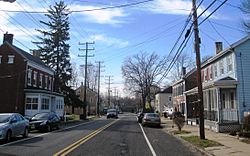
Downtown Fieldsboro
|
|
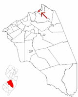
Location of Fieldsboro in Burlington County highlighted in red (right). Inset map: Location of Burlington County in New Jersey highlighted in red (left).
|
|
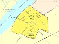
Census Bureau map of Fieldsboro, New Jersey
|
|
| Country | |
| State | |
| County | Burlington |
| Incorporated | March 7, 1850 |
| Named for | Field family |
| Government | |
| • Type | Borough |
| • Body | Borough Council |
| Area | |
| • Total | 0.36 sq mi (0.93 km2) |
| • Land | 0.28 sq mi (0.72 km2) |
| • Water | 0.08 sq mi (0.21 km2) 22.22% |
| Area rank | 552nd of 565 in state 40th of 40 in county |
| Elevation | 59 ft (18 m) |
| Population
(2020)
|
|
| • Total | 526 |
| • Estimate
(2023)
|
538 |
| • Rank | 551st of 565 in state 40th of 40 in county |
| • Density | 1,886.9/sq mi (728.5/km2) |
| • Density rank | 302nd of 565 in state 17th of 40 in county |
| Time zone | UTC−05:00 (Eastern (EST)) |
| • Summer (DST) | UTC−04:00 (Eastern (EDT)) |
| ZIP Code |
08505 – Bordentown, New Jersey
|
| Area code(s) | 609 exchanges: 291, 298, 324, 424 |
| FIPS code | 3400523250 |
| GNIS feature ID | 0885219 |
Fieldsboro is a small town, called a borough, located in Burlington County, New Jersey. It's part of a larger area that includes the cities of Philadelphia, Reading, and Camden.
Fieldsboro became an official borough on March 7, 1850. It was originally part of Mansfield Township. Later, around 1894, it became a separate town from Bordentown Township. The borough was named after the Field family, who were important early settlers in the area.
Contents
Fieldsboro's Location and Size
Fieldsboro is a small place. It covers about 0.36 square miles (0.93 square kilometers). Most of this area is land, about 0.28 square miles (0.72 square kilometers). The rest, about 0.08 square miles (0.21 square kilometers), is water.
The borough is next to Bordentown Township and the Delaware River.
People Living in Fieldsboro
| Historical population | |||
|---|---|---|---|
| Census | Pop. | %± | |
| 1900 | 459 | — | |
| 1910 | 480 | 4.6% | |
| 1920 | 530 | 10.4% | |
| 1930 | 493 | −7.0% | |
| 1940 | 537 | 8.9% | |
| 1950 | 589 | 9.7% | |
| 1960 | 583 | −1.0% | |
| 1970 | 615 | 5.5% | |
| 1980 | 597 | −2.9% | |
| 1990 | 579 | −3.0% | |
| 2000 | 522 | −9.8% | |
| 2010 | 540 | 3.4% | |
| 2020 | 526 | −2.6% | |
| 2023 (est.) | 538 | −0.4% | |
| Population sources: 1900–2000 1900–1920 1900–1910 1850–1930 1940–2000 2000 2010 2020 |
|||
In 2020, the census counted 526 people living in Fieldsboro. This was a small decrease from 540 people counted in 2010.
Population Details
In 2010, there were 540 people living in Fieldsboro. Most residents (81.11%) were White, and 12.59% were Black or African American. About 2.04% were Asian, and 3.89% were from two or more racial backgrounds. About 2.78% of the population identified as Hispanic or Latino.
The average household had about 2.62 people, and the average family had about 3.13 people. About 25% of the population was under 18 years old. The median age, which is the middle age of all residents, was 37.1 years.
How Fieldsboro is Governed
Fieldsboro uses a "borough" style of local government, which is common in New Jersey. This means it has a mayor and a borough council.
Local Government Structure
The mayor is chosen by voters for a four-year term. The borough council has six members. They are elected for three-year terms, with two seats up for election each year. In Fieldsboro, the council makes most of the laws, and the mayor leads meetings. The mayor can also stop a law from passing, but the council can overrule this decision with enough votes.
As of 2023, the mayor of Fieldsboro is David R. Hansell. His term ends on December 31, 2025. The Borough Council members include Dr. John Errigo, Richard Lynch, Mike Carroll, Amy Telford, Timothy D. Tyler, and Rosemarie Weaver.
In 2015, Fieldsboro decided to have Bordentown City provide police services instead of having its own police force. This was a way to save money.
Political Representation
Fieldsboro is part of specific areas for federal and state government. It is in the 3rd Congressional District for the U.S. House of Representatives. For state laws, it is in New Jersey's 7th state legislative district.
Most registered voters in Fieldsboro are part of the Democratic Party. A smaller number are registered as Republicans or are not affiliated with any party.
Education in Fieldsboro
Students from Fieldsboro attend public schools in the Bordentown Regional School District. This district also serves students from Bordentown City and Bordentown Township.
Schools in the District
The Bordentown Regional School District has five schools:
- Clara Barton Elementary School (grades K–2)
- Peter Muschal Elementary School (PreK–5), which serves Fieldsboro students
- MacFarland Intermediate School (grades 3–5)
- Bordentown Regional Middle School (grades 6–8)
- Bordentown Regional High School (grades 9–12)
The district's school board has nine members. One of these seats is for a representative from Fieldsboro.
Some students from New Hanover Township and Wrightstown Borough also attend Bordentown Regional High School.
Students in Burlington County, including Fieldsboro, can also attend the Burlington County Institute of Technology. This school offers special training for jobs and technical skills at its campuses in Medford and Westampton Township.
Getting Around Fieldsboro
Fieldsboro has about 3.31 miles of roads. Most of these roads are maintained by the town itself.
Roads and Highways
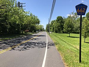
County Route 662 is the main road in Fieldsboro. There are no large highways that go directly through the borough. However, major roads like U.S. Route 130, Interstate 295, U.S. Route 206, and the New Jersey Turnpike are close by in neighboring Bordentown Township.
Public Transportation
NJ Transit provides bus service in Fieldsboro. You can take the 409 bus route to travel between Trenton and Philadelphia.
Notable People from Fieldsboro
Some well-known people have connections to Fieldsboro:
- Len Boone: A singer, songwriter, and musician.
- Archibald Crossley: A pioneer in public opinion research and statistics.
See also
 In Spanish: Fieldsboro para niños
 | John T. Biggers |
 | Thomas Blackshear |
 | Mark Bradford |
 | Beverly Buchanan |


