Fish Lake Valley facts for kids
Quick facts for kids Fish Lake Valley |
|
|---|---|

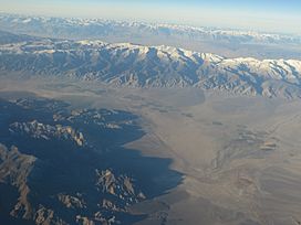
Aerial image
|
|
| Length | 25 miles (40 km) |
| Width | 8 miles (13 km) |
| Geography | |
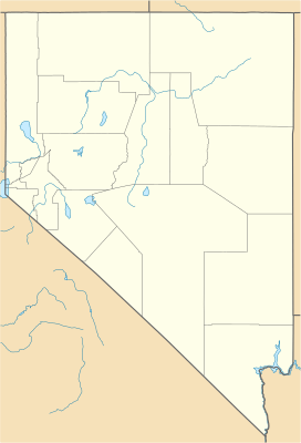
| Location | United States, Esmeralda County, NV, Mono & Inyo Counties, CA |
| Borders on | White Mountains-W, SW & S Silver Peak Range-E & SE Monte Cristo Range-NE Nev Rte 773 & Excelsior Mountains-NW |
The Fish Lake Valley is a long valley, about 25 miles (40 km) (40 km) in length. It is located in southwest Nevada. This valley is special because it is an endorheic basin. This means that any water that flows into it, like from rain or streams, stays within the valley and does not flow out to the ocean. Fish Lake Valley is part of a larger group of these basins called the Great Basin.
The valley is found northwest of Death Valley. It is next to the White Mountains in California. A small part of the valley also stretches into California. This includes the community of Oasis. Not many people live in the valley. Most residents are ranchers or members of the indigenous Paiute tribe. The main town for services like the Post Office is Dyer.
What is Fish Lake Valley Like?
Fish Lake Valley runs mostly from the southwest to the northeast. It sits right next to the White Mountains. Water flows into the valley from the mountains. This water comes from Cottonwood Creek and other small streams.
As you go southeast from the mountains, you'll find a smaller part of the valley. This area has some small dry lakes and areas covered in salt. The main part of the valley has a large area of salt. This salt area is about 10 miles (16 km) long. It contains a mineral called borax.
In the middle of the valley, there is a small dry lake. It is about 1.5 miles (2.4 km) long. This lake also gets water from the White Mountains. On the west side of this dry lake, you can see large, fan-shaped piles of dirt and rocks. These are called alluvial fans. Nevada State Route 264 runs through the hills in this area.
To the east, the Silver Peak Range borders the valley. These mountains do not have many alluvial fans. The northern part of the valley has very narrow alluvial fans. It also has broken salt flats that lead to the central dry lake. The town of Coaldale, Nevada is located near the northern edge of Fish Lake Valley.
How to Get to Fish Lake Valley
Several roads provide access to Fish Lake Valley:
- Nevada State Route 264 enters the valley from the west. It runs near the White Mountains. At Dyer, this route turns southeast. It ends at Oasis, Mono County, California.
- Nevada State Route 773 connects with Route 264. This connection is in the hills on the northwest side of Fish Lake Valley.
- U.S. Route 6 passes near the northern border of the valley. You can find it at Coaldale, Nevada.
 | Aurelia Browder |
 | Nannie Helen Burroughs |
 | Michelle Alexander |


