Floodwood, Minnesota facts for kids
Quick facts for kids
Floodwood
|
|
|---|---|
|
City
|
|
| City of Floodwood | |
 |
|
| Nickname(s):
The Catfish Capital of the World
|
|
| Motto(s):
A City for All Seasons
|
|

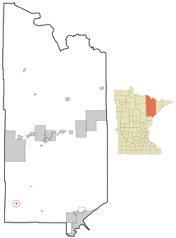
Location of the city of Floodwood
within Saint Louis County, Minnesota |
|
| Country | United States |
| State | Minnesota |
| County | Saint Louis |
| Incorporated | 1899 |
| Area | |
| • Total | 1.51 sq mi (3.91 km2) |
| • Land | 1.51 sq mi (3.91 km2) |
| • Water | 0.00 sq mi (0.00 km2) |
| Elevation | 1,250 ft (380 m) |
| Population
(2020)
|
|
| • Total | 517 |
| • Density | 342.38/sq mi (132.18/km2) |
| Time zone | UTC-6 (Central (CST)) |
| • Summer (DST) | UTC-5 (CDT) |
| ZIP code |
55736
|
| Area code(s) | 218 |
| FIPS code | 27-21338 |
| GNIS feature ID | 0661287 |
| Website | floodwood.govoffice.com |
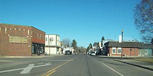
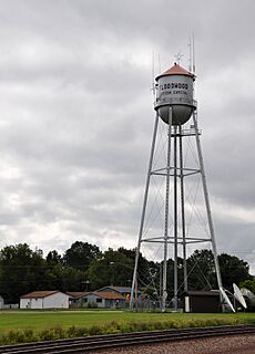
Floodwood is a small city in Saint Louis County, Minnesota, United States. In 2020, about 517 people lived there.
Floodwood started as a place for logging. Later, it became known for its dairy farms. Today, many people who live in Floodwood work in bigger cities nearby. These cities include Duluth, Grand Rapids, Hibbing, and Cloquet. Floodwood calls itself "The Catfish Capital of the World." This fun nickname came from its yearly Catfish Days festival.
You can reach Floodwood by taking U.S. Highway 2 or State Highway 73 (MN 73). These are the two main roads that go through the city.
Contents
History of Floodwood
Early Days and Trade
Long ago, even before Floodwood was a city, this area was important for trade. The East Savanna River and the Saint Louis River meet here. This meeting point made Floodwood a key spot for travel and business.
The Savanna Portage was a major path for people traveling in the southern Arrowhead. It became even more important when European fur traders arrived. They used this route to find beavers and other animals for their furs. As early as 1679, traders passed through this area. They would switch from the Saint Louis River to the East Savanna River on their way to the portage.
Logging and Growth
Homes started to appear in the Floodwood area in the late 1800s. In 1889, people heard that a railroad would be built here. This news caused the population to grow quickly. Everyone hoped the railroad would bring new chances for work.
In 1890, J. C. Campbell started big logging operations. The C. N. Nelson Lumber Company also built a logging railroad. This special railroad only ran in winter. In summer, logs were floated down the Saint Louis River to mills in Cloquet.
In 1893, the first local government was set up. A school building made of logs was also built that year. The Nelson Company was bought by what became the Weyerhaeuser Timber Company in 1899. This meant even more logging happened. The community kept growing and officially became a city in 1899.
By 1900, Floodwood had 224 people. In the next 10 years, this number more than doubled to 481. In 1911, the Floodwood School became its own school district. A new brick school building with six rooms was built. The city continued to grow until a big fire in 1918 almost destroyed it.
Surviving Challenges
The 1918 Cloquet Fire was a huge disaster. Like many nearby towns, Floodwood survived the fire. It began to recover slowly. However, the rivers were no longer as important for business. By 1926, the time of large logging operations was over. Without logging, Floodwood's future was uncertain.
But a new solution had already started in 1911. The land around Floodwood was good for raising dairy cows. So, the city's economy changed to focus on dairy farming. The Floodwood Creamery Cooperative was formed in 1911. This creamery became the main support for the local economy. It sold dairy products all over the world. The creamery closed in the late 1960s. Still, dairy cows are an important part of the local economy today.
The population of Floodwood started to decrease after 1970. This trend has continued. The last time the city's population grew was in 1960.
Where is Floodwood?
Floodwood is a city that covers about 1.42 square miles (3.68 square kilometers) of land. It has no water area.
The city is located where U.S. Highway 2 and Minnesota State Highway 73 meet. It's about halfway between Duluth and Grand Rapids on U.S. Highway 2. It's also roughly halfway between Hibbing and Moose Lake on State Highway 73. The city of Cloquet is also not far away.
Floodwood is about 46 miles (74 km) northwest of Duluth. It is 37 miles (60 km) southeast of Grand Rapids. It is also 33 miles (53 km) northwest of Cloquet. And it is 40 miles (64 km) south of Hibbing.
Rivers and Nature
The city is located where the Floodwood River and the East Savanna River join the Saint Louis River. The area around Floodwood has many forests and wetlands. Where the land is suitable, you can also find dairy farms.
Nearby peat bogs provide jobs for many people. These bogs are found in Floodwood, Meadowlands, and other towns. Protected natural areas near Floodwood include Savanna Portage State Park, the Savanna State Forest, and the Floodwood Game Reserve. The Savanna Portage and the three rivers are very important to the local culture.
Weather in Floodwood
Floodwood has a climate with warm summers and cold, snowy winters. This type of climate is called a "warm-summer humid continental climate."
The hottest temperature ever recorded in Floodwood was 99°F (37°C) on July 27, 1988. The coldest temperature ever recorded was -50°F (-46°C) on January 20, 1996.
| Climate data for Floodwood, Minnesota, 1991–2020 normals, extremes 1903–present | |||||||||||||
|---|---|---|---|---|---|---|---|---|---|---|---|---|---|
| Month | Jan | Feb | Mar | Apr | May | Jun | Jul | Aug | Sep | Oct | Nov | Dec | Year |
| Record high °F (°C) | 51 (11) |
57 (14) |
77 (25) |
86 (30) |
89 (32) |
93 (34) |
99 (37) |
97 (36) |
95 (35) |
87 (31) |
74 (23) |
53 (12) |
99 (37) |
| Mean maximum °F (°C) | 38.2 (3.4) |
44.4 (6.9) |
58.1 (14.5) |
72.1 (22.3) |
82.5 (28.1) |
86.5 (30.3) |
87.9 (31.1) |
86.5 (30.3) |
82.2 (27.9) |
75.0 (23.9) |
55.9 (13.3) |
41.2 (5.1) |
89.5 (31.9) |
| Mean daily maximum °F (°C) | 17.9 (−7.8) |
23.7 (−4.6) |
36.3 (2.4) |
50.1 (10.1) |
63.7 (17.6) |
72.5 (22.5) |
77.1 (25.1) |
75.5 (24.2) |
67.0 (19.4) |
52.5 (11.4) |
36.0 (2.2) |
23.1 (−4.9) |
49.6 (9.8) |
| Daily mean °F (°C) | 7.1 (−13.8) |
11.4 (−11.4) |
24.6 (−4.1) |
38.4 (3.6) |
51.1 (10.6) |
60.4 (15.8) |
65.0 (18.3) |
63.4 (17.4) |
55.2 (12.9) |
42.2 (5.7) |
27.6 (−2.4) |
14.3 (−9.8) |
38.4 (3.6) |
| Mean daily minimum °F (°C) | −3.7 (−19.8) |
−0.8 (−18.2) |
13.0 (−10.6) |
26.8 (−2.9) |
38.6 (3.7) |
48.3 (9.1) |
53.0 (11.7) |
51.2 (10.7) |
43.5 (6.4) |
31.9 (−0.1) |
19.2 (−7.1) |
5.5 (−14.7) |
27.2 (−2.6) |
| Mean minimum °F (°C) | −30.2 (−34.6) |
−24.9 (−31.6) |
−14.8 (−26.0) |
11.5 (−11.4) |
24.2 (−4.3) |
32.9 (0.5) |
40.0 (4.4) |
38.3 (3.5) |
27.6 (−2.4) |
17.6 (−8.0) |
−1.8 (−18.8) |
−21.4 (−29.7) |
−33.1 (−36.2) |
| Record low °F (°C) | −50 (−46) |
−43 (−42) |
−35 (−37) |
−4 (−20) |
15 (−9) |
25 (−4) |
35 (2) |
30 (−1) |
20 (−7) |
6 (−14) |
−17 (−27) |
−40 (−40) |
−50 (−46) |
| Average precipitation inches (mm) | 0.63 (16) |
0.66 (17) |
1.15 (29) |
2.29 (58) |
2.93 (74) |
4.92 (125) |
3.89 (99) |
3.17 (81) |
3.50 (89) |
2.78 (71) |
1.24 (31) |
0.99 (25) |
28.15 (715) |
| Average snowfall inches (cm) | 10.5 (27) |
8.5 (22) |
6.8 (17) |
6.6 (17) |
0.2 (0.51) |
0.0 (0.0) |
0.0 (0.0) |
0.0 (0.0) |
0.0 (0.0) |
2.3 (5.8) |
8.0 (20) |
13.5 (34) |
56.4 (143.31) |
| Average extreme snow depth inches (cm) | 13.2 (34) |
15.8 (40) |
14.5 (37) |
6.6 (17) |
0.2 (0.51) |
0.0 (0.0) |
0.0 (0.0) |
0.0 (0.0) |
0.0 (0.0) |
1.4 (3.6) |
5.4 (14) |
8.8 (22) |
18.1 (46) |
| Average precipitation days (≥ 0.01 in) | 6.1 | 4.8 | 5.9 | 7.4 | 10.6 | 11.8 | 11.1 | 8.6 | 9.3 | 9.5 | 6.4 | 7.3 | 98.8 |
| Average snowy days (≥ 0.1 in) | 6.7 | 5.2 | 4.0 | 2.7 | 0.2 | 0.0 | 0.0 | 0.0 | 0.0 | 0.9 | 4.0 | 7.2 | 30.9 |
| Source 1: NOAA | |||||||||||||
| Source 2: National Weather Service | |||||||||||||
Who Lives in Floodwood?
| Historical population | |||
|---|---|---|---|
| Census | Pop. | %± | |
| 1900 | 224 | — | |
| 1910 | 481 | 114.7% | |
| 1920 | 277 | −42.4% | |
| 1930 | 343 | 23.8% | |
| 1940 | 571 | 66.5% | |
| 1950 | 667 | 16.8% | |
| 1960 | 677 | 1.5% | |
| 1970 | 650 | −4.0% | |
| 1980 | 648 | −0.3% | |
| 1990 | 574 | −11.4% | |
| 2000 | 503 | −12.4% | |
| 2010 | 528 | 5.0% | |
| 2020 | 517 | −2.1% | |
| U.S. Decennial Census | |||
People and Families
In 2010, there were 528 people living in Floodwood. They lived in 257 households, and 118 of these were families. The city had about 372 people per square mile.
Most people in Floodwood were White (93.9%). A small number were African American (0.8%) or Native American (0.6%). Some people were from other races (0.4%) or from two or more races (4.4%). About 1.1% of the population was Hispanic or Latino.
About 23.7% of households had children under 18 living there. About 30% were married couples. Some households were led by a single woman (10.5%) or a single man (5.4%). Many households (54.1%) were not families. Almost half of all households (47.5%) had only one person living there. About 21.4% of households had someone aged 65 or older living alone.
The average age of people in Floodwood was 40.9 years. About 21.4% of residents were under 18. About 9.3% were between 18 and 24. People aged 25 to 44 made up 24.8% of the population. Those aged 45 to 64 were 24.5%. And 20.1% of residents were 65 or older. The population was almost evenly split between males (50.4%) and females (49.6%).
Famous People from Floodwood
- Joe Polo — He is an American curler. He won a gold medal at the 2018 Winter Olympics. He also competed in the 2006 Winter Olympics. Joe spent some of his early childhood years in Floodwood.
- John Raymond Ylitalo — He was a diplomat. He served as the 29th United States Ambassador to Paraguay. John Raymond Ylitalo was born in Floodwood.
See also
 In Spanish: Floodwood para niños
 | Janet Taylor Pickett |
 | Synthia Saint James |
 | Howardena Pindell |
 | Faith Ringgold |


