
Cloquet, Minnesota facts for kids
Quick facts for kids
Cloquet
|
|
|---|---|

Cloquet Avenue in downtown Cloquet
|
|
| Nickname(s):
Wood City
|
|

Location of the city of Cloquet
within Carlton County, Minnesota |
|
| Country | United States |
| State | Minnesota |
| County | Carlton |
| Incorporated (village) | 1884 |
| Incorporated (city) | 1904 |
| Area | |
| • Total | 36.01 sq mi (93.27 km2) |
| • Land | 35.22 sq mi (91.21 km2) |
| • Water | 0.80 sq mi (2.06 km2) 2.14% |
| Elevation | 1,204 ft (367 m) |
| Population
(2020)
|
|
| • Total | 12,568 |
| • Estimate
(2022)
|
12,603 |
| • Density | 356.87/sq mi (137.79/km2) |
| Time zone | UTC-6 (Central (CST)) |
| • Summer (DST) | UTC-5 (CDT) |
| ZIP code |
55720
|
| Area code(s) | 218 |
| FIPS code | 27-12160 |
| GNIS feature ID | 0641345 |
Cloquet (say "kloh-KAY") is a city in Carlton County, Minnesota, United States. It's located where Interstate 35 and Minnesota State Highway 33 meet. Part of Cloquet is also on the Fond du Lac Indian Reservation. It serves as one of the reservation's main centers. In 2020, about 12,568 people lived there.
Contents
History of Cloquet

Cloquet started as three small settlements. These were called Shaw Town, Nelson Town, and Johnson Town. They were built around sawmills, which cut wood. Later, these towns became known as Knife Falls. This name came from a waterfall over sharp rocks nearby.
The Ojibwe in the area had their own name for it. They called it Mookomaan-onigamiing. This means 'At the Knife Portage'. A portage is a path used to carry boats between waterways. This portage helped people avoid the Knife Falls.
How Cloquet Became a City
In 1883, the area was officially mapped out. The village of Cloquet was formed from the three settlements in 1884. It grew into a city with a mayor and city council in 1904.
The name Cloquet first appeared on a map in 1843. This map was made by Joseph N. Nicollet. It showed the Cloquet River and Cloquet Rapids. The name Cloquet is a French last name. No one is sure how it got here. Some people think the river was named after French scientists Hippolyte and Jules Cloquet. Then the settlement was named after the river.
The Great Fire of 1918
In 1918, a huge fire swept through the area. It was called the Cloquet fire. The fire destroyed most of the town. Sadly, 453 people lost their lives.
Co-ops in Cloquet
Before and after World War II, Cloquet was famous for its strong consumer cooperatives. A cooperative, or co-op, is a business owned by its members. These members are often the customers. The Cloquet Cooperative Society started in 1910. It ran two stores that sold food, tools, shoes, and furniture.
The co-op also offered other services. These included a building supply store and a coal yard. They even had a funeral home and an auto repair shop. In 1939, the co-op did 35% of all business in Cloquet. By the mid-1950s, it had over 4,200 members. This was a national record for co-ops.
Modern Growth
In the 1970s, the city's area grew much larger. It became more than ten times its size in 1970. Even with this growth, the number of people living in Cloquet went down slightly from 1970 to 1980. However, more homes were built during this time.
Special Architecture
Cloquet is home to a unique building. It's the R.W. Lindholm Service Station. This is the only gas station ever designed by the famous architect Frank Lloyd Wright. It is now a special historical place.
Geography and Climate
Cloquet covers about 36 square miles (93 square kilometers). Most of this area is land. A small part is water.
The city is located along the Saint Louis River. It is about 20 miles southwest of Duluth.
Weather in Cloquet
Cloquet has a Humid continental climate. This means it has warm summers. It also has long, cold winters. This type of climate is common in northern Minnesota.
| Climate data for Cloquet, Minnesota (1991–2020 normals, extremes 1900–present) | |||||||||||||
|---|---|---|---|---|---|---|---|---|---|---|---|---|---|
| Month | Jan | Feb | Mar | Apr | May | Jun | Jul | Aug | Sep | Oct | Nov | Dec | Year |
| Record high °F (°C) | 52 (11) |
57 (14) |
79 (26) |
88 (31) |
94 (34) |
98 (37) |
105 (41) |
98 (37) |
96 (36) |
86 (30) |
72 (22) |
57 (14) |
105 (41) |
| Mean daily maximum °F (°C) | 18.2 (−7.7) |
24.0 (−4.4) |
36.8 (2.7) |
50.4 (10.2) |
64.3 (17.9) |
73.5 (23.1) |
78.5 (25.8) |
76.2 (24.6) |
67.2 (19.6) |
51.7 (10.9) |
35.0 (1.7) |
22.7 (−5.2) |
49.9 (9.9) |
| Daily mean °F (°C) | 9.9 (−12.3) |
14.3 (−9.8) |
26.4 (−3.1) |
39.1 (3.9) |
51.4 (10.8) |
60.7 (15.9) |
66.3 (19.1) |
64.6 (18.1) |
56.4 (13.6) |
43.0 (6.1) |
28.4 (−2.0) |
15.8 (−9.0) |
39.7 (4.3) |
| Mean daily minimum °F (°C) | 1.7 (−16.8) |
4.6 (−15.2) |
16.1 (−8.8) |
27.9 (−2.3) |
38.4 (3.6) |
47.8 (8.8) |
54.0 (12.2) |
53.0 (11.7) |
45.6 (7.6) |
34.3 (1.3) |
21.9 (−5.6) |
9.0 (−12.8) |
29.5 (−1.4) |
| Record low °F (°C) | −45 (−43) |
−41 (−41) |
−35 (−37) |
−7 (−22) |
8 (−13) |
24 (−4) |
30 (−1) |
26 (−3) |
19 (−7) |
0 (−18) |
−24 (−31) |
−37 (−38) |
−45 (−43) |
| Average precipitation inches (mm) | 1.00 (25) |
0.98 (25) |
1.44 (37) |
2.41 (61) |
3.48 (88) |
4.75 (121) |
4.33 (110) |
4.18 (106) |
3.56 (90) |
3.26 (83) |
1.82 (46) |
1.46 (37) |
32.67 (830) |
| Average snowfall inches (cm) | 13.5 (34) |
13.5 (34) |
10.3 (26) |
6.4 (16) |
0.3 (0.76) |
0.0 (0.0) |
0.0 (0.0) |
0.0 (0.0) |
0.0 (0.0) |
1.8 (4.6) |
9.6 (24) |
15.9 (40) |
71.3 (181) |
| Average precipitation days (≥ 0.01 in) | 9.8 | 8.4 | 8.6 | 9.9 | 11.9 | 13.3 | 12.2 | 10.7 | 11.1 | 12.1 | 9.6 | 11.1 | 128.7 |
| Average snowy days (≥ 0.1 in) | 12.3 | 9.2 | 5.6 | 2.6 | 0.2 | 0.0 | 0.0 | 0.0 | 0.0 | 1.1 | 6.9 | 12.7 | 50.6 |
| Source: NOAA | |||||||||||||
People of Cloquet
| Historical population | |||
|---|---|---|---|
| Census | Pop. | %± | |
| 1880 | 93 | — | |
| 1890 | 2,530 | 2,620.4% | |
| 1900 | 3,072 | 21.4% | |
| 1910 | 7,031 | 128.9% | |
| 1920 | 5,127 | −27.1% | |
| 1930 | 6,782 | 32.3% | |
| 1940 | 7,304 | 7.7% | |
| 1950 | 7,685 | 5.2% | |
| 1960 | 9,013 | 17.3% | |
| 1970 | 8,699 | −3.5% | |
| 1980 | 11,142 | 28.1% | |
| 1990 | 10,885 | −2.3% | |
| 2000 | 11,201 | 2.9% | |
| 2010 | 12,124 | 8.2% | |
| 2020 | 12,568 | 3.7% | |
| 2022 (est.) | 12,603 | 4.0% | |
| U.S. Decennial Census 2020 Census |
|||
Population in 2020
In 2020, Cloquet had 12,568 people. There were about 5,399 homes. Most people (80%) were White. About 10.9% were Native American. Other groups included Black, Asian, and Pacific Islander people. About 7% of people were from two or more races. A small number (1.8%) were Hispanic or Latino.
Population in 2010
In 2010, the city had 12,124 people. There were 4,959 households. About 33% of households had children under 18. Many households (43.1%) were married couples. About 30.5% of households had just one person living there.
The average age in Cloquet was 37 years old. About 25.5% of people were under 18. Another 15.2% were 65 or older. The city had slightly more females (51.3%) than males (48.7%).
Transportation
Main Roads
 Interstate 35
 Minnesota State Highway 33
Education
Most of Cloquet is part of the Cloquet Public School District. Some smaller parts are in the Carlton Public School District.
There is also a school for students from kindergarten to 12th grade. It is called Fond du Lac Ojibwe School. This school is connected to the Bureau of Indian Education.
Notable People
Many interesting people have come from Cloquet:
- U.W. "Judge" Hella, who directed Minnesota State Parks
- Jerry Knickerbocker, a Minnesota state lawmaker and businessman
- Jessica Lange, a famous actress
- Jamie Langenbrunner, a former professional hockey player in the NHL
- Clarence Larson, a chemist and Commissioner of the U.S. Atomic Energy Commission
- Corey Millen, a former professional hockey player and coach
- Barbara Payton, an actress
- Derek Plante, a former professional hockey player and current coach for the Chicago Blackhawks
- Roy W. Ranum, a former mayor of Cloquet and Minnesota state senator
- Lawrence Yetka, a judge on the Minnesota Supreme Court
Images for kids
-
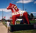
A large Dalecarlian horse

See also
 In Spanish: Cloquet para niños
