
List of Minnesota state parks facts for kids

Hold cursor over locations to display park name;
click to go to park article.
Minnesota is home to an amazing system of state parks! There are 67 state parks, nine state recreation areas, nine state waysides, and 23 state trails. Together, these special places cover about 267,000 acres (1,080 km2) of land. A Minnesota state park is a piece of land kept safe by the state because of its beautiful nature, important history, or other cool features. Each park was created by a law from the Minnesota government and is looked after by the Minnesota Department of Natural Resources. The Minnesota Historical Society also helps manage some historical spots within the parks.
Minnesota's state park system started way back in 1891 with Itasca State Park. A law was passed to "keep intact, forever, a limited quantity of the domain of this commonwealth...in a state of nature." This makes Minnesota's state park system the second oldest in the United States, right after New York's!
These parks are spread out so well that almost every Minnesotan lives within 50 miles (80 km) of a state park. The newest park is Lake Vermilion State Park, which was created in 2010. The parks come in all sizes, from tiny Franz Jevne State Park at 118 acres (48 ha) to the huge Saint Croix State Park at 34,037 acres (13,774 ha). Some parks even have special places called National Natural Landmarks, like Big Bog State Recreation Area and Itasca State Park. Six parks have National Historic Landmarks, which are very important historical sites. These include Charles A. Lindbergh, Fort Snelling, Mille Lacs Kathio, St. Croix, Soudan Underground Mine, and Split Rock Lighthouse State Parks. Many parks also have buildings or areas built by programs in the 1930s that helped people find jobs during tough times.
Contents
History of Minnesota's Parks
Minnesota first tried to create a state park in 1885 to protect Minnehaha Falls. But there were some legal problems, and by the time they were sorted out, the state didn't have enough money. So, the city of Minneapolis stepped in and bought the land, making it a city park instead.
But Minnesota didn't give up! In 1891, they successfully created Itasca State Park around Lake Itasca. This park was important for fun activities and to protect the source of the mighty Mississippi River. Then, Interstate Park on the St. Croix River was created in 1895. More parks were added over the next 20 years.
At first, different people managed the parks, which made things a bit messy. In 1923, a state official named Ray P. Chase said they needed a better plan and a dedicated person to manage the parks. His ideas worked! Two years later, the Department of Conservation was created to manage all of Minnesota's natural resources, including the state parks. In 1935, the state parks got their own special division. This helped them use federal programs, like the Civilian Conservation Corps (CCC), which built many of the park structures you can still see today. In 1971, this department became the Minnesota Department of Natural Resources, which still manages the parks.
In July 2011, the state parks had to close for almost three weeks because of a state government shutdown.
State Parks and Recreation Areas
Here's a list of many of Minnesota's state parks and recreation areas. Each one offers something special to explore!
| Park name | County or Counties | Size | Year Established | Water Body(s) | Coordinates | What's Special Here? | Image | |
|---|---|---|---|---|---|---|---|---|
| acres | ha | |||||||
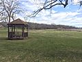
| Afton State Park | Washington | 1,600 | 650 | 1969 | St. Croix River | 44°51′45″N 92°47′01″W / 44.8624675°N 92.7835367°W | Explore deep valleys that drop 300 feet (91 m) down to the St. Croix River. |  |
| Banning State Park | Pine | 5,597 | 2,265 | 1963 | Kettle River | 46°10′15″N 92°50′39″W / 46.1707812°N 92.8440889°W | Enjoy 1.5 miles (2.4 km) of exciting whitewater rapids and see old quarry ruins. |  |
| Bear Head Lake State Park | St. Louis | 3,013 | 1,219 | 1961 | Bear Head Lake | 47°47′47″N 92°04′37″W / 47.7963051°N 92.0768231°W | Experience nature similar to the nearby Boundary Waters, with easy road access. |  |
| Beaver Creek Valley State Park | Houston | 715 | 289 | 1937 | East Beaver Creek | 43°38′34″N 91°34′55″W / 43.6427458°N 91.5818101°W | Discover a rugged valley carved by a trout stream in the unique Driftless Area. |  |
| Big Bog State Recreation Area | Beltrami | 9,170 | 3,710 | 2000 | Red Lake, Tamarac River | 48°10′22″N 94°30′43″W / 48.172761°N 94.512033°W | Walk on a boardwalk through a huge peatland and enjoy great fishing. |  |
| Big Stone Lake State Park | Big Stone | 980 | 400 | 1961 | Big Stone Lake | 45°22′57″N 96°30′47″W / 45.3824644°N 96.5131148°W | Protects parts of the shoreline on Big Stone Lake, where the Minnesota River begins. |  |
| Blue Mounds State Park | Rock | 1,567 | 634 | 1937 | Mound Creek | 43°42′25″N 96°11′13″W / 43.7069134°N 96.1869728°W | See cool rock formations and Minnesota's only public bison herd! |  |
| Buffalo River State Park | Clay | 1,068 | 432 | 1937 | Buffalo River | 46°51′56″N 96°28′04″W / 46.8655165°N 96.4678474°W | Explore one of the state's largest and best tallgrass prairies. |  |
| Camden State Park | Lyon | 1,855 | 751 | 1935 | Redwood River | 44°21′45″N 95°55′30″W / 44.362462°N 95.9250247°W | Discover a beautiful forested river valley surrounded by prairie. |  |
| Carley State Park | Wabasha | 209 | 85 | 1949 | Whitewater River | 44°07′00″N 92°10′34″W / 44.1166318°N 92.1760002°W | Home to a stand of tall white pines, great for a quiet visit. |  |
| Cascade River State Park | Cook | 2,867 | 1,160 | 1957 | Lake Superior and Cascade River | 47°42′35″N 90°31′20″W / 47.7097222°N 90.5222222°W | Enjoy 10.5 miles (16.9 km) of Lake Superior coastline. | .JPG) |
| Charles A. Lindbergh State Park | Morrison | 417 | 169 | 1931 | Mississippi River | 45°57′32″N 94°23′43″W / 45.9588545°N 94.3952813°W | Visit the restored home of famous aviator Charles Lindbergh and his father. |  |
| Crow Wing State Park | Crow Wing, Cass, and Morrison | 2,335 | 945 | 1959 | Mississippi and Crow Wing Rivers | 46°16′20″N 94°20′00″W / 46.2722222°N 94.3333333°W | Learn about the historic town of Old Crow Wing, an important trading center. |  |
| Cuyuna Country State Recreation Area | Crow Wing | 6,850 | 2,770 | 1993 | Chain of small lakes and streams, filled pit mines | 46°29′22″N 93°58′39″W / 46.489550°N 93.977500°W | Explore land that used to be iron mines, now with the state's deepest lake! |  |
| Father Hennepin State Park | Mille Lacs | 275 | 111 | 1941 | Mille Lacs Lake | 46°08′41″N 93°29′17″W / 46.1446779°N 93.4880157°W | Enjoy lakeside fun in the area visited by Father Louis Hennepin in 1680. |  |
| Flandrau State Park | Brown | 840 | 340 | 1937 | Cottonwood River | 44°17′18″N 94°28′25″W / 44.2882956°N 94.4735837°W | Offers water recreation near New Ulm. |  |
| Forestville/Mystery Cave State Park | Fillmore | 3,163 | 1,280 | 1963 | South Branch Root River and tributaries | 43°37′32″N 92°14′51″W / 43.6255204°N 92.247388°W | Explore a historic town, the state's longest cave, and great trout streams. |  |
| Fort Ridgely State Park | Nicollet and Renville | 537 | 217 | 1911 | Fort Ridgely Creek | 44°27′09″N 94°43′51″W / 44.4524621°N 94.7308199°W | Visit the site of Fort Ridgely, important during the Dakota War of 1862. |  |
| Fort Snelling State Park | Ramsey, Hennepin, and Dakota | 1,825 | 739 | 1961 | Mississippi and Minnesota Rivers | 44°53′09″N 93°10′41″W / 44.8857988°N 93.1779985°W | See historic Fort Snelling, built in 1819, right in the heart of the Twin Cities. |  |
| Franz Jevne State Park | Koochiching | 118 | 48 | 1967 | Rainy River | 48°38′32″N 94°04′49″W / 48.642240°N 94.080410°W | Enjoy beautiful views on the Canada–United States border. |  |
| Frontenac State Park | Goodhue | 2,226 | 901 | 1957 | Lake Pepin on Mississippi River | 44°30′27″N 92°19′35″W / 44.5074677°N 92.3262914°W | A great spot for birdwatching with over 260 species of birds! |  |
| Garden Island State Recreation Area | Lake of the Woods | 715 | 289 | 1998 | Lake of the Woods | 49°10′31″N 94°50′05″W / 49.175335°N 94.834671°W | A mostly untouched island, once home to Native American gardens. | |
| George H. Crosby Manitou State Park | Lake | 6,200 | 2,500 | 1955 | Manitou River | 47°30′22″N 91°06′33″W / 47.506018°N 91.109045°W | A wild North Woods area perfect for backpackers. |  |
| Glacial Lakes State Park | Pope | 1,857 | 752 | 1963 | Several kettle lakes | 45°32′15″N 95°31′19″W / 45.537461°N 95.521983°W | Preserves beautiful rolling tallgrass prairies and glacial landforms. |  |
| Glendalough State Park | Otter Tail | 1,924 | 779 | 1991 | Six kettle lakes | 46°20′00″N 95°40′00″W / 46.3333333°N 95.6666667°W | Once a private retreat, now a park with great fishing for large game fish. |  |
| Gooseberry Falls State Park | Lake | 1,741 | 705 | 1937 | Lake Superior, Gooseberry River | 47°08′49″N 91°27′48″W / 47.1468715°N 91.4632289°W | Known for its five amazing waterfalls and an agate beach. |  |
| Grand Portage State Park | Cook | 278 | 113 | 1989 | Pigeon River | 48°00′37″N 89°36′43″W / 48.0101633°N 89.6120317°W | See Minnesota's tallest waterfall, 120-foot (37 m) high, right on the Canada border! |  |
| Great River Bluffs State Park | Winona | 2,122 | 859 | 1963 | Mississippi River | 43°56′47″N 91°23′58″W / 43.9463526°N 91.3993094°W | Features stunning 500-foot-high (150 m) bluffs overlooking the Mississippi River. | |
| Greenleaf Lake State Recreation Area | Meeker | 1,230 | 500 | 2004 | Greenleaf and Sioux Lakes | 45°00′57″N 94°28′00″W / 45.01591°N 94.46671°W | A newer park still being developed, great for day visits. |  |
| Hayes Lake State Park | Roseau | 2,118 | 857 | 1967 | Hayes Lake, North Fork Roseau River | 48°37′24″N 95°30′28″W / 48.623309°N 95.507753°W | Perfect for fishing and swimming in a clean, calm lake. | .jpg) |
| Hill-Annex Mine State Park | Itasca | 634 | 257 | 1988 | Filled pit mine | 47°19′39″N 93°16′39″W / 47.327490°N 93.277520°W | Take tours of a former iron mine and even collect fossils! |  |
| Interstate State Park | Chisago | 288 | 117 | 1895 | St. Croix River | 45°23′42″N 92°40′11″W / 45.3949622°N 92.6696521°W | Protects a basalt gorge and cool glacial potholes, shared with a Wisconsin state park. |  |
| Iron Range Off-Highway Vehicle State Recreation Area | St. Louis | 1,864 | 754 | 2002 | Lake Ore-be-gone | 47°28′57″N 92°26′37″W / 47.48247°N 92.44349°W | Offers 36 miles (58 km) of trails for off highway vehicles. | _Recreation_Area,_Minnesota_(28064197648).jpg) |
| Itasca State Park | Hubbard, Clearwater, and Becker | 30,553 | 12,364 | 1891 | Lake Itasca | 47°11′51″N 95°12′07″W / 47.1974579°N 95.2019642°W | Minnesota's oldest state park, famous for being the start of the Mississippi River! |  |
| Jay Cooke State Park | Carlton | 8,125 | 3,288 | 1915 | Saint Louis River | 46°38′59″N 92°19′51″W / 46.6496646°N 92.330748°W | See a rocky, whitewater river flowing through the North Woods. |  |
| John A. Latsch State Park | Winona | 409 | 166 | 1925 | Mississippi River | 44°09′43″N 91°49′20″W / 44.1619082°N 91.8220997°W | Features three steep river bluffs with great views. |  |
| Judge C. R. Magney State Park | Cook | 4,323 | 1,749 | 1957 | Lake Superior, Brule River | 47°51′05″N 90°03′30″W / 47.8512799°N 90.0584299°W | Home to the mysterious Devil's Kettle, where half the Brule River disappears! |  , , |
| Kilen Woods State Park | Jackson | 202 | 82 | 1945 | Des Moines River | 43°43′36″N 95°03′47″W / 43.7266244°N 95.0630473°W | A beautiful forested area along the river. |  |
| La Salle Lake State Recreation Area | Hubbard | 1,000 | 400 | 2011 | Mississippi River, La Salle Lake | 47°20′14″N 95°10′14″W / 47.33719°N 95.17061°W | A newer park being developed around Minnesota's second-deepest lake. |  |
| Lac qui Parle State Park | Lac qui Parle and Chippewa | 897 | 363 | 1959 | Lac qui Parle, Minnesota and Lac qui Parle Rivers | 45°01′14″N 95°53′20″W / 45.0205141°N 95.888921°W | Attracts thousands of migrating waterfowl, giving it the name "Lake that Speaks." |  |
| Lake Bemidji State Park | Beltrami | 1,653 | 669 | 1923 | Lake Bemidji | 47°32′11″N 94°49′22″W / 47.5363413°N 94.8227704°W | Features a fun lakeshore and a unique spruce-tamarack bog. |  |
| Lake Bronson State Park | Kittson | 2,806 | 1,136 | 1937 | Lake Bronson, South Branch Two Rivers | 48°43′29″N 96°36′12″W / 48.7247004°N 96.6033741°W | Built around a reservoir created during a drought in the 1930s. |  |
| Lake Carlos State Park | Douglas | 1,175 | 476 | 1937 | Lake Carlos | 45°59′12″N 95°19′40″W / 45.9866293°N 95.3278143°W | Home to many different habitats, from prairie to forest. |  |
| Lake Louise State Park | Mower | 849 | 344 | 1963 | Lake Louise, Upper and Little Iowa Rivers | 43°32′01″N 92°31′32″W / 43.5335762°N 92.5254538°W | Features a lake surrounded by oak trees and hardwood forests. |  |
| Lake Maria State Park | Wright | 1,475 | 597 | 1963 | Several kettle lakes | 45°18′50″N 93°57′26″W / 45.3138543°N 93.9572003°W | A wild area with beautiful lakes, close to the Twin Cities. |  |
| Lake Shetek State Park | Murray County | 1,109 | 449 | 1937 | Lake Shetek | 44°06′08″N 95°41′24″W / 44.1021838°N 95.6900114°W | See reminders of pioneer history around the largest lake in southwestern Minnesota. |  |
| Lake Vermilion Soudan Underground Mine State Park | St. Louis | 2,875 | 1,163 | 2010 | Lake Vermilion | 47°50′05″N 92°11′53″W / 47.83471°N 92.19812°W | A newer park on Minnesota's fifth-largest lake. |  |
| Maplewood State Park | Otter Tail | 8,127 | 3,289 | 1963 | Several kettle lakes | 46°32′01″N 95°56′57″W / 46.5335703°N 95.9492193°W | A beautiful mix of forest and prairie. |  |
| McCarthy Beach State Park | St. Louis | 1,908 | 772 | 1945 | Sturgeon and Side Lakes | 47°40′22″N 93°01′49″W / 47.6727068°N 93.0301834°W | Features a .5-mile-long (0.80 km) beach between two lakes. |  |
| Mille Lacs Kathio State Park | Mille Lacs | 9,786 | 3,960 | 1957 | Mille Lacs Lake, Rum River | 46°07′44″N 93°44′26″W / 46.1288485°N 93.7405269°W | Home to 19 ancient archaeological sites, some dating back 9000 years! |  |
| Minneopa State Park | Blue Earth | 1,617 | 654 | 1905 | Minnesota River, Minneopa Creek | 44°09′44″N 94°06′08″W / 44.1621879°N 94.1021803°W | See the largest waterfall in southern Minnesota. |  |
| Minnesota Valley State Recreation Area | Hennepin, Dakota, Scott, Carver, Sibley, and Le Sueur | 6,442 | 2,607 | 1969 | Minnesota River | 44°39′43″N 93°42′12″W / 44.661999°N 93.703337°W | Made up of different sections along the Minnesota River valley. |  |
| Monson Lake State Park | Swift | 343 | 139 | 1937 | Monson and West Sunberg Lakes | 45°19′14″N 95°16′30″W / 45.3205175°N 95.2750235°W | A memorial to settlers who died in the Dakota War of 1862. |  |
| Moose Lake State Park | Carlton | 829 | 335 | 1971 | Moosehead and Echo Lakes | 46°26′11″N 92°43′31″W / 46.436319°N 92.72521°W | Offers water fun and a cool exhibit hall about Minnesota's state gemstone, the Lake Superior agate. |  |
| Myre-Big Island State Park | Freeborn | 1,578 | 639 | 1947 | Albert Lea Lake | 43°37′26″N 93°17′21″W / 43.6238465°N 93.2890959°W | Features two islands with very old hardwood forests. |  |
| Nerstrand-Big Woods State Park | Rice | 1,646 | 666 | 1945 | Prairie Creek | 44°20′43″N 93°06′27″W / 44.3452425°N 93.1074337°W | Protects a remaining part of the historic "Big Woods" forest. |  |
| Old Mill State Park | Marshall | 287 | 116 | 1951 | Middle River | 48°21′41″N 96°34′13″W / 48.361364°N 96.5703288°W | See two old mills and a log cabin from the late 1800s. |  |
| Red River State Recreation Area | Polk | 104 | 42 | 1997 | Red River of the North and Red Lake River | 47°55′58″N 97°02′08″W / 47.9327778°N 97.0355556°W | This park was created on land damaged by a big flood in 1997, now it helps control floods and offers recreation. |  |
| Rice Lake State Park | Steele and Dodge | 712 | 288 | 1963 | Rice Lake | 44°05′15″N 93°03′41″W / 44.0874639°N 93.061315°W | Surrounds a shallow lake that attracts many migrating birds. |  |
| St. Croix Islands State Recreation Area | Washington | 25 | 10 | 1935 | St. Croix River | 45°05′07″N 92°47′10″W / 45.08524°N 92.78608°W | Five islands near the St. Croix Boom Site, great for exploring. |  |
| St. Croix State Park | Pine | 31,775 | 12,859 | 1943 | St. Croix River | 45°58′27″N 92°35′01″W / 45.9741154°N 92.5835304°W | A huge park built by the CCC and WPA, now a National Historic Landmark. |  |
| Sakatah Lake State Park | Le Sueur and Rice | 810 | 330 | 1963 | Sakatah Lake on the Cannon River | 44°13′16″N 93°32′09″W / 44.2210746°N 93.5357792°W | A beautiful area where prairie meets the "Big Woods" forest. |  |
| Savanna Portage State Park | Aitkin and St. Louis | 15,277 | 6,182 | 1961 | East and West Savanna Rivers, numerous kettle lakes | 46°50′15″N 93°09′24″W / 46.8374455°N 93.1566054°W | Protects a historically important and challenging 6-mile (9.7 km) portage route. |  |
| Scenic State Park | Itasca | 2,370 | 960 | 1921 | Sandwick and Coon Lakes | 47°42′57″N 93°33′47″W / 47.7157733°N 93.5629701°W | Features clear lakes and very old pine trees. |  |
| Schoolcraft State Park | Cass and Itasca | 141 | 57 | 1959 | Mississippi River | 47°13′30″N 93°48′00″W / 47.2249502°N 93.7999449°W | Honors Henry Schoolcraft, who mapped the Mississippi River's source. See a white pine tree over 300 years old! |  |
| Sibley State Park | Kandiyohi | 2,540 | 1,030 | 1919 | Lake Andrew and other kettle lakes | 45°19′11″N 95°01′23″W / 45.3196867°N 95.0230696°W | Named after Minnesota's first governor, with a popular lakeshore. |  |
| Split Rock Creek State Park | Pipestone | 947 | 383 | 1937 | Split Rock Lake | 43°53′53″N 96°21′51″W / 43.8980264°N 96.3642032°W | Features a lake perfect for recreation. |  |
| Split Rock Lighthouse State Park | Lake | 2,112 | 855 | 1945 | Lake Superior, Split Rock River | 47°11′32″N 91°23′35″W / 47.1921472°N 91.3929484°W | Surrounds the famous Split Rock Lighthouse, one of the most photographed lighthouses in the U.S. |  |
| Temperance River State Park | Cook | 1,134 | 459 | 1957 | Lake Superior, Temperance and Cross Rivers | 47°33′16″N 90°52′21″W / 47.5543466°N 90.8723722°W | See the deep, narrow gorge of the Temperance River and a great rock climbing area. |  |
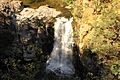
| Tettegouche State Park | Lake | 8,998 | 3,641 | 1979 | Lake Superior and Baptism River | 47°21′32″N 91°15′51″W / 47.358806°N 91.2640506°W | Home to the tallest waterfall in Minnesota and amazing cliffs like Palisade Head. | .jpg) |
| Whitewater State Park | Winona | 1,672 | 677 | 1919 | Whitewater River | 44°03′30″N 92°03′32″W / 44.058297°N 92.0587726°W | A popular park with a steep-sided river valley in the Driftless Area. |  |
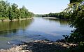
| Wild River State Park | Chisago | 6,574 | 2,660 | 1973 | St. Croix River | 45°34′05″N 92°52′33″W / 45.5680159°N 92.8757696°W | Follows 18 miles (29 km) of the St. Croix River, one of the first "Wild and Scenic Rivers." |  |
| William O'Brien State Park | Washington | 1,783 | 722 | 1947 | St. Croix River | 45°13′10″N 92°45′58″W / 45.2194109°N 92.7660423°W | Offers lots of outdoor fun close to the Twin Cities. |  |
| Zippel Bay State Park | Lake of the Woods | 2,826 | 1,144 | 1959 | Lake of the Woods | 48°51′50″N 94°51′34″W / 48.8638742°N 94.8593862°W | Great for water activities and birdwatching on the shore of the country's sixth largest lake. |  |
State Waysides
The state park system also includes nine waysides. Most of these are along Minnesota State Highway 61 on the beautiful North Shore. Waysides are smaller pieces of land that are too small to be full parks, but they have special natural or historical features. They usually have a parking area and a short trail, and sometimes restrooms and picnic tables.
| Wayside name | County | Date established | Coordinates | What's Special Here? | Image |
|---|---|---|---|---|---|
| Caribou Falls State Wayside | Lake | 1947 | 47°27′52″N 91°01′51″W / 47.46452°N 91.03084°W | See a beautiful waterfall on the Caribou River. |  |
| Devils Track Falls State Wayside | Cook | 1961 | 47°46′41″N 90°16′58″W / 47.77804°N 90.28273°W | A stunning gorge on the Devil Track River within Superior National Forest. |  |
| Flood Bay State Wayside | Lake | 1965 | 47°02′19″N 91°38′33″W / 47.03850°N 91.64254°W | A rocky beach on Lake Superior near Two Harbors. |  |
| Inspiration Peak State Wayside | Otter Tail | 1931 | 46°08′14″N 95°34′41″W / 46.13714°N 95.57809°W | The highest point in the Leaf Hills Moraines, offering great views. |  |
| Joseph R. Brown State Wayside | Renville | 1937 | 44°45′01″N 95°19′28″W / 44.750328°N 95.324425°W | Explore the ruins of Joseph R. Brown's large mansion, destroyed during the Dakota War of 1862. |  |
| Kadunce River State Wayside | Cook | 1947 | 47°47′38″N 90°09′15″W / 47.79393°N 90.15414°W | Enjoy the Lake Superior shoreline around the mouth of the Kadunce River. | .jpg) |
| Ray Berglund State Wayside | Cook | 1951 | 47°36′32″N 90°46′10″W / 47.60894°N 90.76943°W | A peaceful spot at the mouth of the Onion River, honoring a conservationist. |  |
| St. Croix Boom Site State Wayside | Washington | 2016 | 45°05′02″N 92°47′14″W / 45.08386°N 92.78731°W | Learn about the historic place where timber logs were sorted. |  |
| Sam Brown Memorial State Wayside | Traverse | 1929 | 45°35′46″N 96°50′29″W / 45.59616°N 96.84141°W | Honors Samuel J. Brown, who rode 120 miles (190 km) to warn people of an attack in 1866. |  |
State Trails
Minnesota also has many state trails, perfect for biking, walking, or snowmobiling!
| Trail name | Trailheads | Length in miles | Length in kilometers | Surface | What's Special Here? |
|---|---|---|---|---|---|
| Arrowhead State Trail | Tower – International Falls | 135 | 217 | Unpaved | Mostly used for snowmobiling in winter, connects to the Taconite State Trail. |
| Blazing Star State Trail | Albert Lea – Myre-Big Island State Park | 6 | 9.7 | Paved | This trail is planned to connect to Austin and the Shooting Star State Trail. |
| Blufflands State Trail: Harmony-Preston Valley Segment | Harmony – Preston | 18 | 29 | Paved | Climbs out of the beautiful Root River Valley. |
| Blufflands State Trail: Root River Segment | Fountain – Houston | 42 | 68 | Paved | Follows along the scenic Root River. |
| Casey Jones State Trail | Pipestone – Murray County, Lake Shetek State Park – Currie |
19 | 31 | Partly paved | Named after the legendary train engineer, reflecting railroad history. |
| Central Lakes State Trail | Osakis – Fergus Falls | 55 | 89 | Paved | Winds past a series of lakes formed by glaciers and connects to other trails. |
| Cuyuna Lakes State Trail | Cuyuna Country State Recreation Area | 6 | 9.7 | Paved | Goes through an area that used to be open-pit mines, now great for mountain biking. |
| Douglas State Trail | Pine Island – Rochester | 13 | 21 | Parallel paved and unpaved | Stretches through pretty farmlands. |
| Gateway State Trail | St. Paul – Pine Point Regional Park | 18 | 29 | Paved with 10 miles (16 km) of parallel unpaved | Starts in the city and goes out to a rural park near Stillwater. |
| Gitchi-Gami State Trail | Gooseberry Falls State Park – Beaver Bay, Schroeder – Tofte |
25 | 40 | Paved | Runs along the beautiful shore of Lake Superior. |
| Glacial Lakes State Trail | Hawick – Willmar | 22 | 35 | Parallel paved and unpaved | Goes through gently rolling landscapes shaped by glaciers. |
| Goodhue Pioneer State Trail | Red Wing – Hay Creek Township, Zumbrota |
10 | 16 | Paved with some parallel unpaved | This trail is planned to run from Red Wing to Pine Island. |
| Great River Ridge State Trail | Plainview – Eyota | 13 | 21 | Paved with some parallel unpaved | Winds past the river bluffs of the unique Driftless Area. |
| Heartland State Trail | Park Rapids – Cass Lake | 49 | 79 | Paved with some parallel unpaved | Passes through mixed northern forests and connects with the Paul Bunyan State Trail. |
| Luce Line State Trail | Plymouth – Cosmos | 63 | 101 | Partly paved with some parallel unpaved | Stretches from the Minneapolis suburbs out to a rural area. |
| Mill Towns State Trail | Northfield – Dundas | 3 | 4.8 | Paved | This trail is planned to connect to other trails in Faribault and Cannon Falls. |
| Minnesota Valley State Trail | Shakopee – Belle Plaine | 42 | 68 | Mostly unpaved | Follows the Minnesota River. |
| North Shore State Trail | Duluth – Grand Marais | 146 | 235 | Unpaved | Explores the inland areas of the North Shore, mostly for snowmobiling in winter. |
| Paul Bunyan State Trail | Brainerd – Lake Bemidji State Park | 112 | 180 | Paved | One of the longest paved trails in the country! It connects with the Heartland State Trail. |
| Sakatah Singing Hills State Trail | Faribault – Mankato | 39 | 63 | Paved with some parallel unpaved | Follows the Cannon River and goes through Sakatah Lake State Park. |
| Shooting Star State Trail | LeRoy – Adams | 14 | 23 | Paved | Crosses open country and passes through Lake Louise State Park. |
| Taconite State Trail | Grand Rapids – Ely | 155 | 249 | Mostly unpaved | Mostly used for snowmobiling in winter, connects with the Arrowhead State Trail. |
| Willard Munger State Trail | Hinckley – Duluth, Wrenshall – Carlton, Chengwatana State Forest – Holyoke |
76 | 122 | Paved | Honors a state lawmaker and trail supporter, with three different sections. |
Images for kids
-
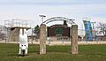
Alexander Ramsey State Park, now a city park.
-
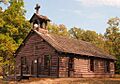
Birch Coulee Battlefield, now managed by the Minnesota Historical Society.
-
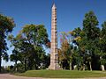
Camp Release State Memorial Wayside, now a state monument.
-
Chippewa Mission State Memorial Wayside, now managed by the Minnesota Historical Society.
-
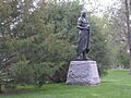
Horace Austin State Park, now a city park.
-
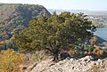
Garvin Heights State Park, now a city park.
-
Kaplan Woods State Park, now a city park.
-
Old Crossing Treaty Historic Wayside, now managed by other agencies.
-
Oronoco Park, now a county park.
-
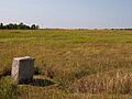
Pomme de Terre Recreational Reserve, now a city park.
-
Traverse des Sioux State Park, now managed by the Minnesota Historical Society and St. Peter.
-
Upper Sioux Agency State Park, now transferred to the Upper Sioux Community.


