
Hubbard County, Minnesota facts for kids
Quick facts for kids
Hubbard County
|
|
|---|---|

The historic Hubbard County Courthouse in Park Rapids
|
|

Location within the U.S. state of Minnesota
|
|
 Minnesota's location within the U.S. |
|
| Country | |
| State | |
| Founded | February 26, 1883 |
| Named for | Lucius Frederick Hubbard |
| Seat | Park Rapids |
| Largest city | Park Rapids |
| Area | |
| • Total | 999.39 sq mi (2,588.4 km2) |
| • Land | 922.46 sq mi (2,389.2 km2) |
| • Water | 76.93 sq mi (199.2 km2) 7.70%% |
| Population
(2020)
|
|
| • Total | 21,344 |
| • Estimate
(2023)
|
22,132 |
| • Density | 23.1/sq mi (8/km2) |
| Time zone | UTC−6 (Central) |
| • Summer (DST) | UTC−5 (CDT) |
| Congressional district | 8th |
Hubbard County is a beautiful area in the northwestern part of Minnesota, a state in the United States. It's known for its many lakes and forests. As of 2020, about 21,344 people call Hubbard County home. The main town and where the county government is located is Park Rapids. A part of the Leech Lake Indian Reservation is also found within the county.
Contents
History of Hubbard County
Hubbard County was officially created on February 26, 1883. It was formed from a part of Cass County. The county was named after Lucius Frederick Hubbard. He was a well-known editor, a soldier in the Civil War, and a businessman. He also served as the governor of Minnesota from 1882 to 1887.
The borders of Hubbard County have stayed the same since it was first created. Around 1890, the county's courthouse was destroyed by a fire. Luckily, all the important public records were saved from the fire.
Geography and Nature
Hubbard County has a landscape with rolling hills and many trees. It is also dotted with lots of lakes and ponds. The land generally slopes towards the east. The northern part of the county slopes north, and the southern part slopes south.
The highest point in the county is Thorpe Lookout. It stands at 1,844 feet (562 meters) above sea level. This is why the forest service has a tower there. The county covers about 1,000 square miles (2,590 square kilometers). About 926 square miles (2,398 square kilometers) is land, and 74 square miles (192 square kilometers) is water.
Main Roads and Highways
 U.S. Highway 2
 U.S. Highway 71
 Minnesota State Highway 34
 Minnesota State Highway 64
 Minnesota State Highway 87
 Minnesota State Highway 113
 Minnesota State Highway 200
 Minnesota State Highway 226
Neighboring Counties
Hubbard County shares its borders with several other counties:
- Beltrami County - to the north
- Cass County - to the east
- Wadena County - to the south
- Becker County - to the southwest
- Clearwater County - to the northwest
Protected Natural Areas
Hubbard County is home to several important natural areas that are protected:
- Badoura Jack Pine Woodland Scientific and Natural Area
- Huntersville State Forest (part)
- Itasca State Park (part)
- Mississippi Headwaters (part)
- Paul Bunyan State Forest (part)
Population and People
Demographics is the study of a population, including how many people live somewhere and what groups they belong to. Here's how the population of Hubbard County has changed over the years:
| Historical population | |||
|---|---|---|---|
| Census | Pop. | %± | |
| 1890 | 1,412 | — | |
| 1900 | 6,578 | 365.9% | |
| 1910 | 9,831 | 49.5% | |
| 1920 | 10,136 | 3.1% | |
| 1930 | 9,596 | −5.3% | |
| 1940 | 11,085 | 15.5% | |
| 1950 | 11,085 | 0.0% | |
| 1960 | 9,962 | −10.1% | |
| 1970 | 10,583 | 6.2% | |
| 1980 | 14,098 | 33.2% | |
| 1990 | 14,939 | 6.0% | |
| 2000 | 18,376 | 23.0% | |
| 2010 | 20,428 | 11.2% | |
| 2020 | 21,344 | 4.5% | |
| 2023 (est.) | 22,132 | 8.3% | |
| U.S. Decennial Census 1790-1960 1900-1990 1990-2000 2010-2020 |
|||
2020 Census Information
The 2020 Census collected information about the people living in Hubbard County. Here's a look at the different groups:
| Race | Number of People | Percentage |
|---|---|---|
| White | 19,139 | 89.7% |
| Black or African American | 82 | 0.4% |
| Native American | 560 | 2.62% |
| Asian | 66 | 0.31% |
| Pacific Islander | 12 | 0.05% |
| Other/Mixed Race | 996 | 4.7% |
| Hispanic or Latino | 489 | 2.3% |
Towns and Communities
Hubbard County has several cities and smaller communities where people live.
Cities
Census-Designated Places
These are areas that are like towns but are not officially incorporated as cities.
- Hubbard
- Lake George
Unincorporated Communities
These are smaller settlements that do not have their own local government.
Townships
Townships are smaller local government areas within a county.
- Akeley Township
- Arago Township
- Badoura Township
- Clay Township
- Clover Township
- Crow Wing Lake Township
- Farden Township
- Fern Township
- Guthrie Township
- Hart Lake Township
- Helga Township
- Hendrickson Township
- Henrietta Township
- Hubbard Township
- Lake Alice Township
- Lake Emma Township
- Lake George Township
- Lake Hattie Township
- Lakeport Township
- Mantrap Township
- Nevis Township
- Rockwood Township
- Schoolcraft Township
- Steamboat River Township
- Straight River Township
- Thorpe Township
- Todd Township
- White Oak Township
Images for kids
-
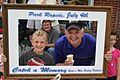
A parade in Park Rapids on July 4th.

See also
 In Spanish: Condado de Hubbard para niños
