Brown County, Minnesota facts for kids
Quick facts for kids
Brown County
|
|
|---|---|

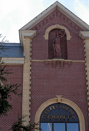
Brown County Courthouse
|
|

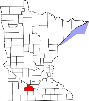
Location within the U.S. state of Minnesota
|
|
 Minnesota's location within the U.S. |
|
| Country | |
| State | |
| Founded | February 20, 1855 (created) 1856 (organized) |
| Named for | Joseph Renshaw Brown |
| Seat | New Ulm |
| Largest city | New Ulm |
| Area | |
| • Total | 618 sq mi (1,600 km2) |
| • Land | 611 sq mi (1,580 km2) |
| • Water | 7.4 sq mi (19 km2) 1.2%% |
| Population
(2020)
|
|
| • Total | 25,912 |
| • Estimate
(2023)
|
25,628 |
| • Density | 41.9/sq mi (16.2/km2) |
| Time zone | UTC−6 (Central) |
| • Summer (DST) | UTC−5 (CDT) |
| Congressional district | 1st |
Brown County is a county located in the state of Minnesota. In 2020, about 25,912 people lived here. The main city and county seat is New Ulm.
The county was officially created in 1855. It was then organized in 1856, meaning it set up its government. Brown County is part of the New Ulm area. It is also included in the larger Mankato-New Ulm-North Mankato region.
Contents
History of Brown County
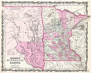
Brown County was established in 1855. At that time, it was in the southwest part of what was called Minnesota Territory. The county was named after Joseph Renshaw Brown. He was an important member of the Governor's Council in the Territory.
How Brown County Changed Over Time
In 1857, Brown County was divided. This created several new counties. These included Cottonwood, Jackson, and Martin. Other counties formed were Murry, Nobles, Pipestone, and Rock.
Later, Watonwan was separated in 1860. In 1862, a large part of Brown County became Redwood. Redwood County was then further divided in the 1870s. This created Lac qui Parle, Lincoln, Lyon, and Yellow Medicine Counties.
The Dakota War of 1862
In 1862, the northern border of Brown County was important. It was the boundary for the Upper and Lower Sioux reservations. This was when the Dakota War began.
New Ulm, the county seat, was attacked twice. A strong group of Mdewakanton Dakota people attacked the town. However, the attacks were stopped. Most of the town was burned, and many people left. They went to nearby towns like St. Peter and Mankato. Many people in the town were hurt or died.
In 1863, agreements with the eastern Dakota people were ended. The two reservations were closed. Because of this, the county border moved north. It moved about 10 miles closer to the Minnesota River.
Geography and Nature
The Minnesota River flows along the northern edge of Brown County. The Cottonwood River also flows through the middle of the county. It joins the Minnesota River at the northern border. The Little Cottonwood River flows through the southern part. It eventually joins the Minnesota River in Blue Earth County.
The land in Brown County has rolling hills. Most of it is used for farming. The land generally slopes towards the east. It tends to drop down into the river valleys. The highest point is in the southwest corner. It is about 1,263 ft (385 m) above sea level.
The county covers about 618 square miles (1,600 km2) in total. Of this, 611 square miles (1,580 km2) is land. The remaining 7.4 square miles (19 km2) (which is 1.2%) is water.
Travel and Roads
- Hermann Express is a local transit service.
Major Highways in Brown County
Neighboring Counties
- Nicollet County - to the northeast
- Blue Earth County - to the southeast
- Watonwan County - to the south
- Cottonwood County - to the southwest
- Redwood County - to the west
- Renville County - to the northwest
Lakes of Brown County
Most of Brown County is rich farmland. Many wet areas were drained for farming. This left a number of lakes. The county has at least 32 lakes. Some of these are "protected waters" by the State of Minnesota. These are marked with "(p)" below.
These lakes are often found in dips in the land. Many of them do not have water flowing into or out of them.
Here are some of the lakes in Brown County:
- Altermatt Lake (p)
- Bachelor Lake (p), located in Stark township
- Boise Lake (p)
- Clear Lake (p)
- Gilman Lake (p)
- Horseshoe Lake
- Juni Lake (p), named after Benedict Juni, an early settler from Switzerland.
- Lake Cottonwood (p)
- Lake Hanska (p)
- Linden Lake (p)
- Lone Tree Lake (p)
- Omsrud Lake (p)
- School Lake (p), named because it is in school section 16.
- Sleepy Eye Lake (p)
- Zanders Lake (p)
Climate and Weather
In recent years, the average temperatures in New Ulm have varied. In January, the low temperature is about 6 °F (−14 °C). In July, the high temperature is about 83 °F (28 °C). The coldest temperature ever recorded was −37 °F (−38 °C) in January 1984. The hottest was 105 °F (41 °C) in July 1988.
The average monthly rainfall also changes. It is about 0.64 inches (16 mm) in January. It goes up to about 4.82 inches (122 mm) in June.
People of Brown County (Demographics)
2020 Census Information
This table shows the different groups of people living in Brown County in 2020.
| Race | Number of People | Percentage |
|---|---|---|
| White (not Hispanic) | 23,968 | 92.5% |
| Black or African American (not Hispanic) | 118 | 0.5% |
| Native American (not Hispanic) | 39 | 0.2% |
| Asian (not Hispanic) | 126 | 0.5% |
| Pacific Islander (not Hispanic) | 6 | 0.02% |
| Other/Mixed (not Hispanic) | 484 | 1.9% |
| Hispanic or Latino | 1,171 | 4.52% |
Towns and Communities
Cities in Brown County
- Cobden
- Comfrey (partially in Brown County)
- Evan
- Hanska
- New Ulm (This is the county seat)
- Sleepy Eye
- Springfield
Special Community Areas
- Searles is a census-designated place. This means it's a community that the census bureau tracks.
Smaller Unincorporated Communities
These are smaller places that are not officially organized as cities or towns.
- Essig
- Godahl (partially in Brown County)
- Leavenworth
Townships in Brown County
Townships are local government areas.
- Albin Township
- Bashaw Township
- Burnstown Township
- Cottonwood Township
- Eden Township
- Home Township
- Lake Hanska Township
- Leavenworth Township
- Linden Township
- Milford Township
- Mulligan Township
- North Star Township
- Prairieville Township
- Sigel Township
- Stark Township
- Stately Township
See also
 In Spanish: Condado de Brown (Minnesota) para niños
 | Calvin Brent |
 | Walter T. Bailey |
 | Martha Cassell Thompson |
 | Alberta Jeannette Cassell |


