Buffalo River State Park (Minnesota) facts for kids
Quick facts for kids Buffalo River State Park |
|
|---|---|
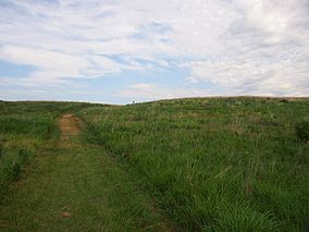
Native prairie in Buffalo River State Park
|
|
| Location | Clay, Minnesota, United States |
| Area | 1,068 acres (4.32 km2) |
| Elevation | 981 ft (299 m) |
| Established | 1937 |
| Named for | the Buffalo River |
| Governing body | Minnesota Department of Natural Resources |
|
Buffalo River State Park WPA/Rustic Style Historic Resources
|
|
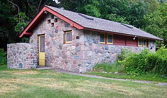
One of the district's six contributing properties, a 1938 latrine
|
|
| Location | Off US 10, Riverton Township |
|---|---|
| Area | 19 acres (7.7 ha) |
| Built | 1937–1940 |
| Architect | O. Newstrom |
| Architectural style | National Park Service rustic |
| MPS | Minnesota State Park CCC/WPA/Rustic Style MPS |
| NRHP reference No. | 89001671 |
| Added to NRHP | October 25, 1989 |
Buffalo River State Park is a fun place in Minnesota, United States. It protects a beautiful prairie (a large area of grassland) that is split by the Buffalo River. The river has lots of trees along its banks.
This park, along with the nearby Bluestem Prairie Scientific and Natural Area, helps protect one of the biggest and best prairies left in Minnesota. The Bluestem Prairie is owned by The Nature Conservancy.
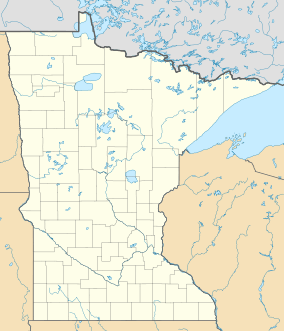
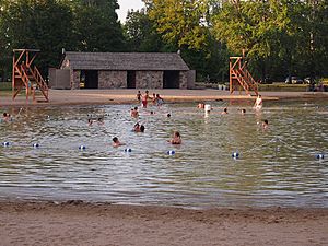
Even though it's important for nature, many people visit the park for swimming and picnics. It has the closest swimming lake to the cities of Fargo–Moorhead. The park is about 1,068-acre (432 ha) big. You can find it near U.S. Route 10 in Clay County. It's about 4.5 miles (7.2 km) east of Glyndon and 14 miles (23 km) east of Moorhead.
Buffalo River State Park was created in 1937. Many of its first buildings were built by the Works Progress Administration (WPA). This was a program that helped people find jobs during the Great Depression. In 1989, three buildings and three structures in the park were added to the National Register of Historic Places. They are special because of their unique building style.
The park first focused on fun outdoor activities like swimming. This was because there weren't many other places for recreation nearby. Later, in the 1960s, people realized how special and rare the prairie around the park was. So, the park grew bigger to protect more of it.
The Bluestem Prairie Scientific and Natural Area is 6,078-acre (2,460 ha) big. Local schools and colleges use it for environmental education. It's also a great spot to see greater prairie chickens. These birds do a special dance in the spring to find a mate.
Contents
Exploring the Park's Natural Wonders
How the Land Was Formed (Geology)
The land at Buffalo River State Park was mostly shaped by a huge proglacial lake (a lake formed by melting glaciers). This happened after the last ice age. The area had been covered by ice many times before.
About 10,000 to 8,000 years ago, a giant lake called Glacial Lake Agassiz covered the Red River Valley. As the lake slowly drained, it left behind a very flat lakebed with fine dirt. But in some places, sandy beach ridges formed as the lake's shoreline moved. You can see Campbell Ridge on the east side of the park. There's also Norcross Ridge to the southeast in the Bluestem Prairie.
The solid rock underneath the park is very deep. It's covered by 250–500 feet (76–152 m) of silt (fine mud) left by Lake Agassiz. When the lake finally drained away, it left behind a super flat plain with very rich soil.
Today, the park gently slopes down towards the west. It drops about 100 feet (30 m) in height from its east side to its west side. The flat prairie is broken up by the two sandy beach ridges and some small rolling hills. Where the Buffalo River crosses these ridges, it has made steep banks up to 30 feet (9.1 m) high. You might also spot a few large rocks, called glacial erratics, scattered across the prairie. These were left behind by glaciers.
Amazing Plants (Flora)
The prairies at Buffalo River and Bluestem are some of the biggest parts left of the "northern tall grasslands." This special type of grassland is mostly found in the Red River Valley. The prairie here is very healthy because much of it has never been farmed.
You'll see tall grasses like big bluestem and little bluestem. There are also many colorful wildflowers called forbs. Look for coneflowers, blazing star, and prairie clover. About 250 different kinds of wildflowers and grasses have been found in the park!
Some rare plants grow here too. These include sticky false-asphodel, small white lady's slipper, northern gentian, plains reedgrass, blanket flower, and the endangered western prairie fringed orchid. You might even find Yuccas and cacti at the south end of the park.
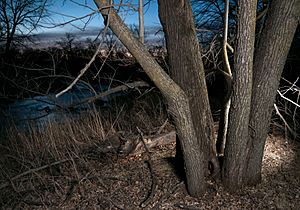
Along the Buffalo River, there's a "gallery forest" that stretches across the prairie. This forest has trees like elm, ash, cottonwood, oak, and basswood. Underneath these tall trees, you'll find younger basswood, ash, and elm trees. There are also boxelder, hazel, and gooseberry bushes. The drier soil right next to the riverbank has bur oak trees. In places on the prairie where water doesn't drain well, you might see patches of willow, aspen, and boxelder trees.
Wildlife in the Park (Fauna)
Buffalo River State Park is home to many animals! Over 200 types of birds and 40 types of mammals have been seen here.
- Mammals: You might spot moose, white-tailed deer, coyotes, red foxes, badgers, white-tailed jackrabbits, beavers, plains pocket mice, and northern grasshopper mice.
- Birds: Several special prairie birds live here. Keep an eye out for greater prairie chickens, marbled godwits, and upland sandpipers. You might also see sandhill cranes, loggerhead shrikes, and Henslow's sparrows.
- Other Animals: The park also has the Great Plains toad and the western hognose snake. Three rare butterflies have been found in the prairie: the regal fritillary, Poweshiek skipper, and Dakota skipper.
A Look at the Park's Past (Cultural History)
Native American History
Long ago, American bison (buffalo) would spend the winter in the area where the park is now. Because of this, the Ojibwe people called a stream Pijijiwizbi, which means "Buffalo River." Even though this name was originally for a smaller stream, settlers later used it for the bigger Buffalo River we know today.
Native Americans used the river and the sandy beach ridges as travel paths for a very long time. The Minnesota Historical Society thinks there might be old Native American sites in the park, but not much research has been done yet.
Early Settlers and the Park's Land
People from Europe started arriving in the 1820s. They saw that the rich prairie soil was perfect for farming. One part of the Red River Trails (old travel routes) followed the ancient path along Campbell Ridge, near the park.
In 1855, the local Ojibwe people agreed to give this land to the United States. This happened in the 1855 Treaty of Washington.
In 1864, work began on the Northern Pacific Railway, which crossed the northern United States. This new train access brought homesteaders (people who got land from the government) to the area in the 1870s. In 1875, a man named J.H. Smyser bought much of the land that would become the park. He used it for a horse and cattle ranch. His large house, built in 1875, stood there for many years but burned down in 1959. Most of his land was used for grazing animals and making hay, not for growing crops. This helped keep many of the native plants alive.
In 1906, the Northern Pacific Railway started building a huge dirt embankment (a raised bank of earth). This was to make the train tracks less steep. This embankment still marks the park's northern border today.
How the Park Was Created and Developed
Buffalo River State Park was created in the late 1930s. This was a time when the government had programs to create jobs during the Great Depression. The Moorhead Rod and Gun Club really wanted this park to be made. The Minnesota Legislature officially made it a state park in 1937. At that time, it was the only state-owned place for recreation in the area.
The Works Progress Administration (WPA) set up a camp and started building things in the park's original 122 acres (49 ha) area. WPA workers built important things like the swimming area, the entrance road, parking, water supply, and restrooms. They also built a bath house, another restroom (called a latrine), and a small dam on the river. These buildings were made in a style called National Park Service rustic, using split stone and logs.
The first plans for the park focused mostly on fun activities. But as people learned more about how big and special the prairie around it was, the park grew in the 1960s. The Nature Conservancy started buying more land south of the park in 1975. Some of their land is inside the park's official borders, and some is outside.
In 1989, the WPA buildings in the park were added to the National Register of Historic Places. This area is 19-acre (7.7 ha) big and is called a historic district. It includes six important structures: three buildings and three other structures.
The buildings are:
- A 1938 latrine (now used as a storm shelter for campers).
- The 1940 bath house.
- A 1940 garage/residence (now the park's interpretive center, where you can learn about the park).
The structures are:
- A 1938 diversion dam on the Buffalo River.
- The 1940 swimming beach.
- Some 1940 stone curbs in the parking lot.
These places are important because they show how the government helped people during the Great Depression. They also show how Minnesota's state parks were first built. Plus, they are admired for their beautiful stone work, which took a lot of effort to build.
Fun Things to Do (Recreation)
Buffalo River State Park is very popular with local people, especially for its swimming pool. People who stay overnight often come from far away. They might be stopping here on a longer trip. Many campers come from Canada or the Dakotas.
The campground has 44 campsites. 35 of these have electric hookups for RVs or tents. There are also showers, flush toilets, and a place to empty RV waste (a dump station). A separate group camp can hold up to 50 people. The campground, picnic area, and swimming pool are all in the shady forest.
The swimming pool is special because it has a sand bottom. The water is filtered, and lifeguards are on duty. It also has features that make it easy for everyone to use. The Buffalo River is a good place for fishing.
There are 12 miles (19 km) of hiking trails in the park. In winter, 6 miles (9.7 km) of these trails are prepared for cross-country skiing. The rest of the park is open for snowshoeing. In March and April, The Nature Conservancy has two special viewing spots. From these, visitors can watch the amazing lek mating dance of the greater prairie chicken.
 | John T. Biggers |
 | Thomas Blackshear |
 | Mark Bradford |
 | Beverly Buchanan |


