Grand Portage State Park facts for kids
Quick facts for kids Grand Portage State Park |
|
|---|---|
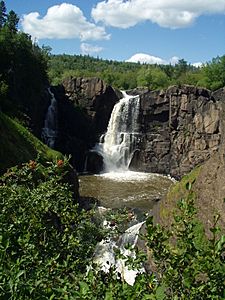
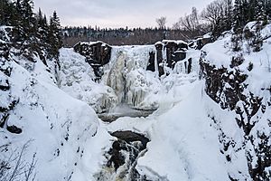
High Falls of the Pigeon River in Grand Portage State Park
|
|
| Location | Cook, Minnesota, United States |
| Area | 278 acres (113 ha) |
| Elevation | 846 ft (258 m) |
| Established | 1989 |
| Governing body | Minnesota Department of Natural Resources, Grand Portage Indian Reservation |
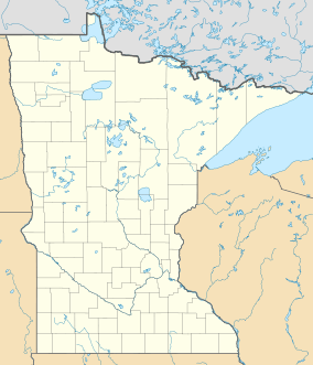
Grand Portage State Park is a special state park located at the very top of Minnesota, right on the border with Canada. It's famous for its amazing 120-foot (37 m) waterfall, called the High Falls. This waterfall is the tallest in Minnesota, even though it's partly in Canada!
The park is on the Pigeon River. Long ago, this river was an important path for the fur trade. But the waterfalls and fast-moving water made it hard to travel. So, people had to carry their boats and goods around them. This carrying path was called a "portage." The most important one was the "Grand Portage," which is 8.5-mile (13.7 km) long. You can learn more about this historic path at the nearby Grand Portage National Monument.
What makes this park extra special is that it's the only U.S. state park managed together by a state (Minnesota) and a Native American group, the Grand Portage Indian Reservation. It's also the only Minnesota state park that the state doesn't actually own. The land is held by the Grand Portage Indian Reservation and leased to Minnesota for just $1 a year!
Contents
Exploring the Park's Natural History
How the Land Was Formed: Geology of Grand Portage
Imagine a shallow sea covering this area about 2.2 to 1.9 billion years ago. Mud and sand settled at the bottom, slowly turning into layers of rock like shale and graywacke. These ancient rocks are called the Rove Formation.
Then, about 1.1 billion years ago, the North American Plate (a huge piece of Earth's crust) started to crack. Hot, melted rock (lava) flowed out, forming the basalt rock you see along Lake Superior's North Shore. At Grand Portage State Park, this melted rock didn't reach the surface. Instead, it pushed into cracks in the older rocks, cooling slowly to form a harder rock called diabase. These diabase rocks created strong ridges that resisted ice and water.
For millions of years, up until about 10,000 years ago, giant sheets of ice (glaciers) covered the region many times. These glaciers carved out the land, creating the big basin that eventually became Lake Superior. The hard diabase ridges stood strong against the ice.
As the glaciers melted, a huge lake called Glacial Lake Minong (an early version of Lake Superior) filled the basin. The land slowly rose as the weight of the ice was removed. This caused the lake's shoreline to move back, revealing the land we see today. The many waterfalls along the North Shore, including the High Falls, were formed because the land drops sharply towards the lake.
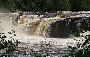
The Pigeon River carved its way through softer ground. But it hit two of those tough diabase rock formations. These hard rocks created the amazing High Falls and the Middle Falls upstream. The Middle Falls drops 10 feet (3 m) and then another 20 feet (6 m)! Below the High Falls, the river has cut a deep canyon through the older shale and graywacke rocks.
The U.S. Geological Survey estimates that 3,200 US gallons (12,000 L) of water rush over High Falls every second! On sunny days, you can often see beautiful rainbows in the mist from the falls. In winter, the falls can freeze with ice 10 to 20 feet (3 to 6 m) thick, but the water still flows underneath.
Plants and Trees: The Park's Flora
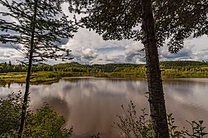
Most of Grand Portage State Park is covered by a mixed forest. You'll see many paper birch and quaking aspen trees. There are also white spruce, eastern white pine, balsam fir, northern white cedar, poplar, and black ash.
On the ridges and slopes, you'll find a more northern-style forest with black spruce mixed with the other conifers, birch, and aspen. Near the river, in the lowlands, you'll find black and green ash trees, along with white cedar, white spruce, and yellow birch.
Animals of the Park: The Park's Fauna
Many different animals live in Grand Portage State Park. You might spot white-tailed deer, moose, Canadian lynx, black bear, red fox, porcupine, pine marten, river otter, and beaver.
Smaller animals like snowshoe hare, skunk, and red squirrel also live here. Sometimes, you might even see a coyote or a timber wolf.
The Pigeon River is a great place for waterfowl (like ducks) and raptors (like eagles and hawks). You might see osprey hunting for fish. The river is also home to fish like walleye, northern pike, and rainbow smelt, especially when they come to spawn in the spring.
A Look at the Park's Cultural History
Early Days and the Fur Trade
Long ago, the Grand Portage area was a meeting point for different Native American groups, including the Dakota and Cree. By the 1700s, the Ojibwe people arrived and became important traders with the French in the fur trade.
The Pigeon River was a useful route for traders traveling between the Great Lakes and inland Canada. However, the last 22 miles (35 km) of the river had many waterfalls and rapids, making it impossible to travel by boat. So, the early Native Americans created a walking path to get around these obstacles. They called it Kitchi Onigaming in the Ojibwe language, which the French explorers translated to Grand Portage, meaning "the Great Carrying Place."
While busy trading posts grew at both ends of the Grand Portage, the area that is now Grand Portage State Park remained mostly untouched.
The region was first claimed by the French, then by the British after the French and Indian War in 1763. After the United States became independent, there was a disagreement with British Canada about the border in this area. Finally, in 1842, the Webster–Ashburton Treaty officially set the Pigeon River as the international border.
When the U.S. government was making a treaty with the Ojibwe in 1854, the Grand Portage Ojibwe leaders worked hard to keep their reservation within their traditional lands, rather than being moved west.
From Logging to Park Land
The land that is now the state park was originally part of the reservation. Later, it was bought by non-Native Americans. In the late 1800s, logging companies started cutting down trees on both sides of the border. To move the logs around the waterfalls, they built special wooden slides and dams. You can still see parts of these old wooden structures on the Canadian side near the High Falls.
By the early 1900s, most of the valuable timber was gone, leading to hard times for the area. In the 1930s, there were plans to build Highway 61 right across the Pigeon River at High Falls. But groups who wanted to protect nature stopped this plan. The bridge and border crossing were built farther downstream in 1966.
How Grand Portage State Park Was Created
A man named Lloyd K. Johnson bought the land around High and Middle Falls. In 1985, a group called the Minnesota Parks and Trails Council suggested creating a state park here, similar to Ontario's Pigeon River Provincial Park on the Canadian side. Johnson agreed to sell some of his land and donate more.
The Parks and Trails Council raised money from people and groups to buy the land in 1988. Since the land was within the Grand Portage Indian Reservation, the plan for the park involved a new way of working together. In 1989, the Minnesota Legislature passed a law to create the park.
The Parks and Trails Council sold the land to the Minnesota Department of Natural Resources (DNR). Then, the DNR worked to transfer the land to the Bureau of Indian Affairs, which would hold it for the Grand Portage Band of Chippewa. The Grand Portage Band then leased the park back to the DNR for just $1 a year. This unique partnership means the park is co-managed by the state and the Grand Portage Band.
Grand Portage State Park finally opened to the public in September 1994.
In April 2020, during the COVID-19 pandemic in the United States, the park was temporarily closed at the request of the Grand Portage Band to help keep everyone safe.
Things to Do at Grand Portage State Park
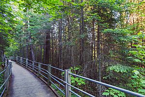
The High Falls is easy to reach! There's a gentle, paved trail and boardwalk that's about 0.5-mile (0.8 km) long. This means it's the only state park on the North Shore where the main attraction is accessible for wheelchairs. You can view the falls from three different wooden decks.
If you like hiking, there's a longer 3.5 miles (5.6 km) trail that leads to the 30-foot (9 m) Middle Falls. From the hilltops along this trail, you can even see distant views of Lake Superior and Isle Royale. A shorter 0.2-mile (0.3 km) path goes from the park office to a historic marker about the Webster-Ashburton Treaty. In winter, all the trails are open for snowshoeing.
Grand Portage State Park is only for day visits, meaning there's no camping inside the park. The closest camping is in Ontario's Pigeon River Provincial Park or in the nearby community of Grand Portage, Minnesota.
The park focuses on teaching visitors about the Ojibwe people's culture and history. Many park employees are members of the Grand Portage Band.
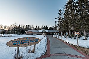
The park is located at the very end of the beautiful Minnesota Highway 61. In 2010, a new visitor center opened. It's a large building that also serves as a state travel information center and a highway rest area. It has exhibits that explain Ojibwe life and is staffed by Grand Portage Band members.
The International Border
Grand Portage State Park follows about two miles (3.2 km) of the Pigeon River, which is the border between Canada and the United States. You can even see the U.S. Customs border checkpoint from the park entrance.
Because the High Falls of the Pigeon River is shared with Canada, the 70-foot (21 m) High Falls on the Baptism River in Tettegouche State Park is often called "the highest waterfall entirely within Minnesota."
 | Frances Mary Albrier |
 | Whitney Young |
 | Muhammad Ali |


