Fort Benton, Montana facts for kids
Quick facts for kids
Fort Benton
|
|
|---|---|
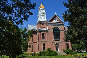
Chouteau County Courthouse
|
|
| Nickname(s):
"The Birth Place Of Montana"
|
|
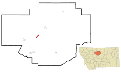
Location of Fort Benton, Montana
|
|
| Country | United States |
| State | Montana |
| County | Chouteau |
| Area | |
| • Total | 2.29 sq mi (5.94 km2) |
| • Land | 2.29 sq mi (5.94 km2) |
| • Water | 0.00 sq mi (0.00 km2) |
| Elevation | 2,651 ft (808 m) |
| Population
(2020)
|
|
| • Total | 1,449 |
| • Density | 631.92/sq mi (243.97/km2) |
| Time zone | UTC-7 (Mountain (MST)) |
| • Summer (DST) | UTC-6 (MDT) |
| ZIP code |
59442
|
| Area code(s) | 406 |
| FIPS code | 30-28000 |
| GNIS feature ID | 2410524 |
Fort Benton is a city in Montana, United States. It is the main town of Chouteau County. Fort Benton was started in 1846. It is the oldest place in Montana where people have lived continuously.
Fort Benton was a very important port on the Mississippi River System. It was known as "the world’s innermost port." This means it was the furthest point upriver that large boats could travel. The city's waterfront area is so important that it was named a National Historic Landmark in 1961.
In 2020, about 1,449 people lived in Fort Benton.
Contents
History of Fort Benton
Early Days and Fur Trade
Fort Benton began in 1846 as Fort Lewis. It was moved a bit downstream in 1847. Alexander Culbertson worked for Auguste Chouteau and Pierre Chouteau, Jr.. They were important fur traders from St. Louis. The fort was the last fur trading post on the upper Missouri River. This made it a key place for trade and business.
For 30 years, many steamboats came to Fort Benton. They brought goods, merchants, gold miners, and settlers. These boats traveled from cities like New Orleans, St. Louis, and Kansas City.
The Mullan Road and Gold Rush
Fort Benton was also the start of the 642-mile-long Mullan Road. The United States Army finished this road in 1860. It connected the Missouri River to the Columbia River in Washington. Twenty thousand people used this road in its first year. It was a major path for miners heading to gold fields in Idaho and Canada.
Steamboat travel to Fort Benton helped the American West grow between 1860 and 1890. After that, railroads became the main way to transport goods and people. The river was also important for miners going to new gold fields. These included places like Bannack, Virginia City, and Helena.
Changes and New Names
As the fur trade slowed down, the American Fur Company sold the fort in 1865. The U.S. Army then used it as a post from 1868 to 1881. Alexander Culbertson officially named it Fort Benton on Christmas Day in 1850. He named it after Senator Thomas Hart Benton from Missouri.
By the early 1860s, a town grew around the fort. Fort Benton was famous for being the "World's Innermost Port." Many special "mountain boats" traveled there. These included the Yellowstone and the Far West. Their captains, Joseph LaBarge and Grant Marsh, were well-known.
Later in the 1800s, transcontinental railroads were built. These new railroads took over much of the trade. This made Fort Benton less important as a port. In 1867, Union General Thomas Francis Meagher was acting governor of Montana Territory. He fell from his steamboat in Fort Benton and was never found.
Tensions with Native Americans
In 1869, Mountain Chief, a leader of the Pikuni Blackfeet Indians, visited Fort Benton. He asked for help to remove people illegally selling whiskey on Blackfeet land. He faced unfair treatment from some white residents. Later that year, Mountain Chief's brother and a young boy were harmed in Fort Benton. This was said to be in response to a white rancher's death. Officials did not file charges for these events involving the Blackfeet people. In 1870, a group of 10 Blackfeet Indians were killed by soldiers and others in Fort Benton. This happened after they were accused of taking cattle.
Geography and Climate
Fort Benton is located near U.S. Route 87. The city covers about 2.07 square miles (5.36 square kilometers) of land.
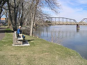
The town sits in a narrow valley on the west bank of the Missouri River. It is in an area called the Golden Triangle. This name comes from the strong wheat farming in the region. For example, in 2007, Chouteau County was one of the top two counties in the U.S. for wheat production. The long summer days and rich soil help grow very "hard" wheat, which has high protein.
Weather Patterns
Fort Benton has a semi-arid climate. This means it has cold, dry winters. Summers are hot and get more rain. On July 5, 1988, an F3 tornado hit the Fort Benton area. Two people were injured.
| Climate data for Fort Benton, Montana, 1991–2020 normals, extremes 1894–present | |||||||||||||
|---|---|---|---|---|---|---|---|---|---|---|---|---|---|
| Month | Jan | Feb | Mar | Apr | May | Jun | Jul | Aug | Sep | Oct | Nov | Dec | Year |
| Record high °F (°C) | 71 (22) |
77 (25) |
83 (28) |
93 (34) |
97 (36) |
108 (42) |
106 (41) |
109 (43) |
104 (40) |
94 (34) |
79 (26) |
73 (23) |
109 (43) |
| Mean maximum °F (°C) | 59.9 (15.5) |
61.4 (16.3) |
70.8 (21.6) |
79.5 (26.4) |
85.8 (29.9) |
92.1 (33.4) |
99.3 (37.4) |
98.9 (37.2) |
93.9 (34.4) |
82.7 (28.2) |
68.5 (20.3) |
60.4 (15.8) |
100.8 (38.2) |
| Mean daily maximum °F (°C) | 34.6 (1.4) |
38.1 (3.4) |
48.2 (9.0) |
58.6 (14.8) |
68.3 (20.2) |
76.3 (24.6) |
86.4 (30.2) |
85.5 (29.7) |
74.2 (23.4) |
59.9 (15.5) |
46.5 (8.1) |
36.7 (2.6) |
59.4 (15.2) |
| Daily mean °F (°C) | 22.3 (−5.4) |
25.3 (−3.7) |
34.3 (1.3) |
44.6 (7.0) |
54.4 (12.4) |
62.5 (16.9) |
70.3 (21.3) |
68.8 (20.4) |
58.3 (14.6) |
45.2 (7.3) |
33.7 (0.9) |
24.9 (−3.9) |
45.4 (7.4) |
| Mean daily minimum °F (°C) | 10.1 (−12.2) |
12.6 (−10.8) |
20.3 (−6.5) |
30.6 (−0.8) |
40.6 (4.8) |
48.6 (9.2) |
54.1 (12.3) |
52.1 (11.2) |
42.3 (5.7) |
30.5 (−0.8) |
21.0 (−6.1) |
13.1 (−10.5) |
31.3 (−0.4) |
| Mean minimum °F (°C) | −18.5 (−28.1) |
−10.6 (−23.7) |
−0.4 (−18.0) |
15.3 (−9.3) |
27.1 (−2.7) |
37.6 (3.1) |
44.3 (6.8) |
40.8 (4.9) |
30.0 (−1.1) |
13.2 (−10.4) |
−2.9 (−19.4) |
−12.4 (−24.7) |
−26.1 (−32.3) |
| Record low °F (°C) | −49 (−45) |
−45 (−43) |
−35 (−37) |
−8 (−22) |
14 (−10) |
27 (−3) |
34 (1) |
29 (−2) |
17 (−8) |
−15 (−26) |
−29 (−34) |
−45 (−43) |
−49 (−45) |
| Average precipitation inches (mm) | 0.52 (13) |
0.44 (11) |
0.56 (14) |
1.48 (38) |
2.08 (53) |
2.62 (67) |
1.19 (30) |
1.16 (29) |
1.20 (30) |
0.92 (23) |
0.58 (15) |
0.47 (12) |
13.22 (335) |
| Average snowfall inches (cm) | 7.9 (20) |
6.9 (18) |
4.3 (11) |
3.0 (7.6) |
0.3 (0.76) |
0.0 (0.0) |
0.0 (0.0) |
0.0 (0.0) |
0.3 (0.76) |
1.9 (4.8) |
5.7 (14) |
7.9 (20) |
38.2 (96.92) |
| Average precipitation days (≥ 0.01 in) | 5.4 | 5.7 | 5.8 | 8.4 | 9.8 | 11.0 | 5.7 | 6.3 | 6.6 | 7.0 | 5.5 | 5.1 | 82.3 |
| Average snowy days (≥ 0.1 in) | 5.1 | 5.5 | 3.1 | 2.0 | 0.2 | 0.0 | 0.0 | 0.0 | 0.1 | 1.2 | 3.0 | 4.7 | 24.9 |
| Source 1: NOAA | |||||||||||||
| Source 2: National Weather Service | |||||||||||||
Population and People
Population Changes Over Time
| Historical population | |||
|---|---|---|---|
| Census | Pop. | %± | |
| 1880 | 1,618 | — | |
| 1890 | 624 | −61.4% | |
| 1900 | 1,024 | 64.1% | |
| 1910 | 1,004 | −2.0% | |
| 1920 | 1,065 | 6.1% | |
| 1930 | 1,109 | 4.1% | |
| 1940 | 1,227 | 10.6% | |
| 1950 | 1,522 | 24.0% | |
| 1960 | 1,887 | 24.0% | |
| 1970 | 1,863 | −1.3% | |
| 1980 | 1,693 | −9.1% | |
| 1990 | 1,660 | −1.9% | |
| 2000 | 1,594 | −4.0% | |
| 2010 | 1,464 | −8.2% | |
| 2020 | 1,449 | −1.0% | |
| U.S. Decennial Census | |||
The population of Fort Benton has changed over the years. In 1880, there were 1,618 people. By 2020, the population was 1,449.
Who Lives in Fort Benton?
In 2010, there were 1,464 people living in Fort Benton. Most residents (97.4%) were White. A small number were Native American or Asian. About 0.6% of the population was Hispanic or Latino.
The average age in the city was 52.1 years old. About 17.6% of residents were under 18. Many people were between 45 and 64 years old (32.7%). Also, 27.7% were 65 or older. There were slightly more females (52.5%) than males (47.5%).
Education and Media
Schools and Library
Fort Benton Public School teaches students from kindergarten through 12th grade. Their sports teams are called the Longhorns. Fort Benton High School is a Class C school for sports. It will move to Class B at the start of the 2025 school year.
The Chouteau County Library has its main branch in Fort Benton.
Local News and Radio
The local newspaper is called The River Press. It comes out every week and also has an online version.
Fort Benton also has a radio station, KYPZ. It is a public radio station that gets its programs from KEMC in Billings.
Transportation and Roads
Montana Highway 80 connects to U.S. Route 87 to enter Fort Benton. Other roads like Montana secondary highway 386 (from the west) and 387 (from the east) also lead into town.
The Fort Benton Airport is a public airport. It is located one mile northeast of the city.
Famous People from Fort Benton
- Denise Curry, a well-known basketball player and coach.
- Eleanor Dumont (1834–1879), also known as "Madame Moustache". She was a professional card dealer and gambler.
- Charles S. Hartman, who served as a United States Congressman.
- William Henry Hunt, a judge who also became governor of Puerto Rico.
- Daniel Webster Marsh, who was a mayor of Calgary, Alberta.
- Charles Nelson Pray, another United States Congressman.
- U.S. Grant Sharp, Jr., a four-star admiral in the United States Pacific Fleet.
See also
 In Spanish: Fort Benton (Montana) para niños
- Shep, a famous dog who waited for his owner at the Fort Benton train station.


