Frazier Mountain facts for kids
Quick facts for kids Frazier Mountain |
|
|---|---|
| Highest point | |
| Elevation | 8,017 ft (2,444 m) NAVD 88 |
| Prominence | 2,440 ft (744 m) |
| Listing | Hundred Peaks Section |
| Geography | |
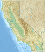
| Location | Los Padres National Forest, Ventura County, California, U.S. |
| Parent range | Transverse Ranges |
| Topo map | USGS Frazier Mountain |
| Climbing | |
| Easiest route | Road |
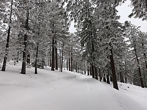
Frazier Mountain is a large mountain covered with pine trees. It is part of the Transverse Ranges in Southern California. You can find it in the Los Padres National Forest, in the northeastern part of Ventura County, California.
Frazier Mountain stands tall at 8,017 feet (2,444 m). This makes it the sixteenth-highest mountain in the Transverse Ranges. It's a great place to explore nature and enjoy the outdoors.
Where is Frazier Mountain?
Frazier Mountain is located in a special spot where three counties meet. These are Ventura, Los Angeles, and Kern Counties. The mountain is just northeast of where these counties come together.
The towns of Frazier Park and Lake of the Woods are north of the mountain. A big highway, Interstate 5, runs along the east side of Frazier Mountain.
Other mountains are nearby too. Mount Pinos is about 21.5 miles west by road. To the south, you can find Alamo Mountain and the Sespe Condor Sanctuary. This sanctuary is a protected area for the California condor, a very large bird.
What's at the Top?
The very top of Frazier Mountain is a special area used by the Forest Service. There are radio towers there that help with communication. You can also see an old fire lookout tower, which was once used to spot wildfires.
You can reach the highest point of the mountain by a forest road. This road is usually open when there is no snow on the mountain. It offers amazing views of the surrounding areas.
See also
 In Spanish: Montaña Frazier para niños
 | James Van Der Zee |
 | Alma Thomas |
 | Ellis Wilson |
 | Margaret Taylor-Burroughs |


