Fueguino facts for kids
Quick facts for kids Fueguino |
|
|---|---|
| Highest point | |
| Geography | |
| Location | Cook, Londonderry Island Tierra del Fuego, Magallanes |
| Parent range | Tierra del Fuego |
| Geology | |
| Age of rock | Miocene-Holocene |
| Mountain type | Volcanic field |
| Volcanic belt | Austral Volcanic Zone |
| Last eruption | 1926 |
Fueguino is a group of volcanoes, also called a volcanic field, located in Chile. It is the southernmost volcano in the long Andes mountain range. You can find it on Cook Island and also on nearby Londonderry Island. This volcanic area is made up of different features like lava domes, cone-shaped hills called pyroclastic cones, and even a lake inside a volcano's crater.
The volcanic activity at Fueguino is part of a larger area called the Austral Volcanic Zone. This zone forms because the Antarctic Plate is slowly sliding underneath the South America Plate. This process is called subduction. Even though the plate is moving downwards, it hasn't gone deep enough to create a typical chain of volcanoes like some other places.
Scientists haven't found any signs that glaciers have worn down the volcanoes at Fueguino. This suggests they are relatively young or have been active more recently. There are old reports of volcanic activity here in 1712, 1820, and 1926.
Contents
Where is Fueguino?
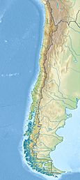
Fueguino volcano is located in the commune of Cabo de Hornos, Chile. This area is very far south in Chile. Some cities in the region include Rio Gallegos, Puerto Natales, Punta Arenas, Rio Grande, and Ushuaia.
Southernmost Andes Volcano
Fueguino is special because it's the southernmost volcano in the entire Andes mountain range. The next volcano to its north is Monte Burney, which is about 400 kilometers (250 miles) away. Both of these volcanoes are part of the Austral Volcanic Zone.
The Andean Volcanic Belt was formed by the subduction of the Nazca Plate and Antarctic Plate under the South America Plate. This huge volcanic belt is divided into several parts, and the Austral Volcanic Zone is the southernmost one. It has six volcanoes that have been active in the last 2.6 million years and stretches for about 800 kilometers (500 miles).
What Fueguino Looks Like
Fueguino is found on a small peninsula on the southeast side of Cook Island, Tierra del Fuego. It also reaches over to Londonderry Island. The main island of Tierra del Fuego is to the northeast of Fueguino. This part of southern Tierra del Fuego is known for its mountains, which are part of the Fuegian Andes.
The volcanic field has lava domes and pyroclastic cones. These can reach heights of about 150 meters (490 feet). One of these cones even has a crater lake inside a crater that is 150 meters (490 feet) wide. The volcanic activity here might be affected by cracks in the Earth's crust called faults that run north to south. Unlike many other volcanoes in this region, Fueguino is not known for producing large amounts of tephra (volcanic ash and rock fragments).
What Fueguino is Made Of
The rocks erupted from Fueguino are mostly andesite. This type of rock is common for volcanoes in the Austral Volcanic Zone, which usually erupt andesite and dacite. The lava domes at Fueguino have interesting patterns called columnar joints, which look like tall, many-sided pillars.
Eruptions and History
The volcanoes at Fueguino show no signs of being affected by glacial activity. This means they might be quite young or have erupted after the last ice age. There are old stories from the Yaghan people about a "world fire," which some think might be about volcanic activity at Fueguino.
Ships passing by the area reported volcanic activity in 1712 and 1820. The 1712 eruption, around November 26, was reported by a French captain named Josselin Guardin. He even marked the volcano on maps as Volcan San Clemente, named after his ship.
The 1820 eruption was seen on November 25-26 by Captain Basil Hall of the HMS Conway. He reported seeing glowing material erupting. This eruption was estimated to be a volcanic explosivity index of 2, which is a moderate eruption. At first, people thought these eruptions happened in the local Andes mountains. However, a geological trip in 1882 by Giacomo Bove found no evidence of a volcano there. The Fueguino volcanic field itself was only discovered by geologists in 1978.
More recently, there might have been activity on February 3, 1926. A ship in the Beagle Channel reported seeing a cloud of ash. This ash cloud could have been carried by winds from Fueguino. Also, in 2018, there were reports of small earthquakes (a seismic swarm) far south of Puerto Williams, which some media linked to Fueguino.
Climate and Nature
The plants in the Fueguino area are part of the Magellanic Province. This region has many deciduous trees (trees that lose their leaves in autumn) at lower elevations. You can also find many peatlands and bogs, which are wet, spongy areas of land.
The climate here is cool and temperate. Temperatures are usually around 5 degrees Celsius (41 degrees Fahrenheit). It gets less rain as you go northeast. The Beagle Channel's ocean water temperatures range from 3 to 10 degrees Celsius (37 to 50 degrees Fahrenheit). The Fuegian Andes mountains are covered by an ice sheet with glaciers, especially on the Chilean side.
During the ice ages, a large ice cap covered the mountains in Patagonia and Tierra del Fuego. After about 10,000 years ago, forests of Nothofagus trees started to grow in the region.
See also
 In Spanish: Volcán Fueguino para niños
 | Frances Mary Albrier |
 | Whitney Young |
 | Muhammad Ali |


