
Gambarogno facts for kids
Quick facts for kids
Gambarogno
|
||
|---|---|---|

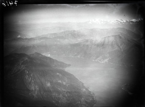
Vira (Gambarogno) village
|
||
|
||

Gambarogno
Location in Switzerland

Gambarogno
Location in Canton of Ticino
|
||
| Country | Switzerland | |
| Canton | Ticino | |
| District | Locarno | |
| Area | ||
| • Total | 51.8 km2 (20.0 sq mi) | |
| Elevation | 196 m (643 ft) | |
| Population
(Dec 2020 )
|
||
| • Total | 5,163 | |
| • Density | 99.67/km2 (258.15/sq mi) | |
| Postal code |
6573
|
|
| Localities | Caviano, Contone, Gerra Gambarogno, Indemini, Magadino, Piazzogna, San Nazzaro, Sant'Abbondio and Vira Gambarogno | |

Gambarogno is a town in the canton of Ticino, Switzerland. It's located in the Locarno district. Gambarogno was created on April 25, 2010. This happened when nine smaller towns decided to join together. These towns were Caviano, Contone, Gerra, Indemini, Magadino, Piazzogna, San Nazzaro, Sant'Abbondio, and Vira.
Gambarogno shares its borders with several other towns. These include Alto Malcantone, Ascona, Curiglia con Monteviasco (in Italy), Locarno, Minusio, Monteceneri, Tenero-Contra, and Maccagno con Pino e Veddasca (also in Italy).
Contents
History of Gambarogno
The area that is now Gambarogno has a long history. Many of its villages are very old. For example, Caviano was first mentioned in records in 1258. Contone appeared even earlier, in 1152. Indemini was first noted in 1260, and Magadino in 1254. Piazzogna was recorded in 1337, San Nazzaro in 1258, and Sant'Abbondio in 1192. The name Gerra likely came about in the 1700s. This was when the village of Ronco de Martignoni grew towards the Gerra river and Lake Maggiore.
Caviano: A Village of Emigrants
In the past, Caviano was part of a larger church area called a parish. It joined the Sant'Abbondio parish in 1558. Later, in 1850, it became its own separate parish. The old church in Caviano was very ancient, possibly even from Roman times. It was taken down in 1864 after a new church, S. Maria Nascente, was finished.
Life was tough in Caviano because there wasn't much land for fishing or farming. Because of this, many people moved away to other parts of Switzerland or other countries. You can still see the old parts of the village today. In an area called Cento Campi, there were many old shelters and barns with thatched roofs. These were used by shepherds on the mountain pastures around Lake Maggiore.
Contone: Ancient Tombs and a Hospital
Archaeologists have found three ancient tombs in Contone. These tombs are from before the Early Middle Ages, a time when important mountain passes were reopened.
A long time ago, before 1219, a hospital was built in Contone by the Knights Hospitaller. This group was like a military and religious order. Later, the hospital became a "Commandry" for the Sovereign Military Order of Malta. In the 1500s, the land owned by this Commandry went to a hospital in Lugano.
An old church, dedicated to St. Nicholas, was built or rebuilt in 1104. It was given to a monastery. This church closed in 1769 and fell apart. The current main church, S. Giovanni Battista, was built in the 1500s where the hospital church used to be.
People in Contone used to be mostly herders and farmers. After 1850, things changed. The port of Magadino became less important, and new railways were built. Many people moved abroad to find work as painters, plasterers, or stove-makers. Later, more people moved to Contone, especially from Italy. Today, most jobs are in the service industry. After the Ticino river was straightened, the once marshy land became a place for businesses and factories.
Gerra (Gambarogno): Preserving Old Streets
Gerra was once part of an old community called Vicinanza in Gambarogno. In the 1500s, three smaller settlements joined to form their own town. The St. Rochus and Sebastian church was built in 1744.
One of the old parts of Gerra, Scimiana, still looks much like it used to. It has narrow streets and alleys typical of the Gambarogno area. However, most of the old wooden balconies and fishermen's houses are gone. Today, more than half the people who work in Gerra are in the service industry. Most of them travel outside the town for their jobs.
Indemini: A Secluded Mountain Village

In the Middle Ages, Indemini was also part of the Gambarogno Vicinanza. In the 1600s, there were arguments over who owned the mountain pastures and forests. These disputes were settled in 1752. The village was very isolated for a long time. A road was built on the Swiss side only in 1917-18. A road from Italy didn't arrive until 1964.
This isolation helped Indemini keep its traditional, rural look. In the past, people made a living from farming. But this became less important in the 1970s and 80s. For most of the year, the village is quiet. But in the summer, many people come to visit, and the population grows quickly.
Magadino: A Busy Port Town

Magadino was an important place in the Late Middle Ages. It was mentioned when certain rights, like collecting tolls, were given to local leaders. A Benedictine monastery was in the nearby village of Quartino for centuries. The church of San Carlo was built in Magadino between 1844 and 1846.
Old records mention a tower in Magadino from 1335, but no one has found it. A castle was also mentioned in the 1600s. It was supposedly built in 1365 and destroyed in 1518.
Magadino was a very important port and customs station. Goods traveled through here from Lombardy to the Alps. Its importance grew even more in 1515 when a bridge over the Ticino river collapsed. When steamships started running in 1826 and a new road opened over the Gotthard Pass in 1830, Magadino became a stop for coaches. Many new warehouses, hotels, and restaurants were built. Some of these buildings are still there today.
The port's importance began to decline when railway lines opened to Locarno (1874) and Luino (1882). The town didn't grow much from the 1880s until the 1960s. By 2000, most people worked outside the village. In 2005, almost half of the jobs in Magadino were in the service industry.
Piazzogna: Barometric Experiments
Piazzogna was mentioned in the mid-1500s during a dispute over who could use the alpine meadows. It was first part of the Vira municipality and parish. But by 1704, it became its own independent municipality. It became a separate political town in 1803.
The original church, S. Antonio Abate, was likely built in the Middle Ages in a Romanesque style. But it fell into ruin. A new church was built in 1752. This church was expanded several times in the 1800s.
A small area called Alabardia became famous in 1783. This was because a scientist named Horace-Bénédict de Saussure did experiments there. He used a barometer to measure air pressure around Lake Maggiore.
San Nazzaro: A Historic Center

In the small area of Vairano, very old cremation urns have been found. These might be from the Bronze Age. Roman pottery and coins have also been discovered. In another area called Mossana, several Roman graves were found.
In Taverna, there used to be a tower. It was probably given to the Orelli family in 1186 by Frederick I Barbarossa. This tower later helped control trade in the upper Lake Maggiore and Gambarogno river areas. San Nazzaro was an important center in the Gambarogno valley during the Middle Ages. In the 1200s, community meetings were held in the church square in Taverna. In 1487, Gambarogno became independent from Locarno, and San Nazzaro became the seat of the local government and court.
The church of SS Nazzaro e Celso was first mentioned in 1258. It was rebuilt in 1790 in a classicist style and made larger.
People in San Nazzaro mostly lived from farming and raising animals. In the 1400s, many bricklayers and builders moved to Italy for work. In the late 1900s, the population grew a lot. The village became home to tourist hotels and many second homes. By 2000, about two-thirds of the workers traveled outside the town for their jobs.
Sant'Abbondio: Tourism and Second Homes
The church of SS Abbondio e Andrea was first mentioned in 1364. Several settlements grew up around this church. It was part of the Vira parish before becoming its own independent parish. In 1774, some villages broke away from Sant'Abbondio to join Gerra. Then, in 1850, Caviano and Scaiano also left. The main church of the smaller Sant'Abbondio parish was rebuilt in a classicist style in 1852-53.
The local economy was mainly based on farming and raising animals. In the 1800s, many decorators, painters, and potters moved to France for work. In the second half of the 1900s, Sant'Abbondio became a popular place for tourism. Many second homes were built in the village.
Population and Homes
As of 2013, Gambarogno had a population of 5,017 people. About 20.8% of the people living there were foreign nationals. The population grew by 3.8% between 2010 and 2013.
In 2013, about 18.1% of the population was under 19 years old. Most adults, 59.5%, were between 20 and 64 years old. About 22.5% of the population was 65 or older.
In 2013, there were 2,287 private homes in Gambarogno. In 2014, only 0.13% of homes were empty. This means almost all homes were occupied. In 2012, new homes were being built at a rate of 7.0 new units for every 1000 residents.
Geography and Land Use

Gambarogno covers an area of about 51.8 square kilometers (20 square miles). A large part of this land, 76.1%, is covered by forests. About 11.5% of the land is used for farming.
Buildings and roads make up 7.5% of the area. Rivers and lakes cover 1.2% of the land. The remaining 5.7% is unproductive land, meaning it cannot be used for farming or building.
Most of the forested land is dense forest. A small part has orchards or small groups of trees. For farming, 6.1% is used for growing crops, and 4.6% is for alpine pastures.
Important Heritage Sites

Two important sites in Magadino are considered national heritage sites in Switzerland. These are the Complesso di S. Carlo, which includes a church and parish house, and the Villa Ghisler. The villages of Indemini and Magadino-Rivabella are also listed as important Swiss heritage sites.
Economy and Jobs
In 2012, there were 67 people working in the primary economic sector. This sector includes jobs like farming and forestry. There were 23 businesses in this area.
The secondary sector had 835 workers and 112 businesses. This sector includes jobs in manufacturing and construction.
Finally, the tertiary sector employed 1,360 people in 354 businesses. This sector covers services, like tourism, shops, and offices.
Climate in Gambarogno
The village of Magadino in Gambarogno has a climate with a good amount of rain. Between 1961 and 1990, it had about 103 days of rain or snow each year. The average yearly rainfall was about 1772 millimeters (69.8 inches).
May was the wettest month, with an average of 211 millimeters (8.3 inches) of rain or snow. It rained for about 12.9 days in May. December was the driest month, with only 67 millimeters (2.6 inches) of precipitation over 5.5 days.
| Climate data for Magadino/Cadenazzo(1981-2010) | |||||||||||||
|---|---|---|---|---|---|---|---|---|---|---|---|---|---|
| Month | Jan | Feb | Mar | Apr | May | Jun | Jul | Aug | Sep | Oct | Nov | Dec | Year |
| Mean daily maximum °C (°F) | 6.1 (43.0) |
8.6 (47.5) |
13.8 (56.8) |
16.9 (62.4) |
21.2 (70.2) |
25.1 (77.2) |
27.6 (81.7) |
26.7 (80.1) |
22.2 (72.0) |
16.7 (62.1) |
10.8 (51.4) |
6.5 (43.7) |
16.9 (62.4) |
| Daily mean °C (°F) | 0.9 (33.6) |
3.0 (37.4) |
7.9 (46.2) |
11.5 (52.7) |
15.7 (60.3) |
19.5 (67.1) |
21.7 (71.1) |
20.8 (69.4) |
16.7 (62.1) |
11.6 (52.9) |
5.8 (42.4) |
1.7 (35.1) |
11.4 (52.5) |
| Mean daily minimum °C (°F) | −3.4 (25.9) |
−2.0 (28.4) |
1.7 (35.1) |
5.5 (41.9) |
10.4 (50.7) |
13.8 (56.8) |
15.8 (60.4) |
15.3 (59.5) |
11.6 (52.9) |
7.0 (44.6) |
1.4 (34.5) |
−2.5 (27.5) |
6.2 (43.2) |
| Average precipitation mm (inches) | 70 (2.8) |
59 (2.3) |
91 (3.6) |
188 (7.4) |
227 (8.9) |
186 (7.3) |
164 (6.5) |
178 (7.0) |
220 (8.7) |
186 (7.3) |
173 (6.8) |
89 (3.5) |
1,832 (72.1) |
| Average snowfall cm (inches) | 14 (5.5) |
3.9 (1.5) |
0.9 (0.4) |
0 (0) |
0 (0) |
0 (0) |
0 (0) |
0 (0) |
0 (0) |
0 (0) |
0.2 (0.1) |
11.1 (4.4) |
30.1 (11.9) |
| Average precipitation days (≥ 1.0 mm) | 4.7 | 4.3 | 6.1 | 10.2 | 12.6 | 10.2 | 8.6 | 9.7 | 8.4 | 9.4 | 8.0 | 6.4 | 98.6 |
| Average snowy days (≥ 1.0 cm) | 1.3 | 1 | 0.3 | 0 | 0 | 0 | 0 | 0 | 0 | 0 | 0.1 | 1.2 | 3.9 |
| Average relative humidity (%) | 76 | 70 | 62 | 66 | 70 | 69 | 69 | 72 | 76 | 81 | 78 | 78 | 72 |
| Mean monthly sunshine hours | 128 | 139 | 186 | 179 | 191 | 228 | 261 | 243 | 189 | 143 | 111 | 104 | 2,102 |
| Source: MeteoSwiss | |||||||||||||
Schools and Libraries
The main office for Gambarogno's preschool and primary schools is in San Nazzaro. There are four preschool locations: Contone, Gerra, Quartino-Cadepezzo, and Vira. There are also four primary school locations: Contone, Quartino-Cadepezzo, San Nazzaro, and Vira.
The town's library, Biblioteca comunale Gambarogno, opened in San Nazzaro in 2014. There is also a toy library (called a ludoteca) in San Nazzaro, which opened in 1997.
Getting Around: Transportation
Gambarogno has five railway stations. These are Gerra (Gambarogno), Magadino-Vira, Quartino, Ranzo-Sant'Abbondio, and San Nazzaro. All these stations are on the Cadenazzo–Luino line. Trains run regularly to Cadenazzo, Luino, and Gallarate.
Images for kids
-
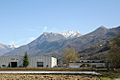
Luserte, a new development near Magadino and Contone

See also
 In Spanish: Gambarogno para niños
