Garibaldi Lake facts for kids
Quick facts for kids Garibaldi Lake |
|
|---|---|
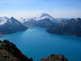
Garibaldi Lake and the north face of Mount Garibaldi, looking south from Panorama Ridge at 6,900 ft (2,100 m).
|
|
| Location | British Columbia |
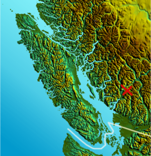
| Coordinates | 49°55′30″N 123°0′36″W / 49.92500°N 123.01000°W |
| Type | Volcanogenic |
| Primary inflows | Mimulus Creek, Sentinel Glacier, Sphinx Glacier |
| Primary outflows | Rubble Creek |
| Basin countries | Canada |
| Surface area | 9.94 km² (2460 acres) |
| Average depth | 119 m (390 ft) |
| Max. depth | 258.7 m (849 ft) |
| Surface elevation | 1,484 m (4,869 ft) |
| Islands | Battleship Islands |
| Settlements | No |
Garibaldi Lake is a beautiful turquoise-coloured lake found in British Columbia, Canada. It is located about 37 km (23 mi) north of Squamish and 19 km (12 mi) south of Whistler. This stunning lake is part of Garibaldi Provincial Park. The park is a protected area, full of amazing mountains, glaciers, trails, forests, flowers, meadows, and waterfalls.
Contents
How Garibaldi Lake Was Formed
Garibaldi Lake sits in a deep basin, almost 1,500 m (4,900 ft) above sea level. It's also very deep, reaching over 250 m (800 ft) in some spots! The lake is mostly surrounded by tall mountains. Some of these are volcanoes on the north, west, and south sides. Other peaks that are not volcanoes are found on the northeast and eastern shores.
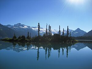
Long ago, lava flows from volcanoes like Mount Price and Clinker Peak created a natural dam. This dam, called The Barrier, blocked a valley and allowed the lake's waters to build up. The Barrier is very thick, over 300 m (1,000 ft) deep, and about 2 km (1.2 mi) wide where it holds back the lake. You can also see small islands in the lake, called the Battleship Islands. These are actually parts of the lava flow that stick out of the water.
Why the Lake is Turquoise
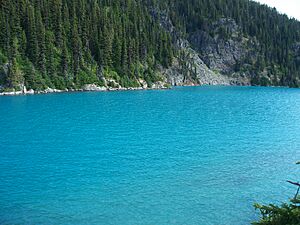
The lake's amazing turquoise colour comes from something called glacial flour. This is super fine rock dust that gets carried into the lake by melting ice from glaciers. The two main glaciers feeding the lake are the Sphinx Glacier and the Sentinel Glacier. When sunlight hits these tiny rock particles in the water, it makes the lake glow with its unique blue-green colour.
Most of the time, water leaves Garibaldi Lake by seeping through tiny cracks in The Barrier. This water then appears as springs at the bottom of The Barrier, forming Rubble Creek. During spring, when a lot of snow melts, enough water flows out to create a small stream over the lava. This stream then flows into Lesser Garibaldi Lake and Barrier Lake.
Safety Around The Barrier
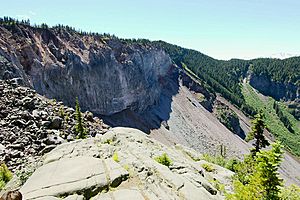
The natural lava dam, The Barrier, has had some large debris flows (like rockslides) in the past. One of the most recent big ones happened in 1855-56. This created a huge field of boulders, which is why the creek below is called Rubble Creek.
Because of concerns about The Barrier's stability, the government decided in 1981 that the area directly below it was not safe for people to live in. This led to people moving from the nearby village of Garibaldi, British Columbia, to safer areas.
Scientists have studied The Barrier very carefully. They have found no scientific evidence that The Barrier will suddenly collapse and cause the lake to empty in a dangerous way. However, a very large rockslide from The Barrier could potentially block the Cheakamus River. This might increase the chance of a debris flood that could affect the Paradise Valley area. Experts continue to monitor The Barrier to ensure safety.
Fun Things to Do at Garibaldi Lake
All activities around Garibaldi Lake are managed by the rules of Garibaldi Provincial Park. The main way to reach the lake is by hiking the Garibaldi Lake Trail. This trail is about 9 km (5.5 mi) long and climbs about 920 m (3,020 ft) from the Rubble Creek Trailhead.
There are places to camp and day-use shelters on the west side of Garibaldi Lake. You can also find more camping spots further northwest at Taylor Meadows. Most camping areas have special platforms for tents to help protect the natural environment.
During summer, it's hard to get to the eastern side of the lake because the slopes are very steep and unstable. In winter, the lake usually freezes over from late December to late April. This makes it easier for backcountry skiers and snowshoers to explore the far shore. There are also a couple of small alpine huts. You can find them in Sphinx Bay on the eastern shore and Sentinel Bay at the southeastern tip of the lake.

 | Tommie Smith |
 | Simone Manuel |
 | Shani Davis |
 | Simone Biles |
 | Alice Coachman |


