Gavel Fell facts for kids
Quick facts for kids Gavel Fell |
|
|---|---|

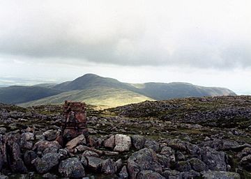
Gavel Fell seen from Great Borne, 2.5 km to the SE
|
|
| Highest point | |
| Elevation | 526 m (1,726 ft) |
| Prominence | c. 75 m |
| Parent peak | Blake Fell |
| Listing | Wainwright |
| Geography | |
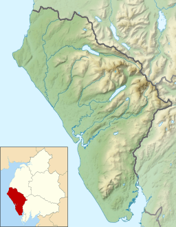
| Location | Cumbria, England |
| Parent range | Lake District, Western Fells |
| OS grid | NY117184 |
| Topo map | OS Landranger 89, 90, Explorer OL4 |
Gavel Fell is a cool hill located in the beautiful Lake District in England. It's right in the middle of five hills called the Loweswater Fells. Gavel Fell sits between two other hills, Hen Comb and Blake Fell. It's not super tall, but it's a fun climb! You can start your adventure from Loweswater village or from a place called Croasdale to the west.
Contents
Exploring the Western Fells
The Western Fells are a group of hills shaped like a triangle in the Lake District. They are bordered by the River Cocker to the northeast and Wasdale to the southeast. As you go west, the hills get smaller and lead towards the coast.
At the very center of these high hills are Great Gable and its smaller neighbors. Two main ridges spread out from either side of Ennerdale, which is a long, wild valley. Gavel Fell and the other Loweswater Fells are at the very end of the northern ridge.
The Loweswater Fells: A Handful of Hills
Imagine your hand: the Loweswater Fells are often compared to fingers spreading out from the "palm" area around Loweswater village. From west to east, these "fingers" are Burnbank Fell, Blake Fell, Gavel Fell, Hen Comb, and Mellbreak, which is like the "thumb."
Gavel Fell is like the "middle finger" of this group. It has a long ridge that stretches southwest from the valley. The path starts gently past High Nook farm, then gets steeper as it climbs up a rocky area called Black Crag. This leads to the flat top of the hill.
There's a smaller peak you reach first, which some guidebooks call High Nook. The ridge then gets wider and turns south at the main summit. It goes down over a rough area called White Oak. Beyond that is Banna Fell, which is usually considered part of Gavel Fell. Banna Fell has a noticeable eastern top called Floutern Cop.
Water Features Around Gavel Fell
On the side facing Loweswater, Gavel Fell is surrounded by two streams: Highnook Beck to the northwest and Whiteoak Beck to the east. These streams meet near High Nook Farm and then flow into Dub Beck, which drains into Loweswater.
One of the streams feeding Highnook Beck is from High Nook Tarn. A tarn is a small mountain lake. High Nook Tarn is a small pool with a low earth wall. Tarns are not very common in this part of the Lake District.
Gavel Fell also shares another tarn on its southern border called Floutern Tarn. This long, calm pool is about 12 feet deep and drains east into a marshy area called Mosedale. A walking path, Floutern Tarn Pass, goes right by Floutern Tarn. This path connects Buttermere to Ennerdale. The western side of the fell is drained by Croasdale Beck.
What Gavel Fell is Made Of
Gavel Fell is made from rocks that are part of the Kirk Stile Formation. These rocks are mostly thin layers of mudstone and siltstone.
There were once some mines on Gavel Fell. The Whiteoak Lead Mine operated between 1864 and 1891, but it didn't make much money. There are also remains of an iron mine near Floutern Tarn, which was worked on and off in the 1860s.
Reaching the Top of Gavel Fell
The very top of Gavel Fell has a large pile of stones, called a cairn, on a grassy, flat area. From the summit, you can't see the sea perfectly because Blake Fell blocks some of the view. However, you get an amazing view of the fells to the east, especially the Grasmoor group of mountains.
Ways to Climb Gavel Fell
- From Loweswater: You can start by following the path to High Nook farm. When you reach High Nook Tarn, you can choose to go up either side of the ridge to get past Black Crag, and then head for the summit.
- From Croasdale: You can use the west ridge of Banna Fell. This is a longer way around.
 | Anna J. Cooper |
 | Mary McLeod Bethune |
 | Lillie Mae Bradford |


