Blake Fell facts for kids
Quick facts for kids Blake Fell |
|
|---|---|

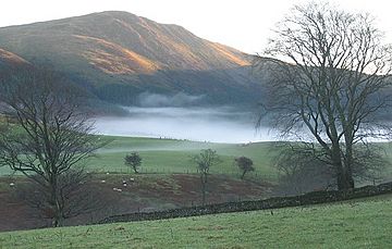
Blake Fell seen over the reservoir of Cogra Moss.
|
|
| Highest point | |
| Elevation | 573 m (1,880 ft) |
| Prominence | c. 164 m |
| Parent peak | High Stile |
| Listing | Marilyn, Wainwright |
| Naming | |
| English translation | (possibly Black Fell) |
| Language of name | Old English |
| Geography | |
| Location | Cumbria, England |
| Parent range | Lake District, Western Fells |
| OS grid | NY110196 |
| Topo map | OS Landranger 89, 90, Explorer OL4 |
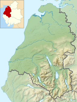
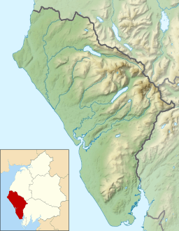
Blake Fell is a hill in the western part of England's Lake District. It's the tallest point in the Loweswater Fells. These are grassy hills with steep sides. They look over the beautiful lake of Loweswater. The hill also overlooks the nearby village of Loweswater. You can start your climb to the top from this village. Another way to reach the summit is from the Cogra Moss reservoir. This reservoir is on the western side of the fell. Blake Fell is known as a Marilyn. This means it's a hill with a certain height and a significant drop on all sides. It is found in the area called Lamplugh.
Contents
What is Blake Fell Like?
The Western Fells are a group of hills in the Lake District. They form a triangle shape. Blake Fell and the other Loweswater Fells are at the very end of the northern part of this group.
Imagine the Loweswater Fells like the fingers of a hand. They spread out from the "palm" area around Loweswater village. Blake Fell is one of these "fingers." Other hills in this group include Burnbank Fell, Gavel Fell, Hen Comb, and Mellbreak.
How High is Blake Fell?
Blake Fell is the highest hill in its group. The top part is a long ridge that runs southwest. It starts near the shore of Loweswater lake. The path goes steeply up through a forest called Holme Wood. Then you reach a rocky spot called Loweswater End.
After that, you'll find Carling Knott, which is 1,784 feet high. The ridge dips a bit, changing from rocky ground to grass. Then, you make the final climb to the top of Blake Fell.
Other Hills Nearby
A ridge connects Blake Fell northwards to Burnbank Fell. Some people see Burnbank Fell as a smaller part of Blake Fell. But Alfred Wainwright, a famous fell walker, gave it its own status in his guidebooks.
South of Blake Fell is a narrow, grassy dip called Fothergill Head. This connects Blake Fell to Gavel Fell. The western slopes of Blake Fell have many conifer trees. There are also forest roads winding through them.
Blake Fell has several other smaller tops. As you go southwest from the summit, you'll find:
- High Pen (1,558 feet)
- Low Pen (1,427 feet)
- Godworth (1,197 feet)
- Kelton Fell (1,020 feet)
Beyond these, you can see the Croasdale road and the flat land of West Cumberland. Knock Murton (1,467 feet) is another steep hill nearby. It's almost tall enough to be a Marilyn on its own. Blake Fell also has a western ridge. This ridge goes over Sharp Knott (1,581 feet) and High Howes (1,027 feet). It gently slopes down to the village of Lamplugh.
Water Around Blake Fell
Water from the western slopes flows into Sharp Knott Gill and Fother Gill. These streams lead to Cogra Moss. This is a reservoir in a deep valley between Blake Fell and Knock Murton. It's also called Arlecdon Reservoir and is about 30 feet deep. The water from this side of the fell eventually joins the River Marron and then the River Derwent. Water from the eastern side of Blake Fell flows into Loweswater lake. This also ends up in the River Derwent.
What is Blake Fell Made Of?
The very top of Blake Fell is made of a type of rock called Kirkstile Formation. This is a mix of thin layers of mudstone and siltstone. These rocks are common in the Skiddaw fells. The rockier parts, like Carling Knott, show older rocks. These are from the Loweswater Formation. They are made of greywacke sandstone.
Mining History
Knock Murton and Kelton Fell show signs of old mining. People used to dig for haematite here. Haematite is a type of iron ore. Between 1853 and 1914, these mines produced a lot of ore. Sometimes, they dug up to 60,000 tons of ore each year! A railway line was built between the two hills to carry the ore. You can still see where the Rowrah and Kelton Fell Line used to be. Another mine, the Croasdale Iron Mine, was south of Kelton Fell.
Reaching the Top of Blake Fell
The summit of Blake Fell is a grassy, rounded area. There's a large pile of stones called a cairn there. This is where paths from different ridges meet.
From the top, you get amazing views! To the west, there's nothing blocking your view of the sea. To the east, you can see many other hills. These stretch from Binsey in the north to Grike in the south. The North Western Fells across Crummock Water look especially good.
How to Climb Blake Fell
You can climb Blake Fell from Loweswater village. You can take a direct path up Carling Knott. Or, you can choose a path further south via High Nook Beck.
If you're coming from the west, Lamplugh or Felldyke are good starting points. These villages have many footpaths. These paths connect to a track next to Cogra Moss. You can use this track to reach the higher ground through Low Pen. You can also climb Knock Murton from the end of the reservoir.
 | Laphonza Butler |
 | Daisy Bates |
 | Elizabeth Piper Ensley |


