Grand Lake (Colorado) facts for kids
Quick facts for kids Grand Lake |
|
|---|---|

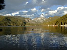
looking east
|
|
| Location | Grand County, Colorado |
| Coordinates | 40°14′42″N 105°48′58″W / 40.24500°N 105.81611°W |
| Lake type | Glacial Lake |
| Catchment area | Native inflows come from the Continental Divide through Rocky Mountain National Park. |
| Basin countries | United States |
| Max. length | 1.5 mi (2.4 km) |
| Max. width | 1 mi (1.6 km) |
| Surface area | 507 acres (205 ha) |
| Max. depth | 389 ft (119 m) |
| Water volume | 68,621 acre⋅ft (84,643,000 m3) |
| Shore length1 | 4 mi (6.4 km) (approx) |
| Surface elevation | 8,367 ft (2,550 m) |
| Settlements | Grand Lake, Colorado |
| 1 Shore length is not a well-defined measure. | |
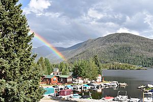
Grand Lake is the biggest and deepest natural lake in Colorado. It is found in Grand County, Colorado, where the Colorado River begins. The historic town of Grand Lake sits on its north shore.
The Ute Tribe, a Native American group, called it Spirit Lake. They believed the lake's very cold waters were where souls went after death.
Contents
About Grand Lake
Grand Lake was formed a long, long time ago during the last Ice Age. This happened between 30,000 and 10,000 years ago. A huge sheet of ice, called a glacier, moved through the area.
How Grand Lake Was Formed
As the glacier melted, it left behind a pile of rocks and dirt. This pile is called a "terminal moraine." This moraine acted like a natural dam. It trapped the melting water and formed the lake we see today.
Water Sources
Water naturally flows into Grand Lake from two main streams. These are the North Inlet and the East Inlet. Both of these streams come from Rocky Mountain National Park. The park surrounds most of the lake. Grand Lake is also very close to the park's western entrance.
The Colorado-Big Thompson Project
Grand Lake is an important part of a big water project. This project is called the Colorado-Big Thompson (C-BT) Project. It helps move water to different parts of Colorado.
Moving Water for People
Grand Lake is connected to two man-made lakes. These are Shadow Mountain Lake and Lake Granby. Water from Lake Granby can be pumped back into Shadow Mountain Lake. From there, it flows into Grand Lake.
The water then travels under Rocky Mountain National Park. It goes through a long tunnel called the Alva B. Adams Tunnel. This tunnel crosses the Continental Divide. The water then flows to the Big Thompson River on the eastern side of the Rocky Mountains.
Uses for the Water
From the Big Thompson River, the water flows into the South Platte River. This water is used for many important things. It helps with farming, provides water for towns and cities, and is used by businesses.
The C-BT Project also uses the water to make electricity. This power helps five power stations on the eastern side of Colorado.
Water Diversion
The C-BT Project is one of the first big projects to move water. It takes water from the Colorado River area. The Colorado River usually flows to the Gulf of California. But the C-BT Project moves some of this water to the South Platte River area. The South Platte River eventually flows to the Mississippi River and then to the Gulf of Mexico.
Because the project moves water from one major river basin to another, it is called a "transbasin diversion."
 | Tommie Smith |
 | Simone Manuel |
 | Shani Davis |
 | Simone Biles |
 | Alice Coachman |


