Grayrigg Forest facts for kids
Quick facts for kids Grayrigg Forest |
|
|---|---|

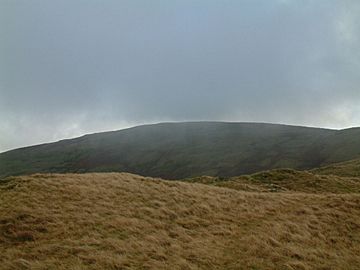
Grayrigg Forest from further west on Grayrigg Common
|
|
| Highest point | |
| Elevation | 494 m (1,621 ft) |
| Prominence | 190 m (620 ft) |
| Parent peak | High Street |
| Listing | Marilyn, Fellranger, Hump, Tump, Clem |
| Geography | |
| OS grid | SD598998 |
| Topo map | OS Landranger 97 |
Grayrigg Forest is a hill located in Cumbria, England. It sits on the eastern edge of the famous Lake District. In August 2016, this area officially became part of the Lake District National Park. The hill reaches about 494 meters (1,621 feet) above sea level. You can reach it from the less-known Borrowdale valley.
Exploring Grayrigg Forest
Grayrigg Forest is a great place to explore. It offers a unique view of the English countryside. Even though its name includes "Forest," it's mainly a hill with open land.
Amazing Views from the Top
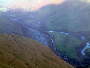
From near the top of Grayrigg Forest, you can see incredible sights. You can look down into the deep Lune valley. Here, the River Lune flows between the hills. You'll also see the M6 motorway and the West Coast Main Line railway. These all squeeze together between the edges of the Lake District and the Howgill Fells. It's a busy and beautiful landscape.

Joining the National Park
Grayrigg Forest is one of three hills that were added to the list of "Fellrangers." Fellrangers are hills described in special guidebooks by Mark Richards. The other two hills are Winterscleugh and Whinfell Beacon. They were included in the new edition of the guidebooks (2019-2021). This happened because the Lake District National Park boundary was made bigger in 2019. This expansion brought these hills into the park for the very first time.
 | Audre Lorde |
 | John Berry Meachum |
 | Ferdinand Lee Barnett |


