Gummer's How facts for kids
Quick facts for kids Gummer's How |
|
|---|---|

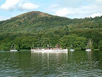
Gummer's How across Windermere from Lakeside
|
|
| Highest point | |
| Elevation | 321 m (1,053 ft) |
| Prominence | c. 217 m |
| Parent peak | High Street |
| Listing | Marilyn, Outlying Wainwright |
| Geography | |
| OS grid | SD390885 |
| Topo map | OS Landranger 96 |
Gummer's How is a lovely hill in the southern part of the Lake District in England. It sits right by the eastern side of Windermere, which is one of the biggest lakes in the area. Even though it's not one of the tallest mountains, it offers some truly amazing views. The word "How" comes from an old language called Old Norse. It means a hill or a mound, which is a common name for hills in this region.
Contents
Discovering Gummer's How
Gummer's How is a popular spot for families and hikers. It's known for its beautiful scenery and relatively easy paths. It's a great place to visit if you want to see the stunning landscapes of the Lake District without a really long or tough climb.
What Makes Gummer's How Special?
Gummer's How is 321 metres (about 1,053 feet) above sea level. While this might not sound super tall compared to other Lake District fells (which are bigger mountains), it's the highest hill in its local area. This means it stands out and offers clear, wide views all around. At the very top, you'll find an OS trig point. This is a special marker used by mapmakers to help them create accurate maps.
Amazing Views from the Top
From the summit of Gummer's How, you can see incredible sights. The best views are along Windermere, stretching out like a long, sparkling ribbon. You can also look across to the Coniston fells and the central fells, which are the higher mountains in the Lake District. On a clear day, you might even see the wide, open waters of Morecambe Bay in the distance. A famous writer, Simon Jenkins, even said that the view from Windermere, including the Lake District, Pennines, and Morecambe Bay, is one of the top ten views in all of England!
The Walk to the Summit
The most common way to reach the top of Gummer's How is from a car park called Astley's Plantation. This car park is already quite high up, over 200 metres (about 650 feet) above sea level. From there, the summit is only about 700 metres (less than half a mile) away.
The walk is short and many families enjoy it. Even though it's considered easy, it still feels like a proper Lakeland walk. You'll find some short, steep parts and rocks to climb over. Along the way, you'll see plants like rowan trees, bracken ferns, and heather. The lower parts of the hill are covered in trees, but as you go higher, it changes to open moorland.
Gummer's How in Books
Gummer's How is even featured in a book by a famous fell walker named Alfred Wainwright. His book, The Outlying Fells of Lakeland, describes many of the smaller hills around the main Lake District mountains. Wainwright called Gummer's How "an old man's mountain," meaning it's a great place for people of all ages to enjoy, even if they can't climb the biggest fells anymore.

 | Sharif Bey |
 | Hale Woodruff |
 | Richmond Barthé |
 | Purvis Young |


