
Hastings River facts for kids
Quick facts for kids Hastings River |
|
|---|---|

North Coast railway bridge over the Hastings River at Wauchope
|
|
| Native name | Doongang |
| Other name(s) | Mooraback Creek |
| Country | Australia |
| State | New South Wales |
| IBRA | New England Tablelands, NSW North Coast |
| District | Northern Tablelands, Mid North Coast |
| local government area | Port Macquarie-Hastings |
| Physical characteristics | |
| Main source | Great Dividing Range southwest of Kemps Pinnacle, within Oxley Wild Rivers National Park 1,040 m (3,410 ft) 31°25′54″S 152°22′4″E / 31.43167°S 152.36778°E |
| River mouth | Tasman Sea, South Pacific Ocean Port Macquarie 0 m (0 ft) 31°25′48″S 152°55′12″E / 31.43000°S 152.92000°E |
| Length | 180 km (110 mi) |
| Basin features | |
| Basin size | 3,658 km2 (1,412 sq mi) |
| Tributaries |
|
| National Parks | Oxley Wild Rivers, Werrikimbe, Cottan-Bimbang |
The Hastings River is a beautiful river in New South Wales, Australia. The local Aboriginal people, the Birpai, call it Doongang. It flows through the Northern Tablelands and Mid North Coast areas. The river is a type of estuary, which means it's where the river meets the sea.
Contents
Journey of the Hastings River
The Hastings River starts high up in the Great Dividing Range. This is a large mountain range in Australia. It begins near a place called Kemps Pinnacle. This area is close to Oxley Wild Rivers National Park and Werrikimbe National Park.
River's Path and Length
The river flows for about 180 kilometers (112 miles). It travels generally south, then southeast, and finally east. Along its journey, seven smaller rivers and creeks join it. These are called tributaries. Some of the main ones are the Tobins, Forbes, and Ellenborough.
The river drops a total of 1,040 meters (3,410 feet) from its source to its mouth. This shows how steep the land is where it begins.
Where the River Ends
The Hastings River eventually reaches its end at Port Macquarie. Here, it flows into the Tasman Sea. The Tasman Sea is part of the larger South Pacific Ocean.
Towns Along the River
Many towns and settlements are located along the Hastings River. These include Ellenborough, Long Flat, Beechwood, and Wauchope. The Oxley Highway often runs alongside the river. The Pacific Highway also crosses the Hastings River near Port Macquarie.
History of the Hastings River
The Hastings River area has a long and rich history. For thousands of years, the Birpai Aboriginal people lived here. They knew the river as Doongang. Their culture and traditions are deeply connected to this land and river.
European Discovery
In 1818, European explorers first mapped the river. John Oxley was the explorer who first saw it. He decided to name the river after Francis Rawdon-Hastings, 1st Marquess of Hastings. At that time, he was the Governor-General of India.
Nature and Fun on the Hastings River
The Hastings River is important for both nature and recreation. It even has a special connection to local products and wildlife.
Wine and Wildlife
The river gives its name to the Hastings River wine region. This area is known for growing grapes and making wine. The river is also home to a very special and rare animal. This is the Hastings River Mouse (Pseudomys oralis). It is an endangered species, meaning it is at risk of disappearing forever.
Fishing Opportunities
If you enjoy fishing, the Hastings River offers great chances to catch fish. In the upper parts of the river, you might find freshwater bass and catfish. Closer to where the river meets the sea, you can catch estuarine fish. These include bream, flathead, and luderick.
Images for kids
-
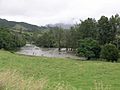
Hastings River, flooded, west of Ellenborough, 2009.
-
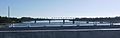
Dennis Bridge from the new Pacific Highway bridge to the west
-
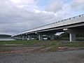
New Hastings River Bridge carrying the Pacific Highway
.JPG)

