Hatfield, Massachusetts facts for kids
Quick facts for kids
Hatfield, Massachusetts
|
|||
|---|---|---|---|

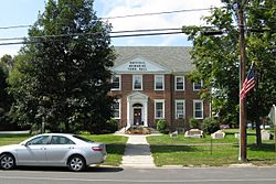
Hatfield Memorial Town Hall
|
|||
|
|||
| Motto(s):
Industry, Prosperity
|
|||

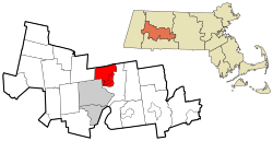
Location in Hampshire County in Massachusetts
|
|||
| Country | United States | ||
| State | Massachusetts | ||
| County | Hampshire | ||
| Settled | 1661 | ||
| Incorporated | 1670 | ||
| Government | |||
| • Type | Open town meeting | ||
| Area | |||
| • Total | 16.8 sq mi (43.6 km2) | ||
| • Land | 15.9 sq mi (41.2 km2) | ||
| • Water | 0.9 sq mi (2.4 km2) | ||
| Elevation | 129 ft (39 m) | ||
| Population
(2020)
|
|||
| • Total | 3,352 | ||
| • Density | 199.12/sq mi (76.88/km2) | ||
| Time zone | UTC−5 (Eastern) | ||
| • Summer (DST) | UTC−4 (Eastern) | ||
| ZIP Codes |
01038, 01066, 01088
|
||
| Area code(s) | 413 | ||
| FIPS code | 25-29265 | ||
| GNIS feature ID | 0618202 | ||
Hatfield is a friendly town located in Hampshire County, Massachusetts, in the United States. In 2020, about 3,352 people lived there. It is part of the larger Springfield area. The main part of Hatfield, called the census-designated place of Hatfield, includes the town center and nearby areas.
Contents
Hatfield's Early History
Hatfield was first settled in 1660. The land was given to two important people, General Daniel Dennison and Governor William Bradford. It officially became a town in 1670. Today, Hatfield is run by a group called the board of selectmen and holds an annual town meeting where citizens can vote on important town matters.
Why Hatfield Became Its Own Town
One interesting story about Hatfield becoming a town in 1670 involves its neighbor, Hadley. At that time, Hatfield was part of Hadley. Hadley's church was across the Connecticut River, which was difficult to cross every week, especially in winter when the river froze.
The people living in Hatfield asked if they could build a church on their side of the river. Hadley said "No." This made the Hatfield residents very upset. They held a vote to decide if they should stay part of Hadley or become their own town. The vote to become a separate town won! Many people thought this was a good idea because travel was so hard back then.
Early Challenges and Conflicts
Hatfield was an important farming area, growing crops like corn and tobacco, and raising cattle and sheep. At first, the settlers and the local Native Americans got along well.
However, things changed during King Philip's War. On October 16, 1675, a large part of Hatfield was destroyed. The people who survived had to go to Springfield for safety. Later, on September 19, 1677, another attack happened. Thirteen people were killed, and seventeen were taken as hostages to Canada. After nine months, the remaining hostages were rescued and returned home.
Hatfield's Role in American History
During the American Revolution, Hatfield played a big part. It provided many supplies and soldiers for the American rebels fighting for independence.
Later, in 1786, Hatfield was a gathering place for unhappy people who were part of Shays' Rebellion. This was a protest by farmers who were struggling after the war.
Important Families and People
One family, the Hastings, provided many doctors for Hatfield over several generations. They were descendants of English Puritan immigrant Thomas Hastings. The first Thomas Hastings was also the town's first schoolteacher. He even wrote about a terrible attack on nearby Deerfield in 1704.
Hatfield was also the birthplace of Sophia Smith (1796–1870). She was a very important person who founded two schools: Smith Academy (Hatfield's public high school) and Smith College, a famous college for women in Northampton. Another notable resident was Rebecca Dickinson (1738–1812), a dressmaker whose diary helps us learn about the lives of early American women.
Hatfield's Geography
Hatfield is located on the west side of the Connecticut River, where the Mill River flows into it. It's about 25 miles (40 km) north of Springfield and about 100 miles (160 km) west of Boston.
Neighboring Towns and Roads
To the west, Hatfield is bordered by Horse Mountain and the town of Williamsburg. To the north is Whately. Across the Connecticut River to the east and south is Hadley. To the southwest is the city of Northampton.
Several villages are part of Hatfield, including Westbrook, North Hatfield, Bradstreet, and West Hatfield.
Major roads like U.S. Route 5/Route 10 and Interstate 91 pass through the town. You can get onto Interstate 91 from Exits 27 and 30. The main village of Hatfield is about 2 miles (3 km) east of these major roads.
Land and Water Area
The town of Hatfield covers a total area of about 43.6 square kilometers (16.8 square miles). Most of this is land, about 41.2 square kilometers (15.9 square miles). The rest, about 2.4 square kilometers (0.9 square miles), is water, mainly from the Connecticut River.
Population and People
| Historical population | ||
|---|---|---|
| Year | Pop. | ±% |
| 1850 | 1,073 | — |
| 1860 | 1,337 | +24.6% |
| 1870 | 1,594 | +19.2% |
| 1880 | 1,495 | −6.2% |
| 1890 | 1,246 | −16.7% |
| 1900 | 1,500 | +20.4% |
| 1910 | 1,986 | +32.4% |
| 1920 | 2,651 | +33.5% |
| 1930 | 2,476 | −6.6% |
| 1940 | 2,216 | −10.5% |
| 1950 | 2,179 | −1.7% |
| 1960 | 2,350 | +7.8% |
| 1970 | 2,825 | +20.2% |
| 1980 | 3,045 | +7.8% |
| 1990 | 3,184 | +4.6% |
| 2000 | 3,249 | +2.0% |
| 2010 | 3,279 | +0.9% |
| 2020 | 3,352 | +2.2% |
| 2022* | 3,314 | −1.1% |
| * = population estimate. | ||
In 2000, there were 3,249 people living in Hatfield. These people lived in 1,381 households, with 871 of them being families. About 27.6% of households had children under 18 living with them.
The average household had about 2.35 people, and the average family had about 2.96 people. The median age in Hatfield was 43 years old. This means half the people were younger than 43 and half were older.
Hatfield's Schools
Hatfield has two public schools for its students:
- Hatfield Elementary School: This school serves students from Pre-Kindergarten up to 6th grade.
- Smith Academy: This is the town's high school, for grades 7 through 12. It's a small school, with just over 130 students, making it one of the smallest public high schools in Massachusetts.
Places to Visit
- Borden Base Line
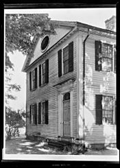
- Mill-Prospect Street Historic District
See also
 In Spanish: Hatfield (Massachusetts) para niños
 | Jessica Watkins |
 | Robert Henry Lawrence Jr. |
 | Mae Jemison |
 | Sian Proctor |
 | Guion Bluford |


