Haxby facts for kids
Quick facts for kids Haxby |
|
|---|---|
| Town | |
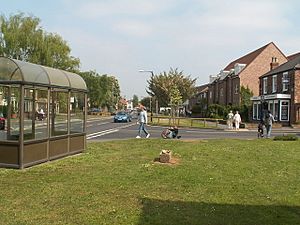
 Haxby town centre |
|
| Population | 8,428 (2011 census) |
| OS grid reference | SE607582 |
| Civil parish |
|
| Unitary authority | |
| Ceremonial county | |
| Region | |
| Country | England |
| Sovereign state | United Kingdom |
| Post town | YORK |
| Postcode district | YO32 |
| Dialling code | 01904 |
| Police | North Yorkshire |
| Fire | North Yorkshire |
| Ambulance | Yorkshire |
| EU Parliament | Yorkshire and the Humber |
| UK Parliament |
|
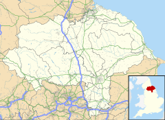
Haxby is a town and civil parish located in North Yorkshire, England. It is part of the City of York district. In 2011, about 8,428 people lived there.
Haxby is surrounded by open fields to the north. The River Foss is to its east. It is just outside the main York ring road. Haxby shares a connected area with the village of Wigginton to the west.
The name Haxby comes from an old Norse (Viking) word. It means "Hákr's settlement." It was first written as Haxebi in the Domesday Book in 1086. The town centre, often called "The Village," has been a special conservation area since 1976. Haxby officially became a town in 1992.
Contents
History of Haxby
Early Settlements
A settlement called Haxebi was started by the Vikings around the 9th century. The word "BY" in Norse meant a small town or farm. It was usually added to the name of the person who owned the land. In this case, it was a man named Hakr.
Evidence of Vikings has been found here. A Viking cross base is in the churchyard of St Mary's Church. Another Viking cross shaft was found in a nearby garden in 1978. This shows how old the settlement is.
There is also proof that Romans lived here. In 1966, a Roman villa was discovered on Haxby Moor. Roman pottery and a silver Roman ring were found on Station Road in 2003.
Medieval Times and Growth
During the Middle Ages, Haxby was part of the royal Forest of Galtres. This meant people living there had to follow special forest laws. King Charles I gave up his rights to the forest in 1629. This allowed the village to get more land and grow. Today, the parish covers about 2,100 acres (8.5 square kilometres).
Haxby was not always its own parish. It was first split between the parishes of Strensall and Driffield. St Mary's Church, Haxby was built in the 16th century. It became a chapel linked to Strensall parish. In 1862, Haxby became its own parish.
Victorian Era and Modern Changes
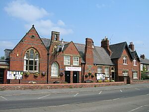
Many buildings in the town centre today are from the 18th and early 19th centuries. However, a lot of building work happened in Victorian times. Important buildings from this period include the Memorial Hall, which used to be a school. It now hosts a local radio station called Vale Radio. The current St Mary's Church and the Methodist Chapel are also from this time.
When the railway arrived in Haxby, it became a popular place to live. People could easily travel to work from here. The town grew steadily until the 1970s. Then, the population quickly grew four times larger. In 1976, the centre of Haxby was made a conservation area. This helps protect its historic look.
By 1992, Haxby had grown a lot and was officially called a town. Its population was over 10,000 people. In 1996, Haxby became part of the City of York council area.
How Haxby is Governed
Haxby has its own local government called the Haxby Town Council. This council has up to 14 members, called Councillors. They represent four areas of Haxby: North, East, Central, and South West.
The Town Council office is in Haxby Memorial Hall. Council meetings are usually held there or at the Oaken Grove Community Centre.
What the Town Council Does
The Town Council looks after several local areas. They maintain the Village Green and Wyre Pond, also known as Haxby Duck Pond. They also take care of Ethel Ward Memorial Playing Fields and Mancroft Recreational Open Space. This includes the Ethel Ward Pavilion and children's play areas.
The council also manages the Allotment gardens on Station Road. They work with Wigginton Parish Council to look after Haxby and Wigginton Cemetery. The Haxby Town Council also organizes the yearly Haxby Carnival.
City of York Council's Role
Haxby is part of the Haxby and Wigginton Ward of the City of York Council. This is a larger council that provides many services for the whole city. Three councillors represent Haxby and Wigginton Ward. They form a local Ward Committee. This committee has a small budget for local road improvements and grants for local groups.
Elections for the City Council happen every four years. In May 2023, Councillors Ian Cuthbertson, Andrew Hollyer, and Edward Pearson were elected. Edward Pearson stepped down in 2024. Richard Watson replaced him after a special election. All of them are members of the Liberal Democrat Party.
The City of York Council is in charge of important services. These include care for adults and children, education, and waste collection. They also manage local roads, footpaths, and library services.
Member of Parliament
Haxby is part of the York Outer parliamentary area. This area elects one person to represent them in the UK Parliament. This person is called a Member of Parliament (MP).
Julian Sturdy, from the Conservative Party, was first elected as the MP for York Outer in 2010. He has been re-elected in every election since then.
Local Elections
Elections for the City Council and Town Council happen every four years. The last elections were in May 2023. The next ones are planned for May 2027. People in Haxby can vote at polling stations in the Memorial Hall, the Scout Hut, and St Margaret Clitherow's Church.
In the May 2023 elections, there were contests for some Town Council seats. However, in other areas, councillors were elected without a contest. This happened because there were fewer candidates than available seats.
Population and People
In 1881, Haxby had 559 people. By 2001, the population grew to 8,754. In 2011, it was 8,428.
Haxby and Wigginton Ward Information
The City of York Council collects information about the people living in Haxby and Wigginton Ward. Here are some facts from 2021–2022:
- The ward had 11,769 residents. A small number (1.8%) were from black and minority ethnic groups.
- Most residents (82.3%) reported being in good health. About 17.8% said they had some limits on their daily activities.
- The average weekly household income in 2017–18 was £664.62.
- Most homes (88%) are owned by the people living in them. About 6% are rented privately, and 5% are social housing. There are no council houses in the ward.
- About 71.3% of residents have some level of qualification. However, 19.5% have no qualifications.
- About 8.3% of children live in families with low incomes. About 8.9% of households struggle to pay for heating (fuel poverty).
- Only 1.2% of working-age people claim unemployment benefits.
Geography of Haxby
Haxby is on flat land. The ground is mostly clay, with some sand and alluvium (soil left by rivers). It is near the old Forest of Galtres. To the north, there is a small stream called Goland Dike. It flows into the River Foss, which is to the east.
The nearby village of Wigginton now joins with Haxby. However, old maps still show the original boundary. This line runs behind the houses on Wheatfield Lane. It then turns north, crossing Greenshaw Drive and The Village road. It continues north past Windsor Drive and into the countryside.
Getting Around Haxby
Bus Services
As of November 2021, several bus companies run services in Haxby. These include First York, Connexions, and Transdev. There are four main bus routes:
- 1: Wigginton to Chapelfields, going through York City Centre. This bus runs every day, including evenings and weekends.
- 13: Haxby (West Nooks) to Copmanthorpe, through York City Centre. This service runs Monday to Saturday during the day.
- 14: Haxby (West Nooks) to Foxwood, through York City Centre. This bus runs Monday to Saturday evenings.
- 20: Rawcliffe to Monks Cross, then Heworth & Osbaldwick, via Haxby and Wigginton. This service runs Monday to Saturday, daytime and early evening.
In February 2024, changes to these bus services were approved. This included fewer services and less frequent buses on Station Road, Towthorpe Road, and West Nooks.
Train Services
Haxby used to have a train station from 1845 to 1930. It was on the York to Scarborough line. There have been many attempts to reopen a new station over the years.
In 2020, the City of York Council received money from the government. This money was to plan a new station. The council bought land near the railway in Haxby in September 2021. This land could be used for the new station. There are plans for trains to run every half hour.
In 2023, more money was given to design the station in detail. This included plans for the car park and how to access the station. Tests were also done on the ground conditions. In October 2023, the new Haxby station was announced as part of a national transport project. Planning permission for the station was submitted in early 2024. Construction was planned for 2025, with the station opening in 2026. However, funding for this project was withdrawn in July 2024.
Education in Haxby
Primary Schools
Children in Haxby attend primary school at two places:
- Headlands Primary School on Oak Tree Lane.
- Ralph Butterfield School on Station Road.
Secondary School
Haxby is in the area for Joseph Rowntree Secondary School.
Library and Community Centre
Oaken Grove Primary School closed in 2002. Part of the site became Reid Park. The rest of the site, including a football pitch, was kept by the Haxby and Wigginton Youth and Community Association. It reopened as the Oaken Grove Community Centre.
In January 2023, the new Haxby and Wigginton Library opened at the Oaken Grove Community Centre. It had been refurbished for £1.2 million. The centre now has two large community rooms for classes and youth services. It also has a community cafe, a children's library, and a main library and reading room.
Media and News
Local news and TV shows for Haxby come from BBC Yorkshire and ITV Yorkshire.
For local radio, you can listen to BBC Radio York (103.7 FM), Greatest Hits Radio Yorkshire (104.7 FM), YO1 Radio (102.8 FM), Jorvik Radio (94.8 FM), and YorkMix Radio (DAB).
The local newspaper for the town is The York Press.
Sports in Haxby
Haxby has local sports teams:
- Haxby United Football Club plays at the Ethel Ward Playing Fields. In 2013, their main team played in the York League Division 2. They won the Premier League title in the 2009–10 season.
- Haxby Netball Club plays in the York and District Netball League. As of 2010, they had six teams in different divisions.
Religion in Haxby
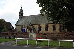
St Mary's Church, Haxby was rebuilt in 1878. It is on the site of an older church from the 16th century. The church records go back to 1678. It is located on the road called The Village.
In the 19th century, Haxby had two Methodist chapels. Today, only the Wesleyan Chapel remains. It is now called Haxby & Wigginton Methodist Church. It is also on The Village road.
St Margaret Clitherow's Church, Haxby is a Roman Catholic church. It is located on Holly Tree Lane.
Famous People from Haxby
- Actress Taj Atwal, known for shows like Line of Duty, used to live in Haxby.
See also
- Haxby Hall
 | Aaron Henry |
 | T. R. M. Howard |
 | Jesse Jackson |


