Hazel Creek (Great Smoky Mountains) facts for kids
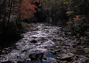
Hazel Creek is a beautiful stream located in the southwestern Great Smoky Mountains of North Carolina. It flows into the Little Tennessee River. Long ago, the flat areas along the creek were home to several pioneer communities and logging towns. These towns were part of the Appalachian region. Later, Hazel Creek became part of the Great Smoky Mountains National Park. Today, it's a popular spot for camping and exploring history in the park's backcountry.
Exploring Hazel Creek's Geography
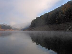
Hazel Creek starts high up near the top of Silers Bald. It then flows southwest for about 18 miles (29 km) until it reaches the Fontana Lake part of the Little Tennessee River. The creek drains the land between two long ridges: Welch Ridge to the east and Jenkins Trail Ridge to the west. Both of these ridges are very tall, reaching over 5,000 feet (1,524 m) in many places.
Hazel Creek is one of three main creek areas in the southwestern Smokies. The others are Eagle Creek and Forney Creek. These three areas make up a remote, roadless part of Fontana Lake's northern side, known as the North Shore.
The creek drops very quickly at first, falling 1,500 feet (457 m) in less than a mile. It then flows more calmly. As it goes, it picks up water from other smaller streams like Walkers Creek, Bone Valley Creek, and Sugar Fork. Near the town of Proctor, Hazel Creek meets Shehan Branch before flowing into Fontana Lake.
There are no public roads that lead directly into the Hazel Creek valley. You can get there by ferry from Fontana Village, which is about 5 miles (8 km) west of the creek's mouth. The closest towns by road are Bryson City to the east and Maryville, Tennessee to the northwest. Hazel Creek is entirely within Swain County, North Carolina.
Towns and Communities Along Hazel Creek
From the 1830s to the 1940s, several small towns grew up along Hazel Creek. Here are some of the most important ones:
- Proctor — This town was located where Shehan Branch meets Hazel Creek. It was named after Moses and Patience Proctor, who were the first settlers in the area. Today, you can find Campsite 86 and the old Ritter Mill ruins here.
- Cable Branch — This community was downstream from Proctor, where Cable Branch meets Hazel Creek. It was named after Samuel Cable, who settled there around 1835.
- Medlin — Located where Sugar Fork meets Hazel Creek, this area is now Campsite 84. It was named after Marion Medlin, who settled there in the 1860s.
- Bone Valley — This community was at the meeting point of Bone Valley Creek and Hazel Creek, near what is now Campsite 83. It got its name from a sad event where many cattle froze to death, leaving their bones behind.
- Ritter — This town was at the original spot where Hazel Creek met the Little Tennessee River. It's now underwater because of Fontana Lake. It was named after the Ritter Lumber Company, which used it as a train center.
Other important communities in the North Shore area included Bushnell and Fontana.
A Look at Hazel Creek's Past
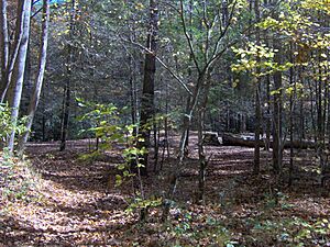
The Cherokee people were the first known residents of the Hazel Creek valley. While not as crowded as other Cherokee settlements, a small village existed where Sugar Fork meets Hazel Creek. Cherokee families also lived in a narrow valley called Possum Hollow.
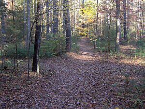
An old Cherokee trail connected Hazel Creek to Cades Cove in Tennessee. This trail went over the mountains and was used for travel and hunting. Other trails linked Hazel Creek to nearby areas like Forney Creek and the Tuckasegee River.
Early Settlers Arrive (1829-1860)
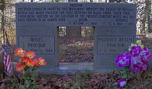
Moses Proctor (1794–1864) and his wife Patience Rustin Proctor were the first known permanent European-American settlers in the Hazel Creek area. They arrived in 1829 and built a cabin in Possum Hollow, where Proctor Cemetery is today. The Proctors had a good relationship with the Cherokee people living nearby.
In 1835, Samuel Cable and his wife Elizabeth settled downstream from the Proctors. The area where they lived is now called Cable Branch. These early settlers likely used an old cattle road to reach markets in other counties.
Hazel Creek didn't have many people until the American Civil War. During this time, the creek was given its name, probably because of the hazelnut bushes growing along its banks.
The Civil War's Impact (1861-1865)
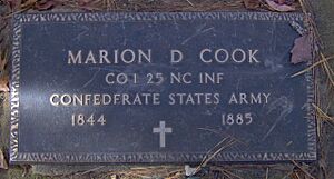
Even with few families, the Civil War greatly affected Hazel Creek. Most people on the North Carolina side of the Smokies supported the Confederacy. This was different from their relatives in Cades Cove, Tennessee, who strongly supported the Union.
People fleeing North Carolina often used the trails through Hazel Creek to reach Cades Cove. Both sides would sometimes raid each other to steal food and animals. Two of Moses and Patience Proctor's sons died fighting for the Confederacy. The community of Bone Valley was mostly settled by Confederate soldiers who returned from the war. Six of them are buried in Bone Valley Cemetery.
Mining and Early Logging (1889–1901)
After the war, more settlers came to Hazel Creek. Families like the Jones, Hall, Calhoun, and Medlin families built homes and stores. Marion Medlin even opened a post office in his store in 1887, giving his name to the Medlin settlement.
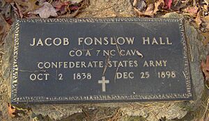
In 1883, Jacob Fonslow Hall found copper in the area. This led to a mining camp being set up in 1889. However, a legal dispute over who owned the land stopped the mine in 1901. The case dragged on for 27 years!
Around 1892, a logging company tried to cut timber along Hazel Creek. They used "splash dams" to create controlled floods that would carry logs downstream. But this company didn't make a profit and left in 1898.
Horace Kephart's Time in the Smokies (1904–1907)
In 1904, Horace Kephart, a librarian from St. Louis, came to Hazel Creek to study the wilderness. He lived in a cabin near Medlin. Kephart described Medlin as having "two little stores... a corn mill, and four dwellings."
Kephart's book, Our Southern Highlanders (published in 1913), was one of the first popular books about Appalachian culture. It included stories about bear hunts with local guides. He was fascinated by the mountain tops, which were once large grassy areas.
While Kephart's book gives us important details about life in the Smokies, some people felt it focused too much on unusual or poor aspects of mountain life. Some former Hazel Creek residents were upset by how the book showed them.
The Ritter Lumber Company Era (1907–1927)
In 1902, the W. M. Ritter Lumber Company planned a huge logging operation on Hazel Creek. They convinced the railroad to extend tracks to the mouth of Hazel Creek, where they built a town called Ritter. From there, they built a logging railroad 16 miles (26 km) up the valley. This train also carried passengers to Proctor and Medlin.
With the railroad, Ritter built a large sawmill near Proctor. Proctor grew a lot, with over 1,000 people by 1920. The company cut down trees on one side of the creek, then turned around and cut down trees on the other side, clearing many areas.
By 1928, when Ritter stopped working, they had cut a huge amount of lumber from the Hazel Creek area. While Ritter brought jobs, their logging methods caused long-term damage to the forest and the creek.
The National Park and Fontana Dam (1927–Present)
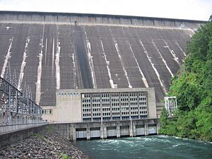
In the 1930s, the Aluminum Company of America (ALCOA) bought land near Fontana to build a large dam for power. When World War II started, the need for aluminum grew, so the Tennessee Valley Authority (TVA) quickly finished the dam in 1944.
That year, the TVA bought out the remaining North Shore communities, including those along Hazel Creek. The TVA offered low prices for the land, and families who refused to sell were forced to leave. The last families left Hazel Creek in November 1944, just before the rising lake waters covered the only main road out. The land then became part of the Great Smoky Mountains National Park. The Civilian Conservation Corps helped by repairing bridges, taking down buildings, and improving trails.
The North Shore Road Promise
When Fontana Lake was created, the valleys of Hazel Creek, Forney Creek, and Eagle Creek became isolated. The government had promised to build a new road along the North Shore so people could still visit cemeteries and old homesites. This promise was part of a 1943 agreement.
Between 1948 and 1970, about 7.2 miles (11.6 km) of this road were built near Bryson City. But environmental groups strongly opposed the project, and it stopped. Locals called the unfinished part "the Road to Nowhere."
In 2000, money was set aside to finish the road. However, in 2007, the National Park Service decided the road would go against the park's plan. They suggested a $52 million payment to Swain County instead. In 2010, Swain County agreed to this payment, ending the 1943 agreement. The county has received some of the money, but not all of it. In 2016, Swain County decided to sue the government to get the rest of the promised funds.
Hazel Creek Today
Hazel Creek remains one of the most remote areas in the Great Smoky Mountains National Park because the North Shore Road was never finished. You can reach it by taking a ferry from Fontana Village Marina. The ferry ride takes about 20 minutes.
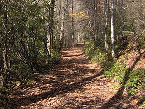
You can also hike to Hazel Creek from Fontana Dam (about 10 miles or 16 km) or from Cades Cove (about 16 miles or 26 km). There are five backcountry campsites along Hazel Creek. Campsite 86 is where the town of Proctor once stood. Campsite 84 was once Medlin and a Cherokee settlement. Campsite 83 was the Bone Valley settlement.
Historical Places in the Hazel Creek Area
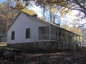
- Calhoun House — Built by George Higdon and bought by Granville Calhoun in 1928. After 1944, park rangers used it as a bunkhouse, calling it the "Hazel Creek Hilton." It's near Campsite 86.
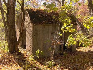
- Hall Cabin — Built in 1892 by Jesse "Crate" Hall. This cabin, made of poplar logs, is one of the most remote historical buildings in the park. It's about a 9-mile (14 km) hike from the ferry. It's listed on the National Register of Historic Places.
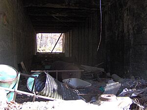
- The Ritter Mill Site — These are the ruins of the Ritter Lumber Company's sawmill and drying kilns, built around 1910. You can still see the walls of the sawmill. It's about 0.5 miles (0.8 km) east of the Calhoun House.
- The Adams-Westfeldt Mine Site — Located along Little Fork of Sugar Fork, about 2 miles (3 km) above Campsite 84 (Medlin). Horace Kephart lived in a cabin here from 1904 to 1907.
- Proctor Cemetery — Located on a hill about 0.5 miles (0.8 km) east of the Calhoun House. This is where Moses and Patience Proctor, the first settlers, built their cabin.
- Bone Valley Cemetery — Located on a hill northwest of the Bone Valley Trail junction. Many members of the Hall, Laney, and Cook families are buried here. The Bone Valley Baptist Church was also once located at the trail junction.
 | Roy Wilkins |
 | John Lewis |
 | Linda Carol Brown |


