History of Kasaragod facts for kids
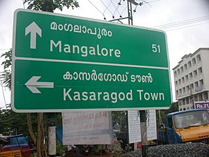
Kasaragod District is the northernmost district in Kerala, a state on the southwest coast of India. This area has a very long history, going back to ancient times.
Kasaragod is located on the Malabar coast. Its northern border, Thalappady, is only about 10 kilometers south of Mangalore. The main town of Kasaragod sits where the Chandragiri River, the longest river in the district, flows into the Arabian Sea.
The famous Ezhimala hill is found in the southern part of the Kavvayi Backwaters near Nileshwaram. Kasaragod is also home to several historic forts. These include Arikady fort, Bekal Fort, Chandragiri Fort, and Hosdurg Fort. Bekal Fort is the largest fort in all of Kerala.
The region where the Tulu language is traditionally spoken, called Tulunad, is said to extend south to the Chandragiri river. This means Kasaragod city is part of the Tulunad area.

Ancient History
Ancient writings from the Sangam Age in Tamil tell us that the area of Kasaragod was once part of a region called Puzhinadu. This coastal area stretched from Kozhikode to Mangalore.
Politically, Kasaragod was part of the Ezhimala Kingdom. Its capital was at Ezhimala in what is now Kannur district. The most famous king of Ezhimala was Nannan. His kingdom reached as far as Gudalur and parts of Coimbatore.
The kings of the Mooshaka dynasty were believed to be descendants of King Nannan. By the 14th century, the Mooshaka Kingdom became known as Kolathirinad. Its rulers were called Kolathiris.
At its strongest, the Kolathunad Kingdom was very large. It stretched from the Netravati River in the north to the Korapuzha in the south. The Arabian Sea was to its west, and the Kodagu hills to its east. It even included the islands of Lakshadweep.
Medieval Times
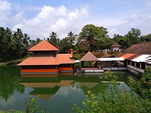
Kasaragod was an important trading center a long time ago. It is about 50 kilometers south of Mangalore. The book Ramacharitam, one of the oldest writings in Old Malayalam from the 12th century, might have been written in Kasaragod. Its old copies were found near Nileshwaram. The book also talks about the Ananthapura Lake Temple in Kumbla.
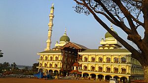
The Arabs knew Kasaragod by the name Harkwillia. The Malik Dinar Mosque in Kasaragod town is one of the oldest mosques in India. It is believed that Malik Dinar himself died in Thalangara, Kasaragod. Many Arab travelers visited Kasaragod between the 9th and 14th centuries because it was a busy trade hub.
A Portuguese traveler named Duarte Barbosa visited Kumbla in 1514. He wrote that rice was traded from here for coir (coconut fiber) to the Maldives. He also noted that people along the southwest coast of India, from Kumbla to Kanyakumari, spoke a unique language called "Maliama" (which is Malayalam).
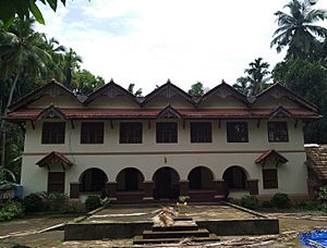
Until the 16th century, Kasaragod town was known as Kanhirakode in Malayalam. This name might mean 'The land of Kanhira Trees'. The Kumbla dynasty ruled the land between the Chandragiri River and the Netravati River. Their palace was the Maipady Palace at Kumbla. They were also connected to the Kolathunadu kingdom.
Later, the Vijayanagara Empire from Kannada regions attacked and took over Kasaragod from the Kolathiri kings in the 16th century. Nileshwaram became one of their capitals. When the Vijayanagara Empire weakened, the Ikkeri Nayakas took control. Venkappa Nayaka declared his independence. Forts like Kumbla, Chandragiri, and Bekal are thought to have been built or improved by Shivappa Nayaka.
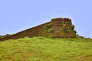
The Chandragiri Fort stands on the south bank of the Chandragiri River, across from Kasaragod town. The Bekal Fort at Bekal, which is the largest fort in Kerala, was built in 1650 by Shivappa Nayaka.
Colonial Period
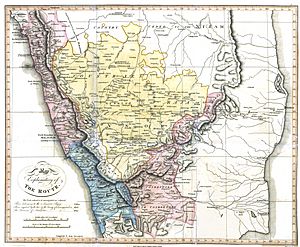
Francis Buchanan, a doctor for Arthur Wellesley, visited Kasaragod in 1800. In his travel notes, he wrote about places like Athiraparambu, Kavvayi, Nileshwaram, Bekal, Chandragiri, and Manjeshwar.
On January 19, 1801, Buchanan mentioned visiting a Siva temple at Pulla (Pallikere). He described the land rising towards the Chandragiri river and Chandragiri Fort, which he saw as the northern border of the Malayalam-speaking area. He noted that the land north of the Chandragiri fort and river was called Tuluva, or the Tulu country, by Hindus.
In 1763, Hyder Ali attacked Bedanoor, the capital of the Ikkery Naiks. His son, Tippu Sultan, later attacked much of the Malabar region in Kerala. After the Treaty of Seringapatam in 1792, Tippu gave Malabar to the British, but not Kanara. The British took Kanara after Tippu Sultan died.
Initially, South Canara was part of the Bombay Presidency. Then, on April 16, 1862, South Canara was moved to the Madras Presidency. The Kasaragod taluk was created, replacing the old Bekal taluk. Kasaragod was the second most populated and second largest taluk in South Canara, after Mangalore.
After Independence
Before Kerala was formed, Kasaragod was part of the South Canara district of the old Madras Presidency. However, in the 19th century, many people in Kasaragod wanted the region to join the Malabar District. This was because Kasaragod was the only area in South Canara where most people spoke Malayalam.
Kasaragod became part of Kannur district in Kerala when the states were reorganized on November 1, 1956. Later, Kasaragod was split into two smaller areas, or taluks, for easier management: Kasaragod and Hosdurg. Finally, Kasaragod was made a separate district in 1984.
The decision to include Kasaragod in Kerala has been debated because many people there speak Tulu and Kannada. In 1951, about 72% of the district's population spoke Malayalam. About 14.2% spoke Tulu, and 6.3% spoke Kannada. However, by 2011, only 8.8% spoke Tulu and 4.2% spoke Kannada as their main language.
In 2012, the government appointed a group to study the problems faced by Kasaragod. They also wanted to create a special plan to help the district. In 2013, two more taluks, Manjeshwaram and Vellarikundu, were added to the district.
 | Charles R. Drew |
 | Benjamin Banneker |
 | Jane C. Wright |
 | Roger Arliner Young |


