Hoonah–Angoon Census Area, Alaska facts for kids
Quick facts for kids
Hoonah-Angoon Census Area
|
|
|---|---|
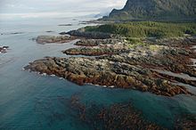
Inland Passage to Dicks Arm, view from Cape Spencer Light
|
|
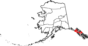
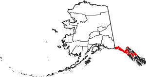
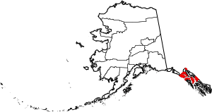
Location within the U.S. state of Alaska
|
|
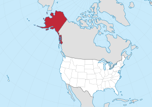 Alaska's location within the U.S. |
|
| Country | |
| State | |
| Established | 2007 |
| Named for | Hoonah and Angoon |
| Largest city | Hoonah |
| Area | |
| • Total | 10,914 sq mi (28,270 km2) |
| • Land | 7,525 sq mi (19,490 km2) |
| • Water | 3,389 sq mi (8,780 km2) 31.1%% |
| Population
(2020)
|
|
| • Total | 2,287 |
| • Density | 0.20955/sq mi (0.080907/km2) |
| Time zone | UTC−9 (Alaska) |
| • Summer (DST) | UTC−8 (ADT) |
| Congressional district | At-large |
The Hoonah–Angoon Census Area is a special region in Alaska, a state in the United States. It's called a "census area" because it helps the government count people.
In 2020, about 2,365 people lived here. This area is part of Alaska's "unorganized borough," which means it doesn't have a main government center like a county seat. The biggest town in this area is Hoonah.
Contents
History of the Hoonah-Angoon Census Area
The Hoonah–Angoon Census Area has changed its name and size over the years. In 1990, it was much larger and known as the Skagway–Yakutat–Angoon Census Area.
Later, some parts of this area became their own independent regions. For example, Yakutat became a separate city and borough in 1992. Then, Skagway also became its own borough in 2007. After these changes, the area became known by its current name: Hoonah–Angoon Census Area.
Geography of the Hoonah-Angoon Region
The Hoonah–Angoon Census Area covers a large space. It has a total area of about 10,914 square miles (28,267 square kilometers). A big part of this area is land, about 7,525 square miles (19,490 square kilometers). The rest, about 3,389 square miles (8,777 square kilometers), is water. This means about 31% of the area is covered by water.
Neighboring Areas and Borders
The Hoonah–Angoon Census Area shares its borders with several other regions. These include:
- Yakutat City and Borough, Alaska to the northwest.
- Haines Borough, Alaska to the northeast.
- Juneau City and Borough, Alaska to the northeast.
- Petersburg Borough, Alaska to the southeast.
- Sitka City and Borough, Alaska to the southwest.
- Parts of British Columbia in Canada, specifically the Stikine Region, British Columbia and Kitimat-Stikine Regional District, are to the east and southeast.
Protected Natural Areas
This region is home to parts of some very important natural areas. These places are protected to keep their natural beauty and wildlife safe. They include:
- Glacier Bay National Park (a part of it is in this area).
- Inside Glacier Bay, there's also a part of the Glacier Bay Wilderness.
- Tongass National Forest (a large part of this forest is here).
- Within the Tongass National Forest, there are several special wilderness areas:
- Admiralty Island National Monument (part of it).
- This monument includes a part of the Kootznoowoo Wilderness.
- Admiralty Island National Monument (part of it).
- Chuck River Wilderness
- Pleasant/Lemesurier/Inian Islands Wilderness
- Tracy Arm-Fords Terror Wilderness (part of it).
- West Chichagof-Yakobi Wilderness (part of it).
- Within the Tongass National Forest, there are several special wilderness areas:
Population and People in Hoonah-Angoon
| Historical population | |||
|---|---|---|---|
| Census | Pop. | %± | |
| 2010 | 2,150 | — | |
| 2020 | 2,365 | 10.0% | |
| 2023 (est.) | 2,262 | 5.2% | |
| U.S. Decennial Census 2010–2020 |
|||
The population of the Hoonah–Angoon Census Area has changed over time. In 2010, about 2,150 people lived here. By 2020, the population had grown to 2,365 people.
The area is not very crowded. In 2000, there were about 3,436 people living in the census area. The average number of people per square mile was very low.
Many different groups of people live here. A significant number of residents are Native American. Some people also speak the Tlingit language at home, which is a language of the local Indigenous people.
Communities in Hoonah-Angoon
The Hoonah–Angoon Census Area includes several towns and smaller communities.
Cities
Census-Designated Places
These are areas that are identified by the U.S. Census Bureau for statistical purposes.
Other Unincorporated Places
See also
 In Spanish: Área censal de Hoonah–Angoon para niños
 | Misty Copeland |
 | Raven Wilkinson |
 | Debra Austin |
 | Aesha Ash |


