Horfield facts for kids
Quick facts for kids Horfield |
|
|---|---|
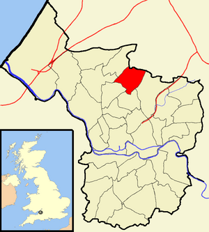
 Boundaries of the city council ward |
|
| Population | 12,826 (2011.Ward) |
| OS grid reference | ST597769 |
| Unitary authority | |
| Ceremonial county | |
| Region | |
| Country | England |
| Sovereign state | United Kingdom |
| Post town | BRISTOL |
| Postcode district | BS7 |
| Dialling code | 0117 |
| Police | Avon and Somerset |
| Fire | Avon |
| Ambulance | Great Western |
| EU Parliament | South West England |
| UK Parliament |
|
Horfield is a suburb in the city of Bristol, located in southwest England. It sits on Bristol's northern edge. Its border with Filton helps mark the line between Bristol and South Gloucestershire. Nearby areas include Bishopston to the south, Monks Park and Golden Hill to the west, and Lockleaze and Ashley Down to the east. The main road, Gloucester Road (A38), runs right through the middle of Horfield.
Horfield is also the name of an electoral ward for Bristol City Council. An electoral ward is like a local area that elects its own representatives. This ward includes Monks Park and Southmead Hospital. However, some parts of Horfield, like Horfield Common and Horfield Prison, are actually in the Bishopston ward.
Contents
Horfield's Past: A Look at History
What's in a Name? The Meaning of Horfield
The name Horfield comes from an old language called Anglo-Saxon. It means "filthy open land." This name tells us a bit about what the area might have looked like long ago.
Early Days and Development
Horfield was once a parish in Gloucestershire. A parish is a small local area, often with its own church. This parish included places like Bishopston and Lockleaze.
Historically, Horfield had a bit of a wild reputation. Horfield Wood was known as a place where thieves and wanderers would hide. The area stayed mostly rural, with lots of open land, until the early 1800s.
After some big events in Bristol in 1831, a new prison was built in Horfield. It was finished in 1847. Around the same time, Horfield Barracks was also completed in 1847. This brought a permanent military presence to the city.
Horfield really started to grow and develop from the mid-1800s onwards. In 1859, Bishopston became its own separate parish. Later, in 1894, Horfield became an Urban District, which is a type of local government area. But in 1904, it became part of Bristol city.
Fun Things to Do: Amenities in Horfield
Sports and Leisure
Horfield is home to the Memorial Stadium. This sports ground was built in 1921. It was made to remember the rugby union players from Bristol who died in World War I. Later, it was also dedicated to those who died in World War II.
For many years, the stadium was home to Bristol Rugby Club. In 1996, Bristol Rovers Football Club also started playing there. They now own the stadium. Bristol Rugby Club has since moved to a different stadium in the south of Bristol.
Horfield also has a modern Horfield Leisure Centre. It was updated in 2005 to include a 25-meter swimming pool. The centre has a gym, a main swimming pool, a learners' pool, and a sports hall. Outside, there's even a small skateboard park.
Green Spaces and Community Spots
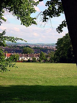
Horfield Common is the biggest green space in the area. It has tennis courts and a bowling club. Horfield Common is also one of the highest points in Bristol.
You can find a Library on Filton Avenue, which is a great place to borrow books. There's also Filton Avenue Primary School for younger students.
For health needs, Horfield has two GP Surgeries: Horfield Health Centre and Monks Park Surgery. The main hospital nearby is Southmead Hospital. It's a large public hospital that serves the area.
Getting Around: Transport in Horfield
Roads and Buses
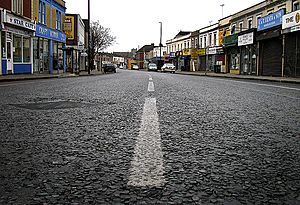
The main road running through Horfield is the Gloucester Road, which is part of the A38. This road is famous for having many independent shops.
Horfield is well-served by bus services. Many different routes run along Gloucester Road and Muller Road, connecting Horfield to other parts of Bristol and beyond.
Past Transport Methods
In the past, from the late 1800s to the early 1900s, Horfield had its own tram system. There was even a tram depot where trams were stored and maintained. Today, that site is a petrol station and a doctor's surgery. You can still see some of the old tram lines preserved in the car park!
There was also a train station called Horfield railway station. It served the northeast part of the district between 1927 and 1964.
Famous People from Horfield
Horfield has been home to some well-known individuals:
- Cary Grant (born 1904) was a famous actor. He was born at 15 Hughenden Road.
- Ray Steadman-Allen (born 1922) was a composer. He was born at 64 Muller Road.
- Annie Fish (born 1890) was a cartoonist. She was born on Brynland Avenue.
Places of Worship: Churches in Horfield
Horfield has several interesting churches, each with its own history and style.
Holy Trinity Church
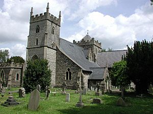
The Church of the Holy Trinity with St Edmund is the local parish church. It might have been founded as early as 603 AD! The oldest part still standing is an old pillar and the circular churchyard. The tower was built in the late 1400s or early 1500s. Other parts were added later, including the nave and aisles in 1847. This church is a Grade II* listed building, which means it's a very important historic building.
Other Churches
- Horfield Barracks Chapel was built in 1859. It's a beautiful chapel with a nice bellcote (a small open structure for bells). It stopped being used as a chapel in the 1920s and was later turned into offices. It is a Grade II listed building.
- Methodist Chapel was built in 1899. It shows a good example of late Victorian Arts and Crafts Gothic style, with a lovely wooden interior.
- Horfield Baptist Chapel has two towers and a special organ.
- The Roman Catholic Chapel of St Maximillian Kolbe is on Alfoxton Road.
- Quaker Meeting House was built in 1906 and is made of red brick.
- Whitefield Tabernacle on Muller Road has an 18th-century pulpit that was moved from another church when it was taken down. It also has a beautiful wooden organ case from 1815.


