Hubbell Butte facts for kids
Quick facts for kids Hubbell Butte |
|
|---|---|
 |
|
| Highest point | |
| Elevation | 6,740 ft (2,050 m) |
| Prominence | 280 ft (85 m) |
| Isolation | 0.84 mi (1.35 km) |
| Parent peak | Siegfried Pyre |
| Geography | |
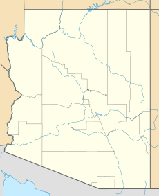
| Location | Grand Canyon National Park Coconino County, Arizona, US |
| Parent range | Kaibab Plateau (Walhalla Plateau) Colorado Plateau |
| Topo map | USGS Walhalla Plateau |
| Geology | |
| Age of rock | Permian down to Cambrian |
| Mountain type | sedimentary rock: sandstone, siltstone, mudstone, sandstone, shale |
| Type of rock | Supai Group, Redwall Limestone, Muav Limestone, Bright Angel Shale |
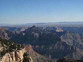
Hubbell Butte is a mountain peak in the eastern part of the Grand Canyon. It stands 6,740 feet (about 2,054 meters) tall. You can find it in Coconino County, in northern Arizona, United States.
This butte is located about 1.5 miles northeast of Cape Final, which is on the North Rim of the Grand Canyon. Hubbell Butte is also close to another peak called Siegfried Pyre, about 1.0 mile to its southeast. The butte is about 5.0 miles east of the Colorado River, which flows through Marble Canyon.
Hubbell Butte is made up of different layers of rock. These include the Supai Group units, which sit on top of Redwall Limestone cliffs. The western side of Hubbell Butte is near a part of Lava Creek. It's also next to the ridgeline of Siegfried Pyre.
History of Hubbell Butte
Hubbell Butte got its name from Don Lorenzo Hubbell. He was a very well-known trader. He worked with the Navajo people a long time ago. His trading post, the Lorenzo Hubbell Trading Post and Warehouse, is still famous today.
Nearby Grand Canyon Features
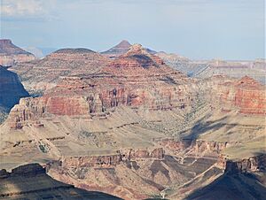
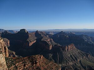
Hubbell Butte, along with its neighbors Poston Butte and Chiavria Point, are all part of the Upper Lava Creek area. This area collects water that flows into Lava Creek. The highest points of this area are formed by the Siegfried Pyre ridgeline. This ridgeline is made of a strong rock layer called the Esplanade Sandstone. This rock forms tall cliffs and flat areas.
There are other cool rock formations nearby. South of Hubbell Butte, you can find Juno Temple. Even taller and more famous is Jupiter Temple. Jupiter Temple is next to Venus and Apollo Temples. These temples are amazing rock structures in the Grand Canyon.
When you look north from certain spots, you can see many of these features. You might spot Point Final, Naji Point, Hubbell Butte, Jupiter Temple, and Venus Temple all at once!
