Iğdır facts for kids
Quick facts for kids
Iğdır
|
|
|---|---|
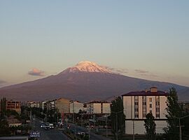
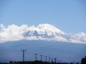
Mount Ararat from Iğdır
|
|
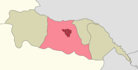
Location within Iğdır Province
|
|
| Country | Turkey |
| Province | Iğdır |
| District | Iğdır |
| Elevation | 850 m (2,790 ft) |
| Population
(2022)
|
101,700 |
| Time zone | TRT (UTC+3) |
| Postal code |
76000
|
| Area code | 0476 |
Iğdır (pronounced EE-dur) is a city in the Eastern Anatolia Region of Turkey. It is the main city of Iğdır Province and Iğdır District. In 2022, about 101,700 people lived there.
Contents
Exploring the History of Iğdır
Iğdır was once known by the Armenian name Tsolakert during the Middle Ages. A Spanish traveler named Ruy González de Clavijo visited this area in the early 1400s. He wrote about a castle called Egida near Mount Ararat.
This castle was built on a rock and was ruled by a woman. She was the widow of a bandit who had been captured by Timur. Today's Iğdır is not on a rock and is far from Mount Ararat. This suggests that the old medieval Iğdır was in a different spot.
Ancient Discoveries and Changes
People believe the old city was at a place now called Taşburun. In the late 1800s, Russian explorers found old house ruins and what looked like a church there. They also found traces of old walls. The settlement might have been left empty after a big earthquake in 1664.
In 1555, Iğdır became part of the Safavid Empire. It stayed under Persian rule for a long time. However, the Ottoman Empire sometimes took control for short periods. This happened in 1514, then again between 1534–35, 1548–49, 1554–55, 1578–1605, 1635–36, and 1722–46.
Iğdır Joins the Russian Empire
Iğdır finally came under the control of the Russian Empire. This happened after the Russo-Persian War of 1826-1828.
Modern History: A Changing City
After the war of 1826-1828, the Russian Empire took Iğdır from Persia. In 1828, it became part of the Armenian Oblast. Later, in 1840, it joined the Georgia-Imeretia Governorate.
By 1850, Iğdır was part of the Surmalu Uyezd (a type of district) in the Erivan Governorate. In 1886, records showed that out of 30,647 people in the district, about 38.7% were Tatars (now called Azerbaijanis). About 49.6% were Armenians, and 11.7% were Kurds.
Life Under Russian Rule
By 1894, about 2,912 Armenians lived in the town itself. Under Russian rule, Iğdır saw some improvements. Two primary schools were opened, one for boys and one for girls. Three churches were also built.
About 100 Armenian families were allowed to move to Iğdır. By 1914, the town's population grew to 10,000 people. Most people worked in farming and trade.
World War I and New Republics
After the Russian Revolution in 1917, a temporary committee took control of the area. This committee was made up of the three main ethnic groups in the Caucasus. They tried to make peace with the Ottoman Empire.
However, Ottoman forces attacked and took Iğdır on May 20, 1918. They stayed until November 1918, when the Armistice of Mudros was signed. Then, the Republic of Armenia took control of Iğdır.
Challenges and Conflicts
The winter of 1918–19 was very hard for the Armenian people. Many died from hunger, sickness, and cold. In May 1919, Iğdır officially became a city.
In November 1920, the U.S. State Department planned for Iğdır to be part of the Republic of Armenia. But in September 1920, the government of the Grand National Assembly of Turkey started a war. They wanted to take control of the region.
Iğdır Becomes Part of Turkey
Turkish General Kâzım Karabekir led the armies. At first, they found it hard to take Iğdır because of strong Armenian resistance. But by October 20, 1920, the Turkish Army drove the Armenian forces out of the city. They then captured Gyumri.
Official Turkish documents say that Armenian forces left Iğdır after a defeat in the Shahtahti area. They burned the Markara Bridge over the Aras river and moved to the northern bank on November 13, 1920. Turkey officially gained the Iğdır region after several peace treaties. The 1921 Treaty of Kars confirmed these new borders.
In the early years of the Republic of Turkey, Iğdır was a district of the Bayazıt province. In 1934, it became part of the Kars Province. Finally, on May 27, 1992, Iğdır became the main city of the new Iğdır Province.
Geography and Climate of Iğdır
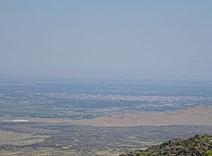
The city of Iğdır is located on a flat plain. This plain is at a lower height than most other eastern provinces in Turkey. This low altitude is great for farming.
Farming in Iğdır
Farmers in Iğdır grow many crops. These include apples, tomatoes, cucumbers, peaches, pears, sugar beet, watermelons, and melons. But the most famous crops from Iğdır are cotton and delicious apricots.
Iğdır's Climate: Hot Summers, Cold Winters
Iğdır has a continental semi-arid climate. This means it has hot, dry summers and cold, snowy winters. Iğdır is actually the driest city in Turkey. It gets about 261 millimeters (10.3 inches) of rain each year.
| Climate data for Iğdır (1991–2020, extremes 1941–2020) | |||||||||||||
|---|---|---|---|---|---|---|---|---|---|---|---|---|---|
| Month | Jan | Feb | Mar | Apr | May | Jun | Jul | Aug | Sep | Oct | Nov | Dec | Year |
| Record high °C (°F) | 18.3 (64.9) |
22.2 (72.0) |
29.5 (85.1) |
33.4 (92.1) |
35.0 (95.0) |
39.2 (102.6) |
41.5 (106.7) |
42.0 (107.6) |
38.4 (101.1) |
33.0 (91.4) |
26.2 (79.2) |
22.2 (72.0) |
42.0 (107.6) |
| Mean daily maximum °C (°F) | 2.4 (36.3) |
6.5 (43.7) |
14.0 (57.2) |
20.0 (68.0) |
24.7 (76.5) |
30.2 (86.4) |
33.8 (92.8) |
33.7 (92.7) |
29.1 (84.4) |
21.8 (71.2) |
12.9 (55.2) |
4.6 (40.3) |
19.5 (67.1) |
| Daily mean °C (°F) | −2.7 (27.1) |
0.7 (33.3) |
7.6 (45.7) |
13.4 (56.1) |
17.9 (64.2) |
22.9 (73.2) |
26.5 (79.7) |
26.2 (79.2) |
21.1 (70.0) |
14.0 (57.2) |
6.0 (42.8) |
−0.3 (31.5) |
12.8 (55.0) |
| Mean daily minimum °C (°F) | −6.7 (19.9) |
−4.1 (24.6) |
1.8 (35.2) |
7.2 (45.0) |
11.6 (52.9) |
15.9 (60.6) |
19.5 (67.1) |
19.0 (66.2) |
13.9 (57.0) |
7.7 (45.9) |
0.7 (33.3) |
−4.1 (24.6) |
6.9 (44.4) |
| Record low °C (°F) | −28.4 (−19.1) |
−28.0 (−18.4) |
−22.2 (−8.0) |
−7.6 (18.3) |
0.1 (32.2) |
2.4 (36.3) |
8.0 (46.4) |
7.2 (45.0) |
1.6 (34.9) |
−7.0 (19.4) |
−15.6 (3.9) |
−30.3 (−22.5) |
−30.3 (−22.5) |
| Average precipitation mm (inches) | 13.3 (0.52) |
14.7 (0.58) |
21.4 (0.84) |
42.0 (1.65) |
50.1 (1.97) |
30.0 (1.18) |
14.9 (0.59) |
9.4 (0.37) |
12.1 (0.48) |
24.1 (0.95) |
19.5 (0.77) |
14.3 (0.56) |
265.8 (10.46) |
| Average precipitation days | 4.73 | 5.77 | 7.97 | 13.40 | 17.10 | 11.53 | 6.73 | 5.27 | 5.30 | 8.57 | 6.37 | 6.77 | 99.5 |
| Average relative humidity (%) | 75 | 71 | 54 | 52 | 59 | 52 | 48 | 48 | 55 | 61 | 68 | 74 | 60 |
| Mean monthly sunshine hours | 83.7 | 124.3 | 170.5 | 180.0 | 229.4 | 282.0 | 306.9 | 291.4 | 252.0 | 180.0 | 136.4 | 77.5 | 2,314.1 |
| Mean daily sunshine hours | 2.7 | 4.4 | 5.5 | 6.0 | 7.4 | 9.4 | 9.9 | 9.4 | 8.4 | 6.0 | 4.4 | 2.5 | 6.3 |
| Source 1: Turkish State Meteorological Service | |||||||||||||
| Source 2: Weatherbase | |||||||||||||
Architecture and Culture in Iğdır
Near the village of Sürmeli, you can find the ruins of the medieval city of Surmari. This area is close to the closed border with Armenia and is currently a military zone. The surviving walls of its citadel (fortress) date back to 1224.
Another old building near Iğdır is the Caravanserai of Zor. A caravanserai was like an inn for travelers and traders in the past. This one was built in the 13th century and has been restored.
Iğdır's Lively Culture
Iğdır's culture is part of the wider culture of Turkey. The city has become more lively and wealthy over the years. This is thanks to more farming and the opening of a border gate with Nakhchivan in 1992.
You can find many cafes and restaurants in Iğdır. A well-known local dish is a meat stew called bozbaş.
Economy: How Iğdır Makes a Living
The main ways people make money in Iğdır are through farming and selling animal products.
Iğdır is located between Kars and Ağrı. Even though it has three important neighbors, the border to Armenia is closed. Also, there is no direct way to reach Iran from Iğdır. This situation makes it harder for the city to grow its economy.
About 70% of Mount Ararat is within Iğdır's borders. However, money for developing tourism on Mount Ararat often goes to the Ağrı Municipality.
Population and People of Iğdır
In 1886, records showed that out of 71,066 people in the districts, about 48.3% were Azerbaijanis. About 31.1% were Armenians, and 20.6% were Kurds.
In 1897, a Russian census found that Iğdır city had 4,680 people. Of these, 84% were Armenians and 12% were Russians. Today, the province is mainly home to Azerbaijanis and Kurds.
| Historical population | |||||||||||||||||||||||||||||||||||||
|---|---|---|---|---|---|---|---|---|---|---|---|---|---|---|---|---|---|---|---|---|---|---|---|---|---|---|---|---|---|---|---|---|---|---|---|---|---|
|
|
||||||||||||||||||||||||||||||||||||
| Source: Population censuses (1970-1997) and TÜIK (2007-2022) | |||||||||||||||||||||||||||||||||||||
Transportation in Iğdır
You can travel to Iğdır by road or by air. Turkish state route D.080 and European route E99 both pass through Iğdır.
Iğdır Airport opened in 2012. It has flights to cities like Istanbul and Ankara within Turkey. Regular bus services connect Iğdır to other big cities and regional centers.
As of 2016, there is no train service to Iğdır. However, the city will be a stop on the Nakhchivan-Kars railway when it is finished.
Famous People from Iğdır
- Avetis Aharonian, an Armenian politician
- Servet Çetin, a Turkish national football team player of Azerbaijani background
- Eduard Isabekyan, an Armenian painter
- Drastamat Kanayan, an Armenian military leader
- Sinan Oğan, a Turkish politician who won a seat in the Turkish parliament in 2011
- Şahin Yakut, a Turkish kickboxer and MMA fighter
International Connections and Sister Cities
Diplomatic Missions
![]() Azerbaijan has a special office called a consular mission in Iğdır. This office helps citizens of Azerbaijan and promotes good relations.
Azerbaijan has a special office called a consular mission in Iğdır. This office helps citizens of Azerbaijan and promotes good relations.
Twin Towns — Sister Cities
Iğdır is twinned with these cities:
 Sharur, Nakhchivan Autonomous Republic, Azerbaijan
 Shamakhi, Azerbaijan
Sports in Iğdır
- Iğdırspor (a football club)
- Iğdır FK (another football club)
|
See also
 In Spanish: Iğdır para niños
 | Jackie Robinson |
 | Jack Johnson |
 | Althea Gibson |
 | Arthur Ashe |
 | Muhammad Ali |


