
Image: Highland UK location map

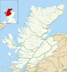
Description: Blank map of Highland, UK with the following information shown: Administrative borders Coastline, lakes and rivers Roads and railways Urban areas Equirectangular map projection on WGS 84 datum, with N/S stretched 180% Geographic limits: West: 6.9W East: 2.9W North: 58.8N South: 56.4N
Title: Highland UK location map
Credit: Ordnance Survey OpenData. Administrative borders and coastline data from Boundary-Line product. All other geographic data from Meridian 2 product. Inset derived from Inset derived from File:Scotland location map.svg by NordNordWest.
Author: Nilfanion, created using Ordnance Survey data
Permission: This file is licensed under the Creative Commons Attribution-Share Alike 3.0 Unported license. Attribution: Contains Ordnance Survey data © Crown copyright and database right You are free: to share – to copy, distribute and transmit the work to remix – to adapt the work Under the following conditions: attribution – You must attribute the work in the manner specified by the author or licensor (but not in any way that suggests that they endorse you or your use of the work). share alike – If you alter, transform, or build upon this work, you may distribute the resulting work only under the same or similar license to this one. http://creativecommons.org/licenses/by-sa/3.0 CC BY-SA 3.0 Creative Commons Attribution-Share Alike 3.0 truetrue
Usage Terms: Creative Commons Attribution-Share Alike 3.0
License: CC BY-SA 3.0
License Link: http://creativecommons.org/licenses/by-sa/3.0
Attribution Required?: Yes
Image usage
The following 57 pages link to this image:
- Abernethy Forest
- An Dun
- Ardersier
- Ardvreck Castle
- Baile Mhargaite (Sandy Dun)
- Beauly
- Caisteal Grugaig
- Caithness and Sutherland Peatlands
- Carn Liath (broch)
- Castle Stuart
- Creag Meagaidh
- Cuillin
- Dornoch Firth
- Dun Cruinn
- Dun Dornaigil
- Dun Grugaig
- Dun Skudiburgh
- Dun Telve
- Dun Troddan
- Erchless Castle
- Forsinard Flows National Nature Reserve
- Fort William, Highlands
- Glen Affric
- Glen Shiel
- Glen Strathfarrar
- Glenmore Forest Park
- Grantown-on-Spey
- Insh Marshes
- Inshlampie Broch
- Invereshie and Inshriach National Nature Reserve
- Inverness Airport
- Inverness Cathedral
- Kintail
- Knockan Crag
- Knoydart
- Langdale Broch
- Murlagan
- Nairn
- Ousdale Broch
- Petty Castle
- RAF Dounreay
- Rait Castle
- Redpoint
- Rhue, Scotland
- Rockfield, Highland
- Rubha an Dùnain
- Skelbo Castle
- Skitten Broch
- St Michael & All Angels, Inverness
- Strathrusdale
- Strathy, Ardross
- Summer Isles
- Tain
- Tore, Scotland
- Torridon Hills
- Trotternish
- Template:Location map Scotland Highland
