Fort William, Highlands facts for kids
Quick facts for kids Fort William
|
|
|---|---|
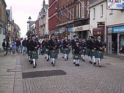
 Fort William High Street |
|
| Population | 10,459 |
| OS grid reference | NN 10584 74114 |
| • Edinburgh | 134 mi (216 km) |
| • London | 512 mi (824 km) |
| Council area | |
| Lieutenancy area | |
| Country | Scotland |
| Sovereign state | United Kingdom |
| Post town | FORT WILLIAM |
| Postcode district | PH33 |
| Dialling code | 01397 |
| EU Parliament | Scotland |
| UK Parliament |
|
| Scottish Parliament | |
Fort William is a lively town in the amazing Scottish Highlands. Its name in Gaelic is An Gearasdan, which means "The Garrison." This town sits on the eastern shore of Loch Linnhe, a beautiful sea loch.
Fort William is a very important place for visitors. It is surrounded by stunning natural beauty. You can find Glen Coe to the south and the famous Ben Nevis to the east. Ben Nevis is the tallest mountain in the United Kingdom!
Discovering Fort William: Scotland's Outdoor Capital
Fort William is often called the "Outdoor Capital of the UK." This is because it is a fantastic place for adventures. Many people come here to enjoy nature and exciting activities.
What Makes Fort William Special?
Fort William is a hub for outdoor fun. It is perfect for anyone who loves exploring. The town is a great starting point for many adventures.
Where is Fort William Located?
Fort William is in the Lochaber area of Scotland. It is on the eastern side of Loch Linnhe. This location makes it easy to reach many famous places. The town is also near the Road to the Isles, which leads to Glenfinnan.
How Many People Live in Fort William?
In 2011, about 10,500 people lived in Fort William. This makes it the second-largest town in the Highland region. Only the city of Inverness has more people.
What Languages Are Spoken in Fort William?
Most people in Fort William speak English. However, about 700 people also speak Gaelic. This is about 7% of the town's population. Gaelic is an ancient language of Scotland.
Exploring Fort William's Natural Wonders
The area around Fort William is full of incredible landscapes. These natural features make it a popular spot for tourists.
Why is Fort William Great for Hillwalking and Climbing?
Fort William is a top spot for hillwalking and climbing. It is very close to Ben Nevis. Many other tall mountains, called Munros, are also nearby. These mountains offer amazing challenges for hikers.
What is the Great Glen Fault?
Fort William sits on a very important geological feature. This is called the Great Glen Fault. It is a huge crack in the Earth's crust. This fault line runs all the way across Scotland. It goes from the southwest to the northeast. It is one of the most noticeable features on a map of Scotland.
 | Roy Wilkins |
 | John Lewis |
 | Linda Carol Brown |


