
Ingalls Peak facts for kids
Quick facts for kids Ingalls Peak |
|
|---|---|

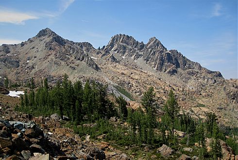
Ingalls Peak, east aspect
|
|
| Highest point | |
| Elevation | 7,662 ft (2,335 m) |
| Prominence | 1,222 ft (372 m) |
| Isolation | 2.07 mi (3.33 km) |
| Parent peak | Mount Stuart (9,415 ft) |
| Geography | |

Ingalls Peak
Location in Washington (state)

Ingalls Peak
Location in the United States
|
|
| Location | Chelan County/Kittitas County Washington, U.S. |
| Parent range | Wenatchee Mountains Cascade Range |
| Topo map | USGS Mount Stuart |
| Type of rock | Peridotite |
| Climbing | |
| First ascent | 1925 |
| Easiest route | class 4 scrambling |
Ingalls Peak is a tall mountain in Washington state. It stands about 7,662 feet (2,335 meters) high. This mountain has three main tops, or "summits." It is located in a wild area called the Alpine Lakes Wilderness. The peak sits right on the border between Kittitas County and Chelan County.
Ingalls Peak is the highest point in the Teanaway area of the Wenatchee Mountains. It is about 2 miles (3.2 km) west of Mount Stuart. It is also just west of Lake Ingalls. The land around the peak is part of the Wenatchee National Forest. The three main tops of Ingalls Peak are the North Peak (the highest), the South Peak (7,640 feet or 2,329 meters), and the East Peak (7,480 feet or 2,280 meters).
Water from the mountain flows into different creeks. Some water goes north into Jack Creek, which joins Icicle Creek. Other water flows west into Fortune Creek or east into Ingalls Creek. Ingalls Creek then flows into the Wenatchee River. The mountain, lake, creek, and a nearby pass are all named after Captain Benjamin Ingalls. He was a soldier who explored this area in 1855. He is also known for finding gold in the region.
Contents
Climbing Ingalls Peak
Ingalls Peak is a popular place for climbing. This is because its rock, called peridotite, is usually strong and good for climbing. It is also fairly easy to get to.
North Peak Challenges
The North Peak is the highest of the three summits. The easiest ways to climb it are from the Southwest Face or the East Ridge. These routes are rated as class 4 in difficulty. The very first people to climb the North Peak did so in 1925. They were a group from The Mountaineers club. The South Ridge is another popular climbing route. It is rated as class 5.4, which is harder. Keith Lankin and Ken Solberg first climbed this route on May 30, 1941. The Southeast Face was first climbed in June 1956 by Lex Maxwell and Bob McCall.
South Peak: Easiest to Reach
The South Peak is the easiest of the three summits to climb. It only involves "class 3 scrambling." This means you might need to use your hands for balance, but it's not full rock climbing.
East Peak: A Tough Climb
The East Peak looks like a classic horn shape. It is the hardest summit to reach. You need to do at least class 5 climbing to get to the top. Gene Prater, Bill Prater, and Stan Butcharc were the first to climb this summit in November 1952. There are several known climbing paths on the East Peak, including routes on the South Face, Southwest Face, and Dike Chimney - East Ridge.
Weather Around Ingalls Peak
Ingalls Peak is located east of the Cascade Mountains. This means the area is a bit drier than places to the west. In summer, it can get warm, and sometimes there are thunderstorms.
Most weather systems come from the Pacific Ocean. They travel east towards the Cascade Mountains. When these weather systems reach the tall peaks of the Cascades, they are forced to rise. This causes them to drop their moisture as rain or snow onto the mountains. So, the western side of the Cascades gets a lot of rain and snow, especially in winter. During winter, it's often cloudy. But in summer, high-pressure systems over the Pacific Ocean usually bring clear skies with little or no clouds.
How Ingalls Peak Formed
The Alpine Lakes Wilderness has some very rugged land. You can see jagged peaks, sharp ridges, deep valleys carved by glaciers, and tall granite walls. There are also more than 700 mountain lakes. Huge geological events that happened millions of years ago created this varied landscape. These events also caused the big changes in height across the Cascade Range, which led to different climates.
The Cascade Mountains started forming millions of years ago, during the late Eocene Epoch. At that time, the North American Plate was slowly moving over the Pacific Plate. This movement caused many volcanic eruptions and igneous activity. Also, small pieces of the Earth's crust, called terranes, helped create the North Cascades about 50 million years ago.
During the Pleistocene period, which was over two million years ago, glaciers moved across the land many times. As they moved, they scraped and shaped the landscape, leaving behind piles of rock. The last time glaciers melted away from the Alpine Lakes area was about 14,000 years ago. They had moved north of the Canada–US border by 10,000 years ago. The "U"-shaped valleys you see today were formed by these glaciers. The rising of the land (called uplift) and faulting, along with the glaciers, have been the main forces that created the tall peaks and deep valleys of the Alpine Lakes Wilderness.
Images for kids
-
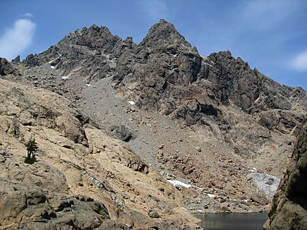
East Peak centered (North Peak left)
-
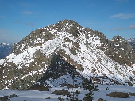
South Peak from SSW on Fortune Peak
-
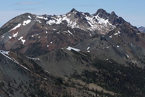
From the southeast
-
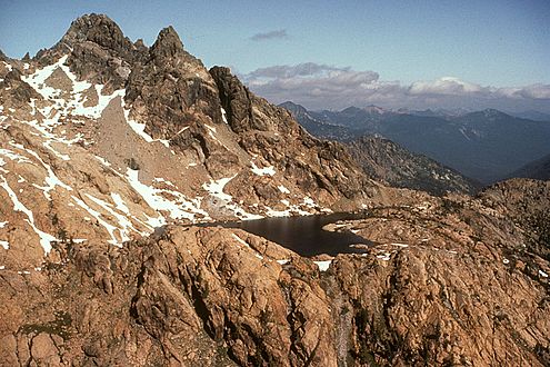
Ingalls Peak and Lake Ingalls
-
Ingalls Peak
-
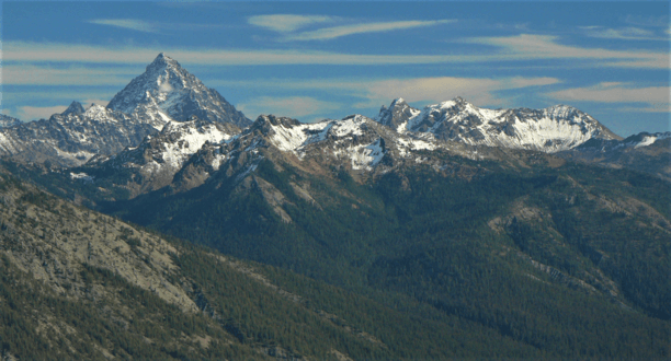
Mt. Stuart, Scatter Peak, Ingalls Peak (right of center) from northwest


.jpg)


