Innisplain, Queensland facts for kids
Quick facts for kids InnisplainQueensland |
|||||||||||||||
|---|---|---|---|---|---|---|---|---|---|---|---|---|---|---|---|

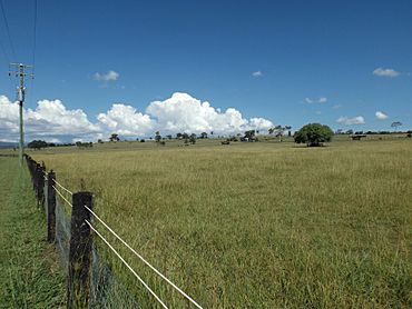
Paddocks along Oaky Scrub Road, 2016
|
|||||||||||||||
| Population | 79 (2021 census) | ||||||||||||||
| • Density | 3.450/km2 (8.94/sq mi) | ||||||||||||||
| Postcode(s) | 4285 | ||||||||||||||
| Area | 22.9 km2 (8.8 sq mi) | ||||||||||||||
| Time zone | AEST (UTC+10:00) | ||||||||||||||
| Location |
|
||||||||||||||
| LGA(s) | Scenic Rim Region | ||||||||||||||
| State electorate(s) | Scenic Rim | ||||||||||||||
| Federal Division(s) | Wright | ||||||||||||||
|
|||||||||||||||
Innisplain is a small rural area in Queensland, Australia. It is part of the Scenic Rim Region. In 2021, about 79 people lived there.
Contents
Exploring Innisplain's Landscape
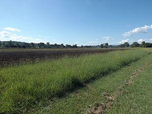
Innisplain is a hilly area. Some of the land is used for farming. The Logan River and the Mount Lindesay Highway form the western edge of the area.
The main railway line between Sydney and Brisbane also goes through Innisplain. The Mount Lindesay Highway crosses over this railway line in the area.
A Look Back at Innisplain's History
Innisplain once had its own railway station. This station was part of the Beaudesert Shire Tramway and opened in 1903.
There was also a state school in Innisplain. It opened in 1921 and taught students until it closed in 1962. The old school was located on Innisplain Road.
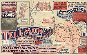
In 1877, a large area of land, about 15,400 acres, was made available for people to settle and farm. This land came from a big farming property called Telemon.
Who Lives in Innisplain?
In 2016, there were 85 people living in Innisplain. There were 40 households in the area. More males lived there (64.3%) than females (35.7%). The average age of people in Innisplain was 37 years old.
By 2021, the population of Innisplain had changed slightly, with 79 people living there.
Farming and Homesteads
Innisplain is a rural area, and there are several large farming properties, known as homesteads, located here:
- Innisplain
- Telemon
- Yaralla
Getting an Education
There are no schools directly in Innisplain today. Students usually travel to nearby towns for their education.
For primary school, the closest government schools are Tamrookum State School, which is to the north, and Rathdowney State School, to the south-west.
For high school, the nearest government secondary school is Beaudesert State High School, located in Beaudesert.
 | Isaac Myers |
 | D. Hamilton Jackson |
 | A. Philip Randolph |


