Rathdowney, Queensland facts for kids
Quick facts for kids RathdowneyQueensland |
|||||||||||||||
|---|---|---|---|---|---|---|---|---|---|---|---|---|---|---|---|
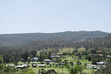
Rathdowney seen from the town's scenic lookout
|
|||||||||||||||
| Population | 320 (2021 census) | ||||||||||||||
| • Density | 4.43/km2 (11.5/sq mi) | ||||||||||||||
| Postcode(s) | 4287 | ||||||||||||||
| Area | 72.2 km2 (27.9 sq mi) | ||||||||||||||
| Time zone | AEST (UTC+10:00) | ||||||||||||||
| LGA(s) | Scenic Rim Region | ||||||||||||||
| State electorate(s) | Scenic Rim | ||||||||||||||
| Federal Division(s) | Wright | ||||||||||||||
|
|||||||||||||||
Rathdowney is a small country town in the Scenic Rim Region of Queensland, Australia. It was also known as Rathdownie in the past. In 2021, about 320 people lived in Rathdowney.
Contents
Exploring Rathdowney's Location
Rathdowney is located on the Mount Lindesay Highway. It is about 32 kilometers (20 miles) south of Beaudesert. The town sits at the bottom of the McPherson Range.
The Logan River forms the eastern edge of the area. Rathdowney is also close to amazing natural places. These include National Parks like Border Ranges National Park and Mount Barney National Park. Here you can find lush rainforests, eucalyptus forests, and mountain heath.
Discovering Bigriggan
The area of Bigriggan is part of Rathdowney. It is about 8 kilometers (5 miles) west of the town. You can reach it by Bigriggan Road. This road leads to the Bigriggan Reserve Park. The park is near where Burnett Creek meets the Logan River. It's a great spot for camping, with a kiosk and river access. Caravans, motorhomes, and buses can easily get there.
A Look Back at Rathdowney's History
The land around Rathdowney has a rich history. The Mununjali people are the traditional owners. They speak a dialect of the Yugambeh language.
Early European Settlement
The first European to explore this area was Patrick Logan in 1828. He was in charge of the Moreton Bay penal colony. In 1842, the land became open for settlement. Thomas Lodge Murray-Prior bought a large estate here in 1876. He named it Rathdowney Station. This name came from his family's estates in Rathdowney, Ireland. The town itself was later named after this station.
Industries and Growth
The first big industry in Rathdowney was clearing timber. Today, the main jobs are cattle grazing and dairy farming.
Several schools opened and closed in the early days. Bigriggan Provisional School opened in 1892. It closed and reopened a few times before closing for good in 1912. Rathdownie Provisional School opened in 1908. It became Rathdownie State School in 1909. In 1914, its name changed to Cashell's Hill State School. It closed in 1924.
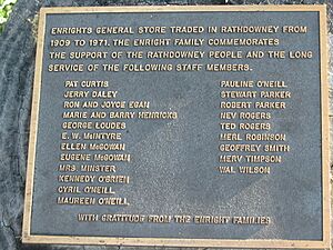
Enright's General Store opened in 1909. It served the community until 1971. A special plaque remembers this important store.
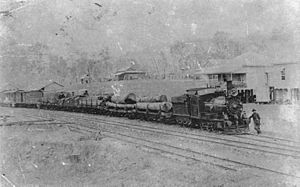
The Beaudesert Shire Tramway reached Rathdowney in 1911. This tramway helped transport goods and people. However, it closed down in 1944.
Rathdowney Terminus State School opened in 1912. Its name likely came from the tramway's end point. In 1915, it was renamed Rathdowney State School.
Churches in Rathdowney
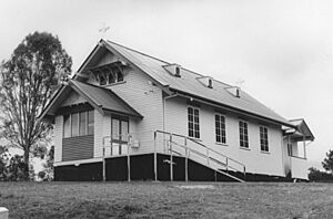
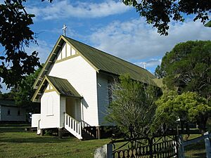
The foundations for St David's Anglican Church were laid in March 1929. The church officially opened in July 1929.
St Joseph's Catholic Church opened in September 1929. Before this, Catholic services were held in the Rathdowney Memorial Hall.
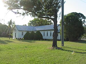
In 1957, the Palen Creek Methodist Church moved to Rathdowney. Later, parts of other halls and churches were added to it. When the Methodist Church joined the Uniting Church in Australia in 1977, it became the Palen Creek Uniting Church. It held its last service in 2014 and is now privately owned.
Population of Rathdowney
In 2011, Rathdowney had 434 people. By 2016, the population was 308. In the most recent count in 2021, 320 people lived in Rathdowney.
Important Heritage Sites
Rathdowney has some buildings listed for their historical importance:
- St David's Anglican Church, at 8-12 Hardgrave Street and 14-18 Prior Street.
- St Joseph's Catholic Church, at 157-159 Mount Lindesay Highway.
Learning in Rathdowney
Rathdowney State School is a government primary school. It teaches students from Prep to Year 6. It is located at 143-155 Mount Lindesay Highway. In 2017, the school had 39 students.
There are no high schools in Rathdowney. Students usually go to Boonah State High School in Boonah or Beaudesert State High School in Beaudesert.
What's in Rathdowney Today?
Rathdowney is a small town with useful services. It has a police station, a small shop, a pub, and a service station. You can also find a post office, memorial grounds, and an information center. There is also a bowls club for fun.
The Scenic Rim Regional Council offers a mobile library service. It visits Collins Street, bringing books to the community.
St David's Anglican Church is located at 8-12 Hardgrave Street. St Joseph's Catholic Church is at 157-159 Mount Lindesay Highway.
Fun Things to Do in Rathdowney
Rathdowney is a great place for visitors. You can find tours, farm stays, and guest houses. It's about a 90-minute drive from Brisbane or the Gold Coast.
Every autumn, thousands of people visit for the Rathdowney Heritage Festival. This event is organized by the Rathdowney and District Historical Association (RADHA).
The RADHA also runs the Rathdowney Information Centre and Historical Museum. It is located at 82 Mount Lindesay Highway. The center shares information about the area's nature, Indigenous history, and European settlement. You can even see the old Glenapp railway siding there.
 | Jewel Prestage |
 | Ella Baker |
 | Fannie Lou Hamer |


