Tamrookum, Queensland facts for kids
Quick facts for kids TamrookumQueensland |
|||||||||||||||
|---|---|---|---|---|---|---|---|---|---|---|---|---|---|---|---|

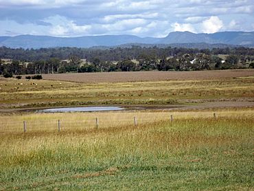
Fields, 2016
|
|||||||||||||||
| Population | 94 (2021 census) | ||||||||||||||
| • Density | 4.92/km2 (12.7/sq mi) | ||||||||||||||
| Postcode(s) | 4285 | ||||||||||||||
| Area | 19.1 km2 (7.4 sq mi) | ||||||||||||||
| Time zone | AEST (UTC+10:00) | ||||||||||||||
| Location |
|
||||||||||||||
| LGA(s) | Scenic Rim Region | ||||||||||||||
| State electorate(s) | Scenic Rim | ||||||||||||||
| Federal Division(s) | Wright | ||||||||||||||
|
|||||||||||||||
Tamrookum is a small, quiet area in the countryside of Queensland, Australia. It's part of the Scenic Rim Region. In 2021, only 94 people lived here, making it a very small community.
Contents
Exploring Tamrookum's Location
Tamrookum is a rural area with beautiful natural features. The Mount Lindesay Highway runs right through it, from north to south. This highway also forms part of the area's north-west border.
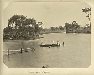
The Logan River flows along Tamrookum's eastern edge. A railway line, called the Sydney–Brisbane rail corridor, also crosses the area. It runs from north to south, west of the highway. You can find Tamrookum railway station there.
In the western part of Tamrookum, there are hills covered in trees. These hills can reach up to 150 meters high. Near the river in the east, farmers grow crops and raise animals on irrigated land. In the west, the land is mostly used for grazing animals on natural plants.
Tamrookum's Past
The name Tamrookum comes from Aboriginal words. People believe it's from the Yugumbir language and means place of boomerangs.
The first person to settle on the land in Tamrookum was John Campbell. Later, in 1848, William Barker rented the land. In 1872, he bought 1,000 acres, which included the main house and the church area.
In 1878, a farmer named John Collins bought the land. His oldest son, Robert Martin Collins, moved there in 1879 after he got married. RM Collins became the official owner in 1886.
RM Collins and his brothers owned many large farms across Queensland and the Northern Territory. He helped start a big farming company and was a leader in the frozen meat industry. He was also a politician from 1896 to 1913. He helped create Lamington National Park, which became a park in 1915 after he passed away.
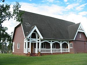
After RM Collins died in 1913, his family built an Anglican church to remember him. He had chosen the spot for it before he died. All Saints' Memorial Church opened on August 31, 1915.
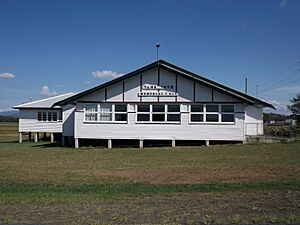
Tamrookum State School opened its doors on January 31, 1939. In 1944, local people decided to build a hall to remember those who served in wars. The Tamrookum Memorial Hall finally opened on April 5, 1952.
People Living in Tamrookum
The number of people living in Tamrookum has changed over the years.
- In 2011, Tamrookum and nearby areas had 266 residents.
- By 2016, Tamrookum itself had a population of 91 people.
- In 2021, the population slightly increased to 94 people.
Special Places in Tamrookum
Tamrookum has some places that are important for their history. These are called heritage-listed sites.
- One of these is the All Saints Memorial Church, located on Tamrookum Church Road.
Education in Tamrookum
Tamrookum State School is a primary school for kids from Prep to Year 6. It's a government school for both boys and girls. You can find it at 9019 Mount Lindesay Highway. In 2017, the school had 141 students.
There isn't a high school in Tamrookum. The closest secondary school is Beaudesert State High School in Beaudesert.
What Tamrookum Offers
Tamrookum has a few useful places for its residents and visitors.
- You can find a roadhouse and a general store on the eastern side of the Mount Lindesay Highway.
- Anglican church services are held once a month at All Saints' Memorial Church on Tamrookum Church Road.
- The Tamrookum Memorial Hall is at the corner of the Mount Lindesay Highway and Tamrookum Church Road.
 | DeHart Hubbard |
 | Wilma Rudolph |
 | Jesse Owens |
 | Jackie Joyner-Kersee |
 | Major Taylor |


