Laravale, Queensland facts for kids
Quick facts for kids LaravaleQueensland |
|||||||||||||||
|---|---|---|---|---|---|---|---|---|---|---|---|---|---|---|---|

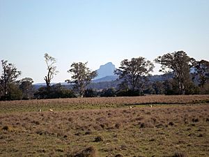
Round Mountain, 2016
|
|||||||||||||||
| Population | 185 (2021 census) | ||||||||||||||
| • Density | 3.240/km2 (8.39/sq mi) | ||||||||||||||
| Postcode(s) | 4285 | ||||||||||||||
| Area | 57.1 km2 (22.0 sq mi) | ||||||||||||||
| Time zone | AEST (UTC+10:00) | ||||||||||||||
| Location |
|
||||||||||||||
| LGA(s) | Scenic Rim Region | ||||||||||||||
| State electorate(s) | Scenic Rim | ||||||||||||||
| Federal Division(s) | Wright | ||||||||||||||
|
|||||||||||||||
Laravale is a small rural area located in the Scenic Rim Region of Queensland, Australia. It's a quiet place where people live in the countryside. In 2021, about 185 people called Laravale home.
Contents
Exploring Laravale's Geography

Laravale is bordered by some natural features. Christmas Creek and the Logan River form part of its southern edge. The Mount Lindesay Highway also runs along this border.
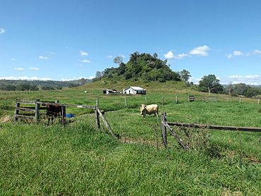
In the northern part of Laravale, you'll find Round Mountain. This mountain rises to about 109 meters (358 feet) high.
The eastern side of Laravale has higher land, reaching over 350 meters (1,148 feet) above sea level. Near the Logan River, the land is very fertile. This has allowed farming, especially dairy farming, to grow in the area.
The main railway line that connects Sydney and Brisbane also passes through Laravale.
A Look Back at Laravale's History
Laravale has a history that includes schools and churches. A school first opened here in 1900, called Errisvale Provisional School. It was later renamed Laravale Provisional School in 1907 and then Laravale State School in 1909. However, the school closed its doors in 2010.
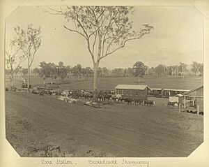
There was also a stop for the Beaudesert Shire Tramway in Laravale. This tramway helped people travel around the area.
A Catholic church, St Stephen's, was officially opened in Laravale in 1923. Many people came to the opening, with some even arriving on a special train. The land for the church was given by Henry Bruxner. Years later, in 2003, the church building was moved to Augustine Heights. It is now used as St Monica's Chapel for a college and the local Catholic community.
Before 2008, Laravale was part of the Beaudesert Shire local government area.
Who Lives in Laravale?
In 2021, Laravale had a population of 185 people. A few years earlier, in 2016, there were 189 residents. Most people in Laravale were born in Australia and speak English at home. The most common backgrounds people identified with were Australian, English, and Scottish.
Education Opportunities
Laravale itself does not have any schools. For primary school, children usually go to Tamrookum State School, which is in the nearby area of Tamrookum. For high school, students attend Beaudesert State High School in Beaudesert.
Places to See in Laravale
If you're looking for a view, Cotters Lookout is located in the western part of Laravale. It's a great spot to take in the scenery.
 | Charles R. Drew |
 | Benjamin Banneker |
 | Jane C. Wright |
 | Roger Arliner Young |


