Oaky Creek, Queensland facts for kids
Quick facts for kids Oaky CreekQueensland |
|||||||||||||||
|---|---|---|---|---|---|---|---|---|---|---|---|---|---|---|---|

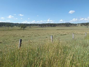
Fields, 2016
|
|||||||||||||||
| Population | 96 (2021 census) | ||||||||||||||
| • Density | 1.808/km2 (4.68/sq mi) | ||||||||||||||
| Postcode(s) | 4285 | ||||||||||||||
| Area | 53.1 km2 (20.5 sq mi) | ||||||||||||||
| Time zone | AEST (UTC+10:00) | ||||||||||||||
| Location |
|
||||||||||||||
| LGA(s) | Scenic Rim Region | ||||||||||||||
| State electorate(s) | Scenic Rim | ||||||||||||||
| Federal Division(s) | Wright | ||||||||||||||
|
|||||||||||||||
Oaky Creek is a small rural area in Queensland, Australia. It's part of the Scenic Rim Region. This area was once known as Oakey Creek.
In 2021, about 96 people lived in Oaky Creek. It's a quiet place with lots of nature.
Contents
Exploring Oaky Creek's Landscape
Oaky Creek is a very natural place. It has many hills and a valley. A single creek flows through the area. This creek eventually joins the Logan River.
Mountains and Hills
The eastern parts of Oaky Creek are quite high. Some spots reach over 300 meters above sea level.
There's a mountain here called Round Hill. It stands about 229 meters tall. It's a notable feature in the landscape.
A Glimpse into History
In the past, cutting down timber was a big industry in Oaky Creek. There used to be a sawmill here. This mill helped process the wood from the area. Today, the sawmill is no longer there.
Who Lives in Oaky Creek?
The number of people living in Oaky Creek has changed over the years.
- In 2011, Oaky Creek and nearby areas had 463 residents.
- By 2016, the population of Oaky Creek itself was 83 people.
- In the most recent count in 2021, 96 people called Oaky Creek home.
Learning Opportunities
Oaky Creek does not have its own schools. Students travel to nearby towns for their education.
Primary School Options
For younger students, there are a few primary schools nearby:
- Rathdowney State School is to the west.
- Hillview State School is in the next area to the east.
- Tamrookum State School is to the north.
Secondary School Options
Older students attend secondary school in Beaudesert. This town is located to the north of Oaky Creek.
 | Selma Burke |
 | Pauline Powell Burns |
 | Frederick J. Brown |
 | Robert Blackburn |


